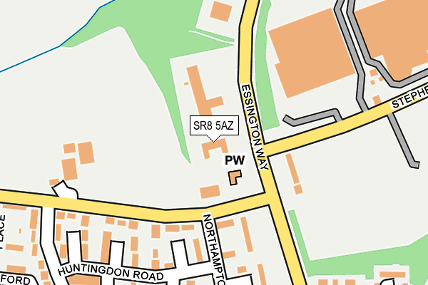
SR8 5AZ lies on Essington Way in Peterlee. SR8 5AZ is located in the Peterlee West electoral ward, within the unitary authority of County Durham and the English Parliamentary constituency of Easington. The Sub Integrated Care Board (ICB) Location is NHS North East and North Cumbria ICB - 84H and the police force is Durham. This postcode has been in use since January 1980.


GetTheData
Source: OS OpenMap – Local (Ordnance Survey)
Source: OS VectorMap District (Ordnance Survey)
Licence: Open Government Licence (requires attribution)
| Easting | 442220 |
| Northing | 542081 |
| Latitude | 54.771892 |
| Longitude | -1.345258 |
GetTheData
Source: Open Postcode Geo
Licence: Open Government Licence
| Street | Essington Way |
| Town/City | Peterlee |
| Country | England |
| Postcode District | SR8 |
| ➜ SR8 open data dashboard ➜ See where SR8 is on a map ➜ Where is Peterlee? | |
GetTheData
Source: Land Registry Price Paid Data
Licence: Open Government Licence
Elevation or altitude of SR8 5AZ as distance above sea level:
| Metres | Feet | |
|---|---|---|
| Elevation | 110m | 361ft |
Elevation is measured from the approximate centre of the postcode, to the nearest point on an OS contour line from OS Terrain 50, which has contour spacing of ten vertical metres.
➜ How high above sea level am I? Find the elevation of your current position using your device's GPS.
GetTheData
Source: Open Postcode Elevation
Licence: Open Government Licence
| Ward | Peterlee West |
| Constituency | Easington |
GetTheData
Source: ONS Postcode Database
Licence: Open Government Licence
| June 2022 | Other theft | On or near Sports/Recreation Area | 107m |
| June 2022 | Other theft | On or near Sports/Recreation Area | 107m |
| June 2022 | Anti-social behaviour | On or near Sports/Recreation Area | 107m |
| ➜ Essington Way crime map and outcomes | |||
GetTheData
Source: data.police.uk
Licence: Open Government Licence
| Essington Way - Stephenson Road (Essington Way) | Peterlee | 87m |
| Essington Way - Stephenson Road (Stephenson Road) | Peterlee | 158m |
| Essington Way - Stephenson Road (Essington Way) | Peterlee | 159m |
| Northampton Road (Lowhills Road) | Peterlee | 168m |
| Northampton Road (Lowhills Road) | Peterlee | 177m |
GetTheData
Source: NaPTAN
Licence: Open Government Licence
GetTheData
Source: ONS Postcode Database
Licence: Open Government Licence


➜ Get more ratings from the Food Standards Agency
GetTheData
Source: Food Standards Agency
Licence: FSA terms & conditions
| Last Collection | |||
|---|---|---|---|
| Location | Mon-Fri | Sat | Distance |
| Peterlee Post Office | 18:30 | 12:15 | 715m |
| Eden Hill Road | 16:45 | 12:00 | 1,325m |
| Laburnum Crescent | 16:00 | 10:30 | 1,537m |
GetTheData
Source: Dracos
Licence: Creative Commons Attribution-ShareAlike
| Facility | Distance |
|---|---|
| Low Hills Road Playing Fields Lowhills Road, Peterlee Grass Pitches | 173m |
| Acre Rigg Academy Acre Rigg Road, Peterlee Swimming Pool, Grass Pitches | 637m |
| Eden Hall Junior School (Closed) Robson Avenue, Peterlee Grass Pitches | 973m |
GetTheData
Source: Active Places
Licence: Open Government Licence
| School | Phase of Education | Distance |
|---|---|---|
| Acre Rigg Academy Acre Rigg Road, Peterlee, SR8 2DU | Primary | 596m |
| Acre Rigg Infant School Acre Rigg Road, Peterlee, SR8 2DU | Primary | 615m |
| East Durham College Willerby Grove, Peterlee, SR8 2RN | 16 plus | 1.2km |
GetTheData
Source: Edubase
Licence: Open Government Licence
The below table lists the International Territorial Level (ITL) codes (formerly Nomenclature of Territorial Units for Statistics (NUTS) codes) and Local Administrative Units (LAU) codes for SR8 5AZ:
| ITL 1 Code | Name |
|---|---|
| TLC | North East (England) |
| ITL 2 Code | Name |
| TLC1 | Tees Valley and Durham |
| ITL 3 Code | Name |
| TLC14 | Durham |
| LAU 1 Code | Name |
| E06000047 | County Durham |
GetTheData
Source: ONS Postcode Directory
Licence: Open Government Licence
The below table lists the Census Output Area (OA), Lower Layer Super Output Area (LSOA), and Middle Layer Super Output Area (MSOA) for SR8 5AZ:
| Code | Name | |
|---|---|---|
| OA | E00105216 | |
| LSOA | E01020734 | County Durham 035B |
| MSOA | E02004328 | County Durham 035 |
GetTheData
Source: ONS Postcode Directory
Licence: Open Government Licence
| SR8 2DW | Lowhills Road | 173m |
| SR8 2BX | Lowhills Road | 210m |
| SR8 2DG | Rutland Walk | 231m |
| SR8 2BU | Lincoln Walk | 231m |
| SR8 2DF | Huntingdon Road | 247m |
| SR8 2DQ | Leicester Walk | 261m |
| SR8 2BS | Kent Walk | 274m |
| SR8 2DH | York Road | 284m |
| SR8 2BY | Northampton Road | 292m |
| SR8 2BT | Norfolk Walk | 319m |
GetTheData
Source: Open Postcode Geo; Land Registry Price Paid Data
Licence: Open Government Licence