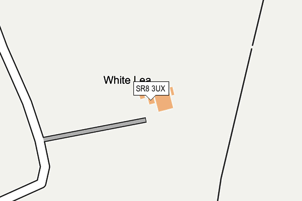
SR8 3UX is located in the Easington electoral ward, within the unitary authority of County Durham and the English Parliamentary constituency of Easington. The Sub Integrated Care Board (ICB) Location is NHS North East and North Cumbria ICB - 84H and the police force is Durham. This postcode has been in use since January 1980.


GetTheData
Source: OS OpenMap – Local (Ordnance Survey)
Source: OS VectorMap District (Ordnance Survey)
Licence: Open Government Licence (requires attribution)
| Easting | 443907 |
| Northing | 544713 |
| Latitude | 54.795388 |
| Longitude | -1.318625 |
GetTheData
Source: Open Postcode Geo
Licence: Open Government Licence
| Country | England |
| Postcode District | SR8 |
| ➜ SR8 open data dashboard ➜ See where SR8 is on a map | |
GetTheData
Source: Land Registry Price Paid Data
Licence: Open Government Licence
Elevation or altitude of SR8 3UX as distance above sea level:
| Metres | Feet | |
|---|---|---|
| Elevation | 70m | 230ft |
Elevation is measured from the approximate centre of the postcode, to the nearest point on an OS contour line from OS Terrain 50, which has contour spacing of ten vertical metres.
➜ How high above sea level am I? Find the elevation of your current position using your device's GPS.
GetTheData
Source: Open Postcode Elevation
Licence: Open Government Licence
| Ward | Easington |
| Constituency | Easington |
GetTheData
Source: ONS Postcode Database
Licence: Open Government Licence
| Holme Hill East View (East View) | Easington Colliery | 702m |
| George Avenue (Street Not Known) | Easington Colliery | 813m |
| Holme Hill George Avenue (Street Not Known) | Easington Colliery | 820m |
| Colliery Offices (Station Road) | Easington Colliery | 822m |
| George Avenue (Street Not Known) | Easington Colliery | 823m |
| Seaham Station | 5.2km |
GetTheData
Source: NaPTAN
Licence: Open Government Licence
GetTheData
Source: ONS Postcode Database
Licence: Open Government Licence


➜ Get more ratings from the Food Standards Agency
GetTheData
Source: Food Standards Agency
Licence: FSA terms & conditions
| Last Collection | |||
|---|---|---|---|
| Location | Mon-Fri | Sat | Distance |
| Easington Colliery Post Office | 16:45 | 10:30 | 898m |
| Laburnum Crescent | 16:00 | 10:30 | 2,115m |
| Hall Walks | 16:00 | 10:30 | 2,748m |
GetTheData
Source: Dracos
Licence: Creative Commons Attribution-ShareAlike
| Facility | Distance |
|---|---|
| Inta Fitness Leisure Ltd Vincent Street, Peterlee Health and Fitness Gym, Studio | 1.1km |
| Easington Welfare Park Briardene Way, Easington Colliery, Peterlee Grass Pitches | 1.4km |
| Easington Colliery Primary School Whickham Street, Peterlee Grass Pitches | 1.6km |
GetTheData
Source: Active Places
Licence: Open Government Licence
| School | Phase of Education | Distance |
|---|---|---|
| Easington Colliery Primary School Whickham Street, Easington Colliery, Peterlee, SR8 3DJ | Primary | 1.6km |
| Our Lady Star of the Sea Roman Catholic Voluntary Aided Primary Thorpe Road, Horden, Peterlee, SR8 4AB | Primary | 2.5km |
| Rosemary Lane Nursery School Rosemary Lane, Easington Village, Peterlee, SR8 3BQ | Nursery | 2.6km |
GetTheData
Source: Edubase
Licence: Open Government Licence
The below table lists the International Territorial Level (ITL) codes (formerly Nomenclature of Territorial Units for Statistics (NUTS) codes) and Local Administrative Units (LAU) codes for SR8 3UX:
| ITL 1 Code | Name |
|---|---|
| TLC | North East (England) |
| ITL 2 Code | Name |
| TLC1 | Tees Valley and Durham |
| ITL 3 Code | Name |
| TLC14 | Durham |
| LAU 1 Code | Name |
| E06000047 | County Durham |
GetTheData
Source: ONS Postcode Directory
Licence: Open Government Licence
The below table lists the Census Output Area (OA), Lower Layer Super Output Area (LSOA), and Middle Layer Super Output Area (MSOA) for SR8 3UX:
| Code | Name | |
|---|---|---|
| OA | E00105308 | |
| LSOA | E01020752 | County Durham 025B |
| MSOA | E02004324 | County Durham 025 |
GetTheData
Source: ONS Postcode Directory
Licence: Open Government Licence
| SR8 3NQ | East View | 691m |
| SR8 3NH | Raby Avenue | 724m |
| SR8 3QH | Allan Street | 734m |
| SR8 3NG | George Avenue | 766m |
| SR8 3NW | Raby Avenue | 767m |
| SR8 3NL | Dene Avenue | 781m |
| SR8 3ND | George Avenue | 783m |
| SR8 3NJ | Dene Avenue | 786m |
| SR8 3NN | West Avenue | 793m |
| SR8 3NE | The Crescent | 794m |
GetTheData
Source: Open Postcode Geo; Land Registry Price Paid Data
Licence: Open Government Licence