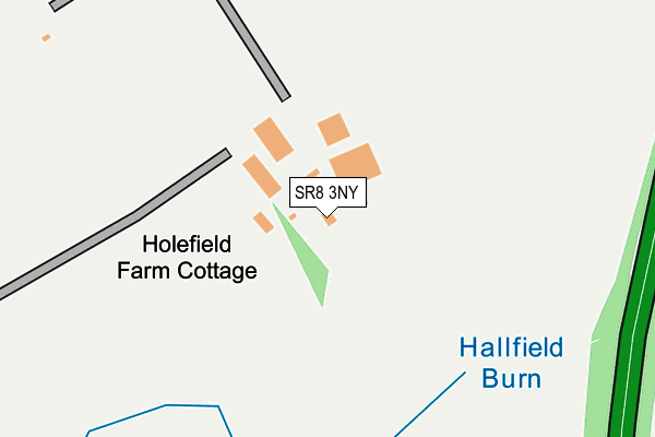
SR8 3NY is located in the Easington electoral ward, within the unitary authority of County Durham and the English Parliamentary constituency of Easington. The Sub Integrated Care Board (ICB) Location is NHS North East and North Cumbria ICB - 84H and the police force is Durham. This postcode has been in use since April 2016.


GetTheData
Source: OS OpenMap – Local (Ordnance Survey)
Source: OS VectorMap District (Ordnance Survey)
Licence: Open Government Licence (requires attribution)
| Easting | 440593 |
| Northing | 544418 |
| Latitude | 54.793016 |
| Longitude | -1.370206 |
GetTheData
Source: Open Postcode Geo
Licence: Open Government Licence
| Country | England |
| Postcode District | SR8 |
| ➜ SR8 open data dashboard ➜ See where SR8 is on a map | |
GetTheData
Source: Land Registry Price Paid Data
Licence: Open Government Licence
Elevation or altitude of SR8 3NY as distance above sea level:
| Metres | Feet | |
|---|---|---|
| Elevation | 110m | 361ft |
Elevation is measured from the approximate centre of the postcode, to the nearest point on an OS contour line from OS Terrain 50, which has contour spacing of ten vertical metres.
➜ How high above sea level am I? Find the elevation of your current position using your device's GPS.
GetTheData
Source: Open Postcode Elevation
Licence: Open Government Licence
| Ward | Easington |
| Constituency | Easington |
GetTheData
Source: ONS Postcode Database
Licence: Open Government Licence
| Pesspool Lane Ends (A182) | Easington Village | 823m |
| Pesspool Lane Ends (A182) | Easington Village | 839m |
| Roundabout (B1283) | Easington Village | 921m |
| Roundabout (B1283) | Easington Village | 921m |
| The Grove (Hall Walks) | Easington Village | 1,079m |
GetTheData
Source: NaPTAN
Licence: Open Government Licence
GetTheData
Source: ONS Postcode Database
Licence: Open Government Licence


➜ Get more ratings from the Food Standards Agency
GetTheData
Source: Food Standards Agency
Licence: FSA terms & conditions
| Last Collection | |||
|---|---|---|---|
| Location | Mon-Fri | Sat | Distance |
| Hall Walks | 16:00 | 10:30 | 1,240m |
| Laburnum Crescent | 16:00 | 10:30 | 1,709m |
| Dunelm Road, Hetton Le Hole | 17:30 | 11:45 | 1,928m |
GetTheData
Source: Dracos
Licence: Creative Commons Attribution-ShareAlike
| Facility | Distance |
|---|---|
| Easington C Of E Primary School Hall Walk, Peterlee Grass Pitches | 1.2km |
| Jupiter Health & Fitness Club Seaside Lane, Easington, Peterlee Health and Fitness Gym, Studio | 1.5km |
| Easington Academy Stockton Road, Easington, Peterlee Sports Hall, Grass Pitches, Artificial Grass Pitch | 1.7km |
GetTheData
Source: Active Places
Licence: Open Government Licence
| School | Phase of Education | Distance |
|---|---|---|
| Easington CofE Primary School Easington Village, Hall Walk, Peterlee, SR8 3BP | Primary | 1.2km |
| Hope Wood Academy Crawlaw Road, Easington Colliery, Peterlee, Durham, SR8 3LP | Not applicable | 1.2km |
| Rosemary Lane Nursery School Rosemary Lane, Easington Village, Peterlee, SR8 3BQ | Nursery | 1.3km |
GetTheData
Source: Edubase
Licence: Open Government Licence
The below table lists the International Territorial Level (ITL) codes (formerly Nomenclature of Territorial Units for Statistics (NUTS) codes) and Local Administrative Units (LAU) codes for SR8 3NY:
| ITL 1 Code | Name |
|---|---|
| TLC | North East (England) |
| ITL 2 Code | Name |
| TLC1 | Tees Valley and Durham |
| ITL 3 Code | Name |
| TLC14 | Durham |
| LAU 1 Code | Name |
| E06000047 | County Durham |
GetTheData
Source: ONS Postcode Directory
Licence: Open Government Licence
The below table lists the Census Output Area (OA), Lower Layer Super Output Area (LSOA), and Middle Layer Super Output Area (MSOA) for SR8 3NY:
| Code | Name | |
|---|---|---|
| OA | E00105312 | |
| LSOA | E01020756 | County Durham 025D |
| MSOA | E02004324 | County Durham 025 |
GetTheData
Source: ONS Postcode Directory
Licence: Open Government Licence
| SR8 3TX | Loaning Burn | 925m |
| SR8 3BZ | South Hetton Road | 980m |
| SR8 3BY | South Hetton Road | 986m |
| SR7 8RU | Sunderland Road | 1017m |
| SR8 3BX | Mill Terrace | 1018m |
| SR8 3BU | The Grove | 1022m |
| SR8 3TS | Sunderland Road | 1067m |
| SR8 3BT | Jackson Terrace | 1081m |
| SR8 3BS | Hall Walk | 1108m |
| SR8 3NX | The Spinney | 1144m |
GetTheData
Source: Open Postcode Geo; Land Registry Price Paid Data
Licence: Open Government Licence