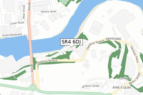
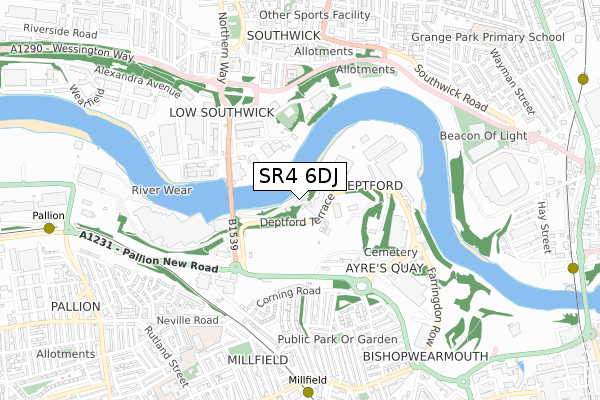
SR4 6DJ is located in the Millfield electoral ward, within the metropolitan district of Sunderland and the English Parliamentary constituency of Sunderland Central. The Sub Integrated Care Board (ICB) Location is NHS North East and North Cumbria ICB - 00P and the police force is Northumbria. This postcode has been in use since November 2018.


GetTheData
Source: OS Open Zoomstack (Ordnance Survey)
Licence: Open Government Licence (requires attribution)
Attribution: Contains OS data © Crown copyright and database right 2025
Source: Open Postcode Geo
Licence: Open Government Licence (requires attribution)
Attribution: Contains OS data © Crown copyright and database right 2025; Contains Royal Mail data © Royal Mail copyright and database right 2025; Source: Office for National Statistics licensed under the Open Government Licence v.3.0
| Easting | 438470 |
| Northing | 557830 |
| Latitude | 54.913709 |
| Longitude | -1.401455 |
GetTheData
Source: Open Postcode Geo
Licence: Open Government Licence
| Country | England |
| Postcode District | SR4 |
➜ See where SR4 is on a map ➜ Where is Sunderland? | |
GetTheData
Source: Land Registry Price Paid Data
Licence: Open Government Licence
Elevation or altitude of SR4 6DJ as distance above sea level:
| Metres | Feet | |
|---|---|---|
| Elevation | 10m | 33ft |
Elevation is measured from the approximate centre of the postcode, to the nearest point on an OS contour line from OS Terrain 50, which has contour spacing of ten vertical metres.
➜ How high above sea level am I? Find the elevation of your current position using your device's GPS.
GetTheData
Source: Open Postcode Elevation
Licence: Open Government Licence
| Ward | Millfield |
| Constituency | Sunderland Central |
GetTheData
Source: ONS Postcode Database
Licence: Open Government Licence
| Pallion New Road-bridge (Deptford Terrace) | Millfield | 343m |
| Trimdon Street-enderby Road (Trimdon Street) | Millfield | 363m |
| Trimdon Street-enderby Road (Priestly Crescent) | Millfield | 374m |
| Pallion New Road-bridge (Pallion New Road) | Millfield | 378m |
| Queen Alexandra Bridge North End (Camden Street) | Southwick | 439m |
| Millfield (Tyne And Wear Metro Station) (Hylton Road) | Millfield | 792m |
| Pallion (Tyne And Wear Metro Station) (European Way) | Pallion | 1,008m |
| St Peter's (Tyne And Wear Metro Station) (Sheepfolds North) | St Peter's | 1,160m |
| Stadium Of Light (Tyne And Wear Metro Station) (Millennium Way) | Sunderland Stadium Of Light | 1,291m |
| University (Tyne And Wear Metro Station) (A183 Chester Road) | University Of Sunderland | 1,345m |
| St Peters Station | 1.2km |
| Sunderland Station | 1.5km |
| Seaburn Station | 2km |
GetTheData
Source: NaPTAN
Licence: Open Government Licence
GetTheData
Source: ONS Postcode Database
Licence: Open Government Licence


➜ Get more ratings from the Food Standards Agency
GetTheData
Source: Food Standards Agency
Licence: FSA terms & conditions
| Last Collection | |||
|---|---|---|---|
| Location | Mon-Fri | Sat | Distance |
| Whitehall Terrace | 17:30 | 12:30 | 656m |
| Carley Road | 17:00 | 11:30 | 729m |
| Sidecliffe Road | 17:15 | 11:45 | 859m |
GetTheData
Source: Dracos
Licence: Creative Commons Attribution-ShareAlike
The below table lists the International Territorial Level (ITL) codes (formerly Nomenclature of Territorial Units for Statistics (NUTS) codes) and Local Administrative Units (LAU) codes for SR4 6DJ:
| ITL 1 Code | Name |
|---|---|
| TLC | North East (England) |
| ITL 2 Code | Name |
| TLC2 | Northumberland, and Tyne and Wear |
| ITL 3 Code | Name |
| TLC23 | Sunderland |
| LAU 1 Code | Name |
| E08000024 | Sunderland |
GetTheData
Source: ONS Postcode Directory
Licence: Open Government Licence
The below table lists the Census Output Area (OA), Lower Layer Super Output Area (LSOA), and Middle Layer Super Output Area (MSOA) for SR4 6DJ:
| Code | Name | |
|---|---|---|
| OA | E00044183 | |
| LSOA | E01008700 | Sunderland 013A |
| MSOA | E02001803 | Sunderland 013 |
GetTheData
Source: ONS Postcode Directory
Licence: Open Government Licence
| SR5 3XA | Wayfarer Road | 366m |
| SR5 2AR | Haswell Court | 389m |
| SR4 6BT | Carol Street | 400m |
| SR5 2BH | Wear Street | 418m |
| SR4 6EE | Corning Road | 423m |
| SR4 6BY | Hanover Place | 440m |
| SR5 2AQ | Pickersgill Court | 451m |
| SR5 2AL | Austin Boulevard | 456m |
| SR4 6BP | Cirencester Street | 460m |
| SR4 6BS | St Cuthberts Terrace | 462m |
GetTheData
Source: Open Postcode Geo; Land Registry Price Paid Data
Licence: Open Government Licence