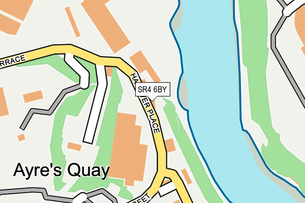
SR4 6BY lies on Hanover Place in Sunderland. SR4 6BY is located in the Millfield electoral ward, within the metropolitan district of Sunderland and the English Parliamentary constituency of Sunderland Central. The Sub Integrated Care Board (ICB) Location is NHS North East and North Cumbria ICB - 00P and the police force is Northumbria. This postcode has been in use since January 1980.


GetTheData
Source: OS OpenMap – Local (Ordnance Survey)
Source: OS VectorMap District (Ordnance Survey)
Licence: Open Government Licence (requires attribution)
| Easting | 438910 |
| Northing | 557820 |
| Latitude | 54.913585 |
| Longitude | -1.394593 |
GetTheData
Source: Open Postcode Geo
Licence: Open Government Licence
| Street | Hanover Place |
| Town/City | Sunderland |
| Country | England |
| Postcode District | SR4 |
➜ See where SR4 is on a map ➜ Where is Sunderland? | |
GetTheData
Source: Land Registry Price Paid Data
Licence: Open Government Licence
Elevation or altitude of SR4 6BY as distance above sea level:
| Metres | Feet | |
|---|---|---|
| Elevation | 20m | 66ft |
Elevation is measured from the approximate centre of the postcode, to the nearest point on an OS contour line from OS Terrain 50, which has contour spacing of ten vertical metres.
➜ How high above sea level am I? Find the elevation of your current position using your device's GPS.
GetTheData
Source: Open Postcode Elevation
Licence: Open Government Licence
| Ward | Millfield |
| Constituency | Sunderland Central |
GetTheData
Source: ONS Postcode Database
Licence: Open Government Licence
| Trimdon Street-enderby Road (Priestly Crescent) | Millfield | 394m |
| Trimdon Street-b&q (Trimdon Street) | Millfield | 421m |
| Trimdon Street-enderby Road (Trimdon Street) | Millfield | 425m |
| Trimdon Street-b&q (Trimdon Street) | Millfield | 436m |
| Southwick Road-wallace Street (Southwick Road) | Monkwearmouth | 512m |
| St Peter's (Tyne And Wear Metro Station) (Sheepfolds North) | St Peter's | 732m |
| Millfield (Tyne And Wear Metro Station) (Hylton Road) | Millfield | 890m |
| Stadium Of Light (Tyne And Wear Metro Station) (Millennium Way) | Sunderland Stadium Of Light | 910m |
| Sunderland (Tyne And Wear Metro Station) (Station Street) | Sunderland | 1,097m |
| University (Tyne And Wear Metro Station) (A183 Chester Road) | University Of Sunderland | 1,204m |
| St Peters Station | 0.7km |
| Sunderland Station | 1.2km |
| Seaburn Station | 1.8km |
GetTheData
Source: NaPTAN
Licence: Open Government Licence
GetTheData
Source: ONS Postcode Database
Licence: Open Government Licence

➜ Get more ratings from the Food Standards Agency
GetTheData
Source: Food Standards Agency
Licence: FSA terms & conditions
| Last Collection | |||
|---|---|---|---|
| Location | Mon-Fri | Sat | Distance |
| Sheepfolds | 17:00 | 11:30 | 634m |
| Carley Road | 17:00 | 11:30 | 666m |
| Whitehall Terrace | 17:30 | 12:30 | 737m |
GetTheData
Source: Dracos
Licence: Creative Commons Attribution-ShareAlike
The below table lists the International Territorial Level (ITL) codes (formerly Nomenclature of Territorial Units for Statistics (NUTS) codes) and Local Administrative Units (LAU) codes for SR4 6BY:
| ITL 1 Code | Name |
|---|---|
| TLC | North East (England) |
| ITL 2 Code | Name |
| TLC2 | Northumberland, and Tyne and Wear |
| ITL 3 Code | Name |
| TLC23 | Sunderland |
| LAU 1 Code | Name |
| E08000024 | Sunderland |
GetTheData
Source: ONS Postcode Directory
Licence: Open Government Licence
The below table lists the Census Output Area (OA), Lower Layer Super Output Area (LSOA), and Middle Layer Super Output Area (MSOA) for SR4 6BY:
| Code | Name | |
|---|---|---|
| OA | E00044183 | |
| LSOA | E01008700 | Sunderland 013A |
| MSOA | E02001803 | Sunderland 013 |
GetTheData
Source: ONS Postcode Directory
Licence: Open Government Licence
| SR4 6AZ | Alliance Place | 451m |
| SR4 6AH | Trimdon Street | 478m |
| SR5 1HQ | Southwick Road | 497m |
| SR5 1EY | Southwick Road | 498m |
| SR4 6AL | Fern Street | 501m |
| SR4 6BT | Carol Street | 505m |
| SR5 1HE | Johnstone Villas | 517m |
| SR5 1EJ | Southwick Road | 521m |
| SR4 6DY | Marigold Court | 530m |
| SR4 6AQ | Lily Street | 536m |
GetTheData
Source: Open Postcode Geo; Land Registry Price Paid Data
Licence: Open Government Licence