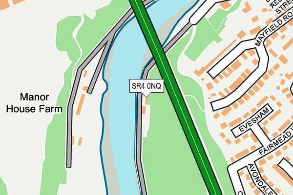
SR4 0NQ is located in the St Anne's electoral ward, within the metropolitan district of Sunderland and the English Parliamentary constituency of Washington and Sunderland West. The Sub Integrated Care Board (ICB) Location is NHS North East and North Cumbria ICB - 00P and the police force is Northumbria. This postcode has been in use since January 1980.


GetTheData
Source: OS OpenMap – Local (Ordnance Survey)
Source: OS VectorMap District (Ordnance Survey)
Licence: Open Government Licence (requires attribution)
| Easting | 434838 |
| Northing | 556612 |
| Latitude | 54.903031 |
| Longitude | -1.458253 |
GetTheData
Source: Open Postcode Geo
Licence: Open Government Licence
| Country | England |
| Postcode District | SR4 |
➜ See where SR4 is on a map | |
GetTheData
Source: Land Registry Price Paid Data
Licence: Open Government Licence
Elevation or altitude of SR4 0NQ as distance above sea level:
| Metres | Feet | |
|---|---|---|
| Elevation | 10m | 33ft |
Elevation is measured from the approximate centre of the postcode, to the nearest point on an OS contour line from OS Terrain 50, which has contour spacing of ten vertical metres.
➜ How high above sea level am I? Find the elevation of your current position using your device's GPS.
GetTheData
Source: Open Postcode Elevation
Licence: Open Government Licence
| Ward | St Anne's |
| Constituency | Washington And Sunderland West |
GetTheData
Source: ONS Postcode Database
Licence: Open Government Licence
| Fairmead Way | South Hylton | 252m |
| High Street - Red Lion (High Street) | South Hylton | 259m |
| High Street - Metro (South Hylton) | South Hylton | 609m |
| High Street - Metro (Hylton Bank) | South Hylton | 628m |
| South View Greenbank Drive (Greenbank Drive) | South Hylton | 631m |
| South Hylton (Tyne And Wear Metro Station) (High Street / Hylton Bank) | South Hylton | 646m |
| St Peters Station | 4.9km |
| Sunderland Station | 4.9km |
| East Boldon Station | 5.4km |
GetTheData
Source: NaPTAN
Licence: Open Government Licence
| Percentage of properties with Next Generation Access | 100.0% |
| Percentage of properties with Superfast Broadband | 100.0% |
| Percentage of properties with Ultrafast Broadband | 100.0% |
| Percentage of properties with Full Fibre Broadband | 0.0% |
Superfast Broadband is between 30Mbps and 300Mbps
Ultrafast Broadband is > 300Mbps
| Percentage of properties unable to receive 2Mbps | 0.0% |
| Percentage of properties unable to receive 5Mbps | 0.0% |
| Percentage of properties unable to receive 10Mbps | 0.0% |
| Percentage of properties unable to receive 30Mbps | 0.0% |
GetTheData
Source: Ofcom
Licence: Ofcom Terms of Use (requires attribution)
GetTheData
Source: ONS Postcode Database
Licence: Open Government Licence


➜ Get more ratings from the Food Standards Agency
GetTheData
Source: Food Standards Agency
Licence: FSA terms & conditions
| Last Collection | |||
|---|---|---|---|
| Location | Mon-Fri | Sat | Distance |
| Fairmead Way | 16:15 | 10:30 | 262m |
| Hylton Post Office | 17:15 | 10:30 | 543m |
| Parkhurst Road | 16:00 | 10:30 | 919m |
GetTheData
Source: Dracos
Licence: Creative Commons Attribution-ShareAlike
| Risk of SR4 0NQ flooding from rivers and sea | Medium |
| ➜ SR4 0NQ flood map | |
GetTheData
Source: Open Flood Risk by Postcode
Licence: Open Government Licence
The below table lists the International Territorial Level (ITL) codes (formerly Nomenclature of Territorial Units for Statistics (NUTS) codes) and Local Administrative Units (LAU) codes for SR4 0NQ:
| ITL 1 Code | Name |
|---|---|
| TLC | North East (England) |
| ITL 2 Code | Name |
| TLC2 | Northumberland, and Tyne and Wear |
| ITL 3 Code | Name |
| TLC23 | Sunderland |
| LAU 1 Code | Name |
| E08000024 | Sunderland |
GetTheData
Source: ONS Postcode Directory
Licence: Open Government Licence
The below table lists the Census Output Area (OA), Lower Layer Super Output Area (LSOA), and Middle Layer Super Output Area (MSOA) for SR4 0NQ:
| Code | Name | |
|---|---|---|
| OA | E00165667 | |
| LSOA | E01032484 | Sunderland 032G |
| MSOA | E02001822 | Sunderland 032 |
GetTheData
Source: ONS Postcode Directory
Licence: Open Government Licence
| SR4 0QL | Offerton Close | 177m |
| SR4 0NB | Evesham | 210m |
| SR4 0NA | Fairmead Way | 225m |
| SR4 0NE | Mayfield Road | 237m |
| SR4 0LY | Fairmead Way | 303m |
| SR4 0PS | Kepier Gardens | 304m |
| SR4 0LZ | Avondale | 318m |
| SR4 0NN | Cambria Green | 325m |
| SR4 0NH | Riverside | 360m |
| SR4 0LX | William Street | 368m |
GetTheData
Source: Open Postcode Geo; Land Registry Price Paid Data
Licence: Open Government Licence