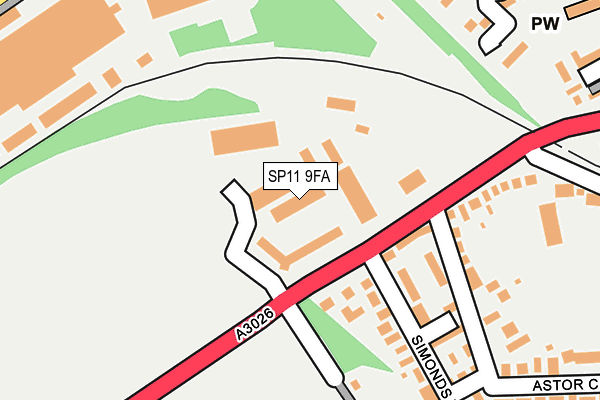
SP11 9FA is located in the Tidworth East & Ludgershall South electoral ward, within the unitary authority of Wiltshire and the English Parliamentary constituency of Devizes. The Sub Integrated Care Board (ICB) Location is NHS Bath and North East Somerset, Swindon and Wiltshire ICB - 92 and the police force is Wiltshire. This postcode has been in use since July 2009.


GetTheData
Source: OS OpenMap – Local (Ordnance Survey)
Source: OS VectorMap District (Ordnance Survey)
Licence: Open Government Licence (requires attribution)
| Easting | 426031 |
| Northing | 150691 |
| Latitude | 51.254791 |
| Longitude | -1.628363 |
GetTheData
Source: Open Postcode Geo
Licence: Open Government Licence
| Country | England |
| Postcode District | SP11 |
| ➜ SP11 open data dashboard ➜ See where SP11 is on a map | |
GetTheData
Source: Land Registry Price Paid Data
Licence: Open Government Licence
Elevation or altitude of SP11 9FA as distance above sea level:
| Metres | Feet | |
|---|---|---|
| Elevation | 130m | 427ft |
Elevation is measured from the approximate centre of the postcode, to the nearest point on an OS contour line from OS Terrain 50, which has contour spacing of ten vertical metres.
➜ How high above sea level am I? Find the elevation of your current position using your device's GPS.
GetTheData
Source: Open Postcode Elevation
Licence: Open Government Licence
| Ward | Tidworth East & Ludgershall South |
| Constituency | Devizes |
GetTheData
Source: ONS Postcode Database
Licence: Open Government Licence
| January 2024 | Violence and sexual offences | On or near Simonds Road | 255m |
| January 2024 | Violence and sexual offences | On or near Parking Area | 399m |
| December 2023 | Violence and sexual offences | On or near Parking Area | 399m |
| ➜ Get more crime data in our Crime section | |||
GetTheData
Source: data.police.uk
Licence: Open Government Licence
| Wiltshire House (Tidworth Road) | Ludgershall | 79m |
| Wiltshire House (Tidworth Road) | Ludgershall | 103m |
| War Memorial (Tidworth Road) | Ludgershall | 439m |
| War Memorial (Station Approach) | Ludgershall | 496m |
| Wellington Academy (Tidworth Road) | Ludgershall | 639m |
GetTheData
Source: NaPTAN
Licence: Open Government Licence
| Median download speed | 67.0Mbps |
| Average download speed | 57.6Mbps |
| Maximum download speed | 80.00Mbps |
| Median upload speed | 20.0Mbps |
| Average upload speed | 14.2Mbps |
| Maximum upload speed | 20.00Mbps |
GetTheData
Source: Ofcom
Licence: Ofcom Terms of Use (requires attribution)
GetTheData
Source: ONS Postcode Database
Licence: Open Government Licence

➜ Get more ratings from the Food Standards Agency
GetTheData
Source: Food Standards Agency
Licence: FSA terms & conditions
| Last Collection | |||
|---|---|---|---|
| Location | Mon-Fri | Sat | Distance |
| Tidworth Road | 17:15 | 12:00 | 147m |
| Ludgershall Post Office | 17:15 | 12:30 | 494m |
| Empress Road | 17:15 | 12:00 | 634m |
GetTheData
Source: Dracos
Licence: Creative Commons Attribution-ShareAlike
| Facility | Distance |
|---|---|
| Ludgershall Sports & Social Club Football Ground Tidworth Road, Ludgershall, Andover Grass Pitches | 247m |
| The Wellington Academy Ludgershall, Andover Sports Hall, Health and Fitness Gym, Squash Courts, Artificial Grass Pitch, Studio, Grass Pitches, Outdoor Tennis Courts | 827m |
| Ludgershall Castle Primary School Short Street, Ludgershall, Andover Grass Pitches | 939m |
GetTheData
Source: Active Places
Licence: Open Government Licence
| School | Phase of Education | Distance |
|---|---|---|
| Wellington Eagles Primary Academy Wellesley Road, Ludgershall, Andover, SP11 9LT | Primary | 294m |
| The Wellington Academy Tidworth Road, Ludgershall, SP11 9RR | Secondary | 885m |
| Ludgershall Castle Primary School Short Street, Ludgershall, Andover, SP11 9RB | Primary | 941m |
GetTheData
Source: Edubase
Licence: Open Government Licence
The below table lists the International Territorial Level (ITL) codes (formerly Nomenclature of Territorial Units for Statistics (NUTS) codes) and Local Administrative Units (LAU) codes for SP11 9FA:
| ITL 1 Code | Name |
|---|---|
| TLK | South West (England) |
| ITL 2 Code | Name |
| TLK1 | Gloucestershire, Wiltshire and Bath/Bristol area |
| ITL 3 Code | Name |
| TLK15 | Wiltshire |
| LAU 1 Code | Name |
| E06000054 | Wiltshire |
GetTheData
Source: ONS Postcode Directory
Licence: Open Government Licence
The below table lists the Census Output Area (OA), Lower Layer Super Output Area (LSOA), and Middle Layer Super Output Area (MSOA) for SP11 9FA:
| Code | Name | |
|---|---|---|
| OA | E00166432 | |
| LSOA | E01031878 | Wiltshire 041C |
| MSOA | E02006643 | Wiltshire 041 |
GetTheData
Source: ONS Postcode Directory
Licence: Open Government Licence
| SP11 9FJ | Malthouse Walk | 116m |
| SP11 9RJ | Redford Lane | 127m |
| SP11 9FL | Porter Place | 139m |
| SP11 9FN | Barley Mews | 151m |
| SP11 9QE | Tidworth Road | 161m |
| SP11 9FB | Spinney Road | 165m |
| SP11 9RH | Simonds Road | 192m |
| SP11 9RF | Astor Crescent | 222m |
| SP11 9RE | Astor Crescent | 310m |
| SP11 9QH | Hei Lin Way | 311m |
GetTheData
Source: Open Postcode Geo; Land Registry Price Paid Data
Licence: Open Government Licence