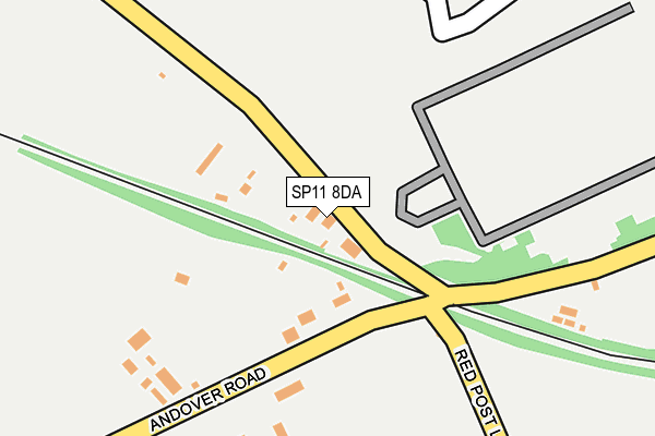
SP11 8DA is located in the Anna electoral ward, within the local authority district of Test Valley and the English Parliamentary constituency of North West Hampshire. The Sub Integrated Care Board (ICB) Location is NHS Hampshire and Isle of Wight ICB - D9Y0V and the police force is Hampshire. This postcode has been in use since January 1980.


GetTheData
Source: OS OpenMap – Local (Ordnance Survey)
Source: OS VectorMap District (Ordnance Survey)
Licence: Open Government Licence (requires attribution)
| Easting | 432665 |
| Northing | 145264 |
| Latitude | 51.205657 |
| Longitude | -1.533809 |
GetTheData
Source: Open Postcode Geo
Licence: Open Government Licence
| Country | England |
| Postcode District | SP11 |
| ➜ SP11 open data dashboard ➜ See where SP11 is on a map | |
GetTheData
Source: Land Registry Price Paid Data
Licence: Open Government Licence
Elevation or altitude of SP11 8DA as distance above sea level:
| Metres | Feet | |
|---|---|---|
| Elevation | 80m | 262ft |
Elevation is measured from the approximate centre of the postcode, to the nearest point on an OS contour line from OS Terrain 50, which has contour spacing of ten vertical metres.
➜ How high above sea level am I? Find the elevation of your current position using your device's GPS.
GetTheData
Source: Open Postcode Elevation
Licence: Open Government Licence
| Ward | Anna |
| Constituency | North West Hampshire |
GetTheData
Source: ONS Postcode Database
Licence: Open Government Licence
| July 2021 | Violence and sexual offences | On or near Newall Road | 486m |
| April 2021 | Violence and sexual offences | On or near Newall Road | 486m |
| February 2021 | Violence and sexual offences | On or near Newall Road | 486m |
| ➜ Get more crime data in our Crime section | |||
GetTheData
Source: data.police.uk
Licence: Open Government Licence
| Willow Farm (Andover Road) | Monxton | 107m |
| Willow Farm (Andover Road) | Monxton | 111m |
| De & S Main Entrance | Andover | 564m |
| Sunnybank (Andover Road) | Monxton | 571m |
| Sunnybank (Andover Road) | Monxton | 572m |
| Andover Station | 3km |
GetTheData
Source: NaPTAN
Licence: Open Government Licence
| Percentage of properties with Next Generation Access | 100.0% |
| Percentage of properties with Superfast Broadband | 0.0% |
| Percentage of properties with Ultrafast Broadband | 0.0% |
| Percentage of properties with Full Fibre Broadband | 0.0% |
Superfast Broadband is between 30Mbps and 300Mbps
Ultrafast Broadband is > 300Mbps
| Percentage of properties unable to receive 2Mbps | 0.0% |
| Percentage of properties unable to receive 5Mbps | 0.0% |
| Percentage of properties unable to receive 10Mbps | 100.0% |
| Percentage of properties unable to receive 30Mbps | 100.0% |
GetTheData
Source: Ofcom
Licence: Ofcom Terms of Use (requires attribution)
GetTheData
Source: ONS Postcode Database
Licence: Open Government Licence


➜ Get more ratings from the Food Standards Agency
GetTheData
Source: Food Standards Agency
Licence: FSA terms & conditions
| Last Collection | |||
|---|---|---|---|
| Location | Mon-Fri | Sat | Distance |
| Sunnybank | 16:30 | 10:30 | 562m |
| West Protway Industrial Estate | 18:30 | 12:00 | 672m |
| Monxton Road | 17:30 | 12:15 | 1,428m |
GetTheData
Source: Dracos
Licence: Creative Commons Attribution-ShareAlike
| Facility | Distance |
|---|---|
| Army Headquarters Monxton Road, Andover Sports Hall | 661m |
| Puregym (Andover) Hawker Siddeley Way, Hawker Siddeley Way, Andover Business Park, Andover Health and Fitness Gym | 1km |
| Reasons Fitness Parnell Court, Andover Health and Fitness Gym, Studio | 1.9km |
GetTheData
Source: Active Places
Licence: Open Government Licence
| School | Phase of Education | Distance |
|---|---|---|
| Portway Junior School Upper Drove, Andover, SP10 3NA | Primary | 1.9km |
| Portway Infant School Ashfield Road, Andover, SP10 3PE | Primary | 1.9km |
| John Hanson Community School Floral Way, Andover, SP10 3PB | Secondary | 2.1km |
GetTheData
Source: Edubase
Licence: Open Government Licence
The below table lists the International Territorial Level (ITL) codes (formerly Nomenclature of Territorial Units for Statistics (NUTS) codes) and Local Administrative Units (LAU) codes for SP11 8DA:
| ITL 1 Code | Name |
|---|---|
| TLJ | South East (England) |
| ITL 2 Code | Name |
| TLJ3 | Hampshire and Isle of Wight |
| ITL 3 Code | Name |
| TLJ36 | Central Hampshire |
| LAU 1 Code | Name |
| E07000093 | Test Valley |
GetTheData
Source: ONS Postcode Directory
Licence: Open Government Licence
The below table lists the Census Output Area (OA), Lower Layer Super Output Area (LSOA), and Middle Layer Super Output Area (MSOA) for SP11 8DA:
| Code | Name | |
|---|---|---|
| OA | E00168062 | |
| LSOA | E01032870 | Test Valley 005F |
| MSOA | E02004818 | Test Valley 005 |
GetTheData
Source: ONS Postcode Directory
Licence: Open Government Licence
| SP11 8BX | Monxton Road | 97m |
| SP11 8BY | Monxton Road | 427m |
| SP11 8DB | Red Post Lane | 501m |
| SP11 8BZ | Sunnybank | 533m |
| SP11 8BU | Monxton Road | 641m |
| SP11 7DU | Cattle Lane | 862m |
| SP11 7DT | Cattle Lane | 882m |
| SP11 7AX | 930m | |
| SP11 7AU | Farm Road | 1058m |
| SP11 8FF | Elizabeth Court | 1061m |
GetTheData
Source: Open Postcode Geo; Land Registry Price Paid Data
Licence: Open Government Licence