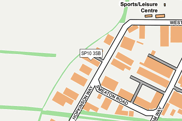
SP10 3SB is located in the Andover Harroway electoral ward, within the local authority district of Test Valley and the English Parliamentary constituency of North West Hampshire. The Sub Integrated Care Board (ICB) Location is NHS Hampshire and Isle of Wight ICB - D9Y0V and the police force is Hampshire. This postcode has been in use since March 1983.


GetTheData
Source: OS OpenMap – Local (Ordnance Survey)
Source: OS VectorMap District (Ordnance Survey)
Licence: Open Government Licence (requires attribution)
| Easting | 433769 |
| Northing | 146615 |
| Latitude | 51.217741 |
| Longitude | -1.517880 |
GetTheData
Source: Open Postcode Geo
Licence: Open Government Licence
| Country | England |
| Postcode District | SP10 |
| ➜ SP10 open data dashboard ➜ See where SP10 is on a map ➜ Where is Andover? | |
GetTheData
Source: Land Registry Price Paid Data
Licence: Open Government Licence
Elevation or altitude of SP10 3SB as distance above sea level:
| Metres | Feet | |
|---|---|---|
| Elevation | 80m | 262ft |
Elevation is measured from the approximate centre of the postcode, to the nearest point on an OS contour line from OS Terrain 50, which has contour spacing of ten vertical metres.
➜ How high above sea level am I? Find the elevation of your current position using your device's GPS.
GetTheData
Source: Open Postcode Elevation
Licence: Open Government Licence
| Ward | Andover Harroway |
| Constituency | North West Hampshire |
GetTheData
Source: ONS Postcode Database
Licence: Open Government Licence
| June 2022 | Burglary | On or near Hopkinson Way | 132m |
| May 2022 | Other theft | On or near Mitchell Close | 371m |
| April 2022 | Public order | On or near Sports/Recreation Area | 295m |
| ➜ Get more crime data in our Crime section | |||
GetTheData
Source: data.police.uk
Licence: Open Government Licence
| Arkwright Gate (West Portway) | Penton Corner | 40m |
| Andover Fc (West Portway) | Charlton | 263m |
| Smeaton Road (Macadam Way) | Charlton | 277m |
| Portway Ind Est North (Macadam Way) | Charlton | 319m |
| Telford Gate (Hopkinson Way) | Penton Corner | 356m |
| Andover Station | 1.9km |
GetTheData
Source: NaPTAN
Licence: Open Government Licence
GetTheData
Source: ONS Postcode Database
Licence: Open Government Licence


➜ Get more ratings from the Food Standards Agency
GetTheData
Source: Food Standards Agency
Licence: FSA terms & conditions
| Last Collection | |||
|---|---|---|---|
| Location | Mon-Fri | Sat | Distance |
| Monxton Road | 17:30 | 12:15 | 827m |
| Weyhill Road Post Office | 18:30 | 12:15 | 1,241m |
| West Protway Industrial Estate | 18:30 | 12:00 | 1,259m |
GetTheData
Source: Dracos
Licence: Creative Commons Attribution-ShareAlike
| Facility | Distance |
|---|---|
| Portway Stadium West Portway, Andover Grass Pitches | 269m |
| The Sports Academy West Portway, Andover Artificial Grass Pitch, Outdoor Tennis Courts, Sports Hall, Studio, Health and Fitness Gym | 396m |
| Andover Bmx Raceway West Portway, Andover Cycling | 459m |
GetTheData
Source: Active Places
Licence: Open Government Licence
| School | Phase of Education | Distance |
|---|---|---|
| Portway Junior School Upper Drove, Andover, SP10 3NA | Primary | 1km |
| Portway Infant School Ashfield Road, Andover, SP10 3PE | Primary | 1km |
| Harrow Way Community School Harrow Way, Andover, SP10 3RH | Secondary | 1.2km |
GetTheData
Source: Edubase
Licence: Open Government Licence
The below table lists the International Territorial Level (ITL) codes (formerly Nomenclature of Territorial Units for Statistics (NUTS) codes) and Local Administrative Units (LAU) codes for SP10 3SB:
| ITL 1 Code | Name |
|---|---|
| TLJ | South East (England) |
| ITL 2 Code | Name |
| TLJ3 | Hampshire and Isle of Wight |
| ITL 3 Code | Name |
| TLJ36 | Central Hampshire |
| LAU 1 Code | Name |
| E07000093 | Test Valley |
GetTheData
Source: ONS Postcode Directory
Licence: Open Government Licence
The below table lists the Census Output Area (OA), Lower Layer Super Output Area (LSOA), and Middle Layer Super Output Area (MSOA) for SP10 3SB:
| Code | Name | |
|---|---|---|
| OA | E00117782 | |
| LSOA | E01023180 | Test Valley 005B |
| MSOA | E02004818 | Test Valley 005 |
GetTheData
Source: ONS Postcode Directory
Licence: Open Government Licence
| SP10 3LF | West Portway | 160m |
| SP10 3SL | Brunel Gate | 247m |
| SP10 3TY | Reith Way | 554m |
| SP11 0QZ | 707m | |
| SP11 0QX | Weyhill Road | 748m |
| SP10 4AA | 753m | |
| SP11 0QY | Beech Close | 761m |
| SP10 3LS | Weyhill Road | 803m |
| SP11 8FF | Elizabeth Court | 812m |
| SP11 8FE | Elizabeth Mews | 824m |
GetTheData
Source: Open Postcode Geo; Land Registry Price Paid Data
Licence: Open Government Licence