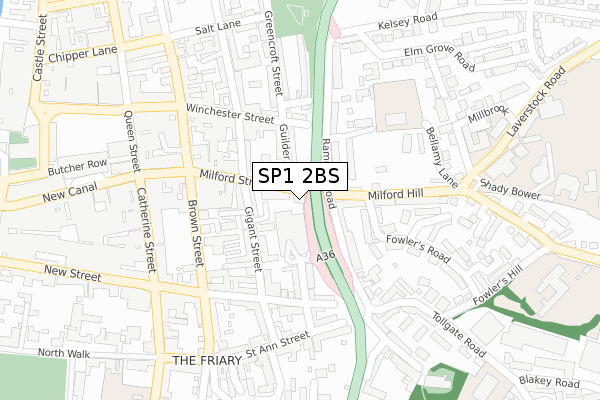
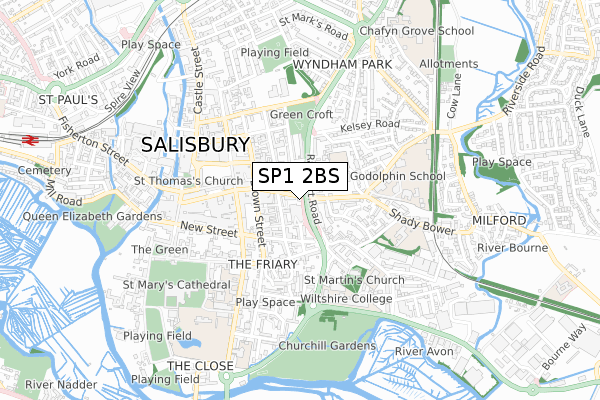
SP1 2BS is located in the Salisbury St Edmund's electoral ward, within the unitary authority of Wiltshire and the English Parliamentary constituency of Salisbury. The Sub Integrated Care Board (ICB) Location is NHS Bath and North East Somerset, Swindon and Wiltshire ICB - 92 and the police force is Wiltshire. This postcode has been in use since January 1980.


GetTheData
Source: OS Open Zoomstack (Ordnance Survey)
Licence: Open Government Licence (requires attribution)
Attribution: Contains OS data © Crown copyright and database right 2024
Source: Open Postcode Geo
Licence: Open Government Licence (requires attribution)
Attribution: Contains OS data © Crown copyright and database right 2024; Contains Royal Mail data © Royal Mail copyright and database right 2024; Source: Office for National Statistics licensed under the Open Government Licence v.3.0
| Easting | 414796 |
| Northing | 129902 |
| Latitude | 51.068262 |
| Longitude | -1.790212 |
GetTheData
Source: Open Postcode Geo
Licence: Open Government Licence
| Country | England |
| Postcode District | SP1 |
| ➜ SP1 open data dashboard ➜ See where SP1 is on a map ➜ Where is Salisbury? | |
GetTheData
Source: Land Registry Price Paid Data
Licence: Open Government Licence
Elevation or altitude of SP1 2BS as distance above sea level:
| Metres | Feet | |
|---|---|---|
| Elevation | 50m | 164ft |
Elevation is measured from the approximate centre of the postcode, to the nearest point on an OS contour line from OS Terrain 50, which has contour spacing of ten vertical metres.
➜ How high above sea level am I? Find the elevation of your current position using your device's GPS.
GetTheData
Source: Open Postcode Elevation
Licence: Open Government Licence
| Ward | Salisbury St Edmund's |
| Constituency | Salisbury |
GetTheData
Source: ONS Postcode Database
Licence: Open Government Licence
| January 2024 | Anti-social behaviour | On or near Nightclub | 131m |
| January 2024 | Anti-social behaviour | On or near Nightclub | 131m |
| January 2024 | Violence and sexual offences | On or near Nightclub | 131m |
| ➜ Get more crime data in our Crime section | |||
GetTheData
Source: data.police.uk
Licence: Open Government Licence
| Milford House (Milford Street) | Salisbury | 73m |
| Rampart Road (Milford Hill) | Salisbury | 79m |
| Rampart Road (Milford Hill) | Salisbury | 93m |
| The Chapel (Milford Street) | Salisbury | 117m |
| Winchester Gate (Rampart Road) | Salisbury | 158m |
| Salisbury Station | 1.2km |
GetTheData
Source: NaPTAN
Licence: Open Government Licence
| Percentage of properties with Next Generation Access | 100.0% |
| Percentage of properties with Superfast Broadband | 100.0% |
| Percentage of properties with Ultrafast Broadband | 100.0% |
| Percentage of properties with Full Fibre Broadband | 100.0% |
Superfast Broadband is between 30Mbps and 300Mbps
Ultrafast Broadband is > 300Mbps
| Percentage of properties unable to receive 2Mbps | 0.0% |
| Percentage of properties unable to receive 5Mbps | 0.0% |
| Percentage of properties unable to receive 10Mbps | 0.0% |
| Percentage of properties unable to receive 30Mbps | 0.0% |
GetTheData
Source: Ofcom
Licence: Ofcom Terms of Use (requires attribution)
GetTheData
Source: ONS Postcode Database
Licence: Open Government Licence


➜ Get more ratings from the Food Standards Agency
GetTheData
Source: Food Standards Agency
Licence: FSA terms & conditions
| Last Collection | |||
|---|---|---|---|
| Location | Mon-Fri | Sat | Distance |
| Milford Hill | 17:30 | 12:00 | 69m |
| Gigant Street | 18:30 | 12:00 | 125m |
| St Ann Street | 18:30 | 12:00 | 211m |
GetTheData
Source: Dracos
Licence: Creative Commons Attribution-ShareAlike
| Facility | Distance |
|---|---|
| Mygym Health & Fitness Guilder Lane, Salisbury Health and Fitness Gym, Studio | 79m |
| The Godolphin School Milford Hill, Salisbury Health and Fitness Gym, Grass Pitches, Sports Hall, Swimming Pool, Studio, Outdoor Tennis Courts | 345m |
| Five Rivers Indoor Bowls Club Ltd Tollgate Road, Salisbury Indoor Bowls | 385m |
GetTheData
Source: Active Places
Licence: Open Government Licence
| School | Phase of Education | Distance |
|---|---|---|
| Godolphin School Milford Hill, Salisbury, SP1 2RA | Not applicable | 345m |
| Bishop Wordsworth's Church of England Grammar School Exeter Street, Salisbury, SP1 2ED | Secondary | 418m |
| Clannad Education Centre 112 Chistlehurst Rd, Bromley, BR6 0DW | Not applicable | 427m |
GetTheData
Source: Edubase
Licence: Open Government Licence
The below table lists the International Territorial Level (ITL) codes (formerly Nomenclature of Territorial Units for Statistics (NUTS) codes) and Local Administrative Units (LAU) codes for SP1 2BS:
| ITL 1 Code | Name |
|---|---|
| TLK | South West (England) |
| ITL 2 Code | Name |
| TLK1 | Gloucestershire, Wiltshire and Bath/Bristol area |
| ITL 3 Code | Name |
| TLK15 | Wiltshire |
| LAU 1 Code | Name |
| E06000054 | Wiltshire |
GetTheData
Source: ONS Postcode Directory
Licence: Open Government Licence
The below table lists the Census Output Area (OA), Lower Layer Super Output Area (LSOA), and Middle Layer Super Output Area (MSOA) for SP1 2BS:
| Code | Name | |
|---|---|---|
| OA | E00163336 | |
| LSOA | E01032022 | Wiltshire 058C |
| MSOA | E02006673 | Wiltshire 058 |
GetTheData
Source: ONS Postcode Directory
Licence: Open Government Licence
| SP1 2BP | Milford Street | 52m |
| SP1 1HW | Guilder Lane | 87m |
| SP1 2QL | Milford Hill | 87m |
| SP1 1HU | Rampart Road | 89m |
| SP1 2DL | Gigant Street | 101m |
| SP1 1HX | Hillview Road | 107m |
| SP1 2LU | Rampart Road | 115m |
| SP1 2LH | Charter Court | 122m |
| SP1 2BY | Culver Street | 135m |
| SP1 1HZ | Rampart Road | 137m |
GetTheData
Source: Open Postcode Geo; Land Registry Price Paid Data
Licence: Open Government Licence