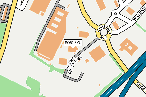
SO53 3YU is located in the Eastleigh South electoral ward, within the local authority district of Eastleigh and the English Parliamentary constituency of Eastleigh. The Sub Integrated Care Board (ICB) Location is NHS Hampshire and Isle of Wight ICB - D9Y0V and the police force is Hampshire. This postcode has been in use since December 1999.


GetTheData
Source: OS OpenMap – Local (Ordnance Survey)
Source: OS VectorMap District (Ordnance Survey)
Licence: Open Government Licence (requires attribution)
| Easting | 443160 |
| Northing | 118586 |
| Latitude | 50.965077 |
| Longitude | -1.386758 |
GetTheData
Source: Open Postcode Geo
Licence: Open Government Licence
| Country | England |
| Postcode District | SO53 |
| ➜ SO53 open data dashboard ➜ See where SO53 is on a map ➜ Where is Chandler's Ford? | |
GetTheData
Source: Land Registry Price Paid Data
Licence: Open Government Licence
Elevation or altitude of SO53 3YU as distance above sea level:
| Metres | Feet | |
|---|---|---|
| Elevation | 40m | 131ft |
Elevation is measured from the approximate centre of the postcode, to the nearest point on an OS contour line from OS Terrain 50, which has contour spacing of ten vertical metres.
➜ How high above sea level am I? Find the elevation of your current position using your device's GPS.
GetTheData
Source: Open Postcode Elevation
Licence: Open Government Licence
| Ward | Eastleigh South |
| Constituency | Eastleigh |
GetTheData
Source: ONS Postcode Database
Licence: Open Government Licence
| January 2024 | Anti-social behaviour | On or near Suffolk Drive | 374m |
| December 2023 | Violence and sexual offences | On or near Suffolk Drive | 374m |
| December 2023 | Violence and sexual offences | On or near Suffolk Drive | 374m |
| ➜ Get more crime data in our Crime section | |||
GetTheData
Source: data.police.uk
Licence: Open Government Licence
| Falkland Road (Chestnut Avenue) | Chandler's Ford | 52m |
| Falkland Road (Chestnut Avenue) | Chandler's Ford | 67m |
| B&q Hq (Chestnut Avenue) | Chilworth | 215m |
| Suffolk Drive (Falkland Road) | Chandler's Ford | 288m |
| Robin Square (Nightingale Avenue) | Eastleigh | 343m |
| Chandlers Ford Station | 2.1km |
| Southampton Airport Parkway Station | 2.3km |
| Eastleigh Station | 2.6km |
GetTheData
Source: NaPTAN
Licence: Open Government Licence
GetTheData
Source: ONS Postcode Database
Licence: Open Government Licence


➜ Get more ratings from the Food Standards Agency
GetTheData
Source: Food Standards Agency
Licence: FSA terms & conditions
| Last Collection | |||
|---|---|---|---|
| Location | Mon-Fri | Sat | Distance |
| Suffolk Drive | 17:15 | 11:45 | 261m |
| Asda Superstore | 17:00 | 11:30 | 366m |
| Velmore Post Office | 17:15 | 11:45 | 819m |
GetTheData
Source: Dracos
Licence: Creative Commons Attribution-ShareAlike
| Facility | Distance |
|---|---|
| Freespace Bmx Track Stoneycroft Rise, Stoneycroft Rise, Chandler's Ford, Eastleigh Cycling | 264m |
| Village Gym (Eastleigh) Bournemouth Road, Chandler's Ford, Eastleigh Health and Fitness Gym, Swimming Pool, Studio | 294m |
| Nightingale Primary School Blackbird Road, Eastleigh Swimming Pool, Grass Pitches | 549m |
GetTheData
Source: Active Places
Licence: Open Government Licence
| School | Phase of Education | Distance |
|---|---|---|
| Nightingale Primary School Blackbird Road, Eastleigh, SO50 9JW | Primary | 451m |
| Stoneham Park Primary Academy 21 Whieldon Way, North Stoneham Park, Eastleigh, SO50 9SB | Primary | 1.4km |
| Barton Peveril Sixth Form College Chestnut Avenue, Eastleigh, SO50 5ZA | 16 plus | 1.5km |
GetTheData
Source: Edubase
Licence: Open Government Licence
The below table lists the International Territorial Level (ITL) codes (formerly Nomenclature of Territorial Units for Statistics (NUTS) codes) and Local Administrative Units (LAU) codes for SO53 3YU:
| ITL 1 Code | Name |
|---|---|
| TLJ | South East (England) |
| ITL 2 Code | Name |
| TLJ3 | Hampshire and Isle of Wight |
| ITL 3 Code | Name |
| TLJ35 | South Hampshire |
| LAU 1 Code | Name |
| E07000086 | Eastleigh |
GetTheData
Source: ONS Postcode Directory
Licence: Open Government Licence
The below table lists the Census Output Area (OA), Lower Layer Super Output Area (LSOA), and Middle Layer Super Output Area (MSOA) for SO53 3YU:
| Code | Name | |
|---|---|---|
| OA | E00168057 | |
| LSOA | E01022677 | Eastleigh 006B |
| MSOA | E02004717 | Eastleigh 006 |
GetTheData
Source: ONS Postcode Directory
Licence: Open Government Licence
| SO50 9JZ | Robin Square | 287m |
| SO53 3ES | Suffolk Green | 304m |
| SO50 9JY | Nightingale Avenue | 327m |
| SO53 3HU | Suffolk Drive | 342m |
| SO50 9LB | Sparrow Square | 344m |
| SO53 3HX | Falkland Road | 353m |
| SO53 3HW | Suffolk Drive | 366m |
| SO53 3ER | Essex Green | 366m |
| SO53 3TG | Tollgate | 367m |
| SO50 9JX | Nightingale Avenue | 381m |
GetTheData
Source: Open Postcode Geo; Land Registry Price Paid Data
Licence: Open Government Licence