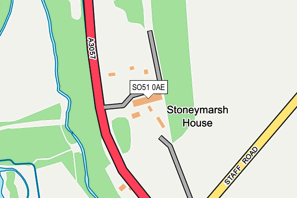
SO51 0AE is located in the Blackwater electoral ward, within the local authority district of Test Valley and the English Parliamentary constituency of Romsey and Southampton North. The Sub Integrated Care Board (ICB) Location is NHS Hampshire and Isle of Wight ICB - D9Y0V and the police force is Hampshire. This postcode has been in use since October 2008.


GetTheData
Source: OS OpenMap – Local (Ordnance Survey)
Source: OS VectorMap District (Ordnance Survey)
Licence: Open Government Licence (requires attribution)
| Easting | 433464 |
| Northing | 126061 |
| Latitude | 51.032943 |
| Longitude | -1.524148 |
GetTheData
Source: Open Postcode Geo
Licence: Open Government Licence
| Country | England |
| Postcode District | SO51 |
| ➜ SO51 open data dashboard ➜ See where SO51 is on a map | |
GetTheData
Source: Land Registry Price Paid Data
Licence: Open Government Licence
Elevation or altitude of SO51 0AE as distance above sea level:
| Metres | Feet | |
|---|---|---|
| Elevation | 30m | 98ft |
Elevation is measured from the approximate centre of the postcode, to the nearest point on an OS contour line from OS Terrain 50, which has contour spacing of ten vertical metres.
➜ How high above sea level am I? Find the elevation of your current position using your device's GPS.
GetTheData
Source: Open Postcode Elevation
Licence: Open Government Licence
| Ward | Blackwater |
| Constituency | Romsey And Southampton North |
GetTheData
Source: ONS Postcode Database
Licence: Open Government Licence
| April 2022 | Other crime | On or near Parking Area | 139m |
| February 2022 | Violence and sexual offences | On or near Parking Area | 139m |
| January 2022 | Violence and sexual offences | On or near Parking Area | 139m |
| ➜ Get more crime data in our Crime section | |||
GetTheData
Source: data.police.uk
Licence: Open Government Licence
| Bear And Ragged Staff (Staff Road) | Kimbridge | 325m |
| Bear And Ragged Staff (Staff Road) | Kimbridge | 331m |
| Mottisfont Turning (A3057) | Stonymarsh | 456m |
| Mottisfont Turning (A3057) | Stonymarsh | 468m |
| Resturant & Farm Shop Only (Kimbridge Lane) | Kimbridge | 778m |
| Mottisfont & Dunbridge Station | 1.6km |
| Romsey Station | 5km |
GetTheData
Source: NaPTAN
Licence: Open Government Licence
GetTheData
Source: ONS Postcode Database
Licence: Open Government Licence


➜ Get more ratings from the Food Standards Agency
GetTheData
Source: Food Standards Agency
Licence: FSA terms & conditions
| Last Collection | |||
|---|---|---|---|
| Location | Mon-Fri | Sat | Distance |
| Bear & Ragged Staff Public Hse | 16:30 | 11:00 | 326m |
| Mesh Road | 16:30 | 09:15 | 635m |
| Mottisfont Post Office | 16:30 | 09:30 | 1,238m |
GetTheData
Source: Dracos
Licence: Creative Commons Attribution-ShareAlike
| Facility | Distance |
|---|---|
| Michelmersh And Timsbury Recreation Ground Mannyngham Way, Timsbury, Romsey Grass Pitches | 1.4km |
| Hunts Farm Sports Ground Stockbridge Road, Timsbury, Romsey Grass Pitches | 1.6km |
| Mottisfont Sports Field Bengers Lane , Mottisfont, Romsey Grass Pitches | 2.1km |
GetTheData
Source: Active Places
Licence: Open Government Licence
| School | Phase of Education | Distance |
|---|---|---|
| Awbridge Primary School Danes Road, Awbridge, Romsey, SO51 0HL | Primary | 2.4km |
| Lockerley Church of England Endowed Primary School Butts Green, Lockerley, Romsey, SO51 0JG | Primary | 3.3km |
| Braishfield Primary School Common Hill Road, Braishfield, Romsey, SO51 0QF | Primary | 4.3km |
GetTheData
Source: Edubase
Licence: Open Government Licence
The below table lists the International Territorial Level (ITL) codes (formerly Nomenclature of Territorial Units for Statistics (NUTS) codes) and Local Administrative Units (LAU) codes for SO51 0AE:
| ITL 1 Code | Name |
|---|---|
| TLJ | South East (England) |
| ITL 2 Code | Name |
| TLJ3 | Hampshire and Isle of Wight |
| ITL 3 Code | Name |
| TLJ36 | Central Hampshire |
| LAU 1 Code | Name |
| E07000093 | Test Valley |
GetTheData
Source: ONS Postcode Directory
Licence: Open Government Licence
The below table lists the Census Output Area (OA), Lower Layer Super Output Area (LSOA), and Middle Layer Super Output Area (MSOA) for SO51 0AE:
| Code | Name | |
|---|---|---|
| OA | E00117808 | |
| LSOA | E01023184 | Test Valley 009D |
| MSOA | E02004822 | Test Valley 009 |
GetTheData
Source: ONS Postcode Directory
Licence: Open Government Licence
| SO51 0NX | Staff Road | 340m |
| SO51 0LD | Mesh Road | 632m |
| SO51 0LE | Benchmark Cottages | 701m |
| SO51 0LN | 947m | |
| SO51 0NQ | 971m | |
| SO51 0NR | 973m | |
| SO51 0NN | Hill View Road | 1050m |
| SO51 0NG | Stockbridge Road | 1081m |
| SO51 0NS | 1184m | |
| SO51 0NP | Haccups Lane | 1194m |
GetTheData
Source: Open Postcode Geo; Land Registry Price Paid Data
Licence: Open Government Licence