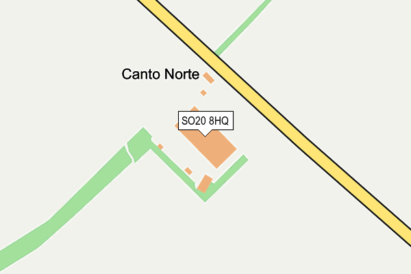
SO20 8HQ is located in the Mid Test electoral ward, within the local authority district of Test Valley and the English Parliamentary constituency of Romsey and Southampton North. The Sub Integrated Care Board (ICB) Location is NHS Hampshire and Isle of Wight ICB - D9Y0V and the police force is Hampshire. This postcode has been in use since September 2013.


GetTheData
Source: OS OpenMap – Local (Ordnance Survey)
Source: OS VectorMap District (Ordnance Survey)
Licence: Open Government Licence (requires attribution)
| Easting | 432297 |
| Northing | 138598 |
| Latitude | 51.145740 |
| Longitude | -1.539673 |
GetTheData
Source: Open Postcode Geo
Licence: Open Government Licence
| Country | England |
| Postcode District | SO20 |
| ➜ SO20 open data dashboard ➜ See where SO20 is on a map | |
GetTheData
Source: Land Registry Price Paid Data
Licence: Open Government Licence
Elevation or altitude of SO20 8HQ as distance above sea level:
| Metres | Feet | |
|---|---|---|
| Elevation | 90m | 295ft |
Elevation is measured from the approximate centre of the postcode, to the nearest point on an OS contour line from OS Terrain 50, which has contour spacing of ten vertical metres.
➜ How high above sea level am I? Find the elevation of your current position using your device's GPS.
GetTheData
Source: Open Postcode Elevation
Licence: Open Government Licence
| Ward | Mid Test |
| Constituency | Romsey And Southampton North |
GetTheData
Source: ONS Postcode Database
Licence: Open Government Licence
| Hill Fort (Old Stockbridge Road) | Danebury | 1,232m |
| Hill Fort (Old Stockbridge Road) | Danebury | 1,255m |
| Beech Close (Old Stockbridge Road) | Middle Wallop | 1,930m |
| Beech Close (Old Stockbridge Road) | Middle Wallop | 1,938m |
GetTheData
Source: NaPTAN
Licence: Open Government Licence
GetTheData
Source: ONS Postcode Database
Licence: Open Government Licence
| Last Collection | |||
|---|---|---|---|
| Location | Mon-Fri | Sat | Distance |
| Cross Roads | 17:30 | 09:45 | 3,254m |
| Red Rice | 17:00 | 07:00 | 3,818m |
| Over Wallop | 17:15 | 09:45 | 3,937m |
GetTheData
Source: Dracos
Licence: Creative Commons Attribution-ShareAlike
| Facility | Distance |
|---|---|
| Middle Wallop Station Salisbury Road, Middle Wallop, Stockbridge Sports Hall, Grass Pitches, Outdoor Tennis Courts, Squash Courts, Artificial Grass Pitch | 2.2km |
| Nether Wallop Playing Field Aylwards Way, Nether Wallop Grass Pitches, Outdoor Tennis Courts | 3.5km |
| Redrice Health & Fitness (Closed) Red Rice, Andover Studio, Health and Fitness Gym, Squash Courts | 3.5km |
GetTheData
Source: Active Places
Licence: Open Government Licence
| School | Phase of Education | Distance |
|---|---|---|
| Wallop Primary School School Lane, Nether Wallop, Stockbridge, SO20 8EH | Primary | 2.9km |
| Farleigh School Red Rice, Andover, SP11 7PW | Not applicable | 3.6km |
| Abbotts Ann Church of England Primary School Duck Street, Abbotts Ann, Andover, SP11 7FE | Primary | 4.3km |
GetTheData
Source: Edubase
Licence: Open Government Licence
The below table lists the International Territorial Level (ITL) codes (formerly Nomenclature of Territorial Units for Statistics (NUTS) codes) and Local Administrative Units (LAU) codes for SO20 8HQ:
| ITL 1 Code | Name |
|---|---|
| TLJ | South East (England) |
| ITL 2 Code | Name |
| TLJ3 | Hampshire and Isle of Wight |
| ITL 3 Code | Name |
| TLJ36 | Central Hampshire |
| LAU 1 Code | Name |
| E07000093 | Test Valley |
GetTheData
Source: ONS Postcode Directory
Licence: Open Government Licence
The below table lists the Census Output Area (OA), Lower Layer Super Output Area (LSOA), and Middle Layer Super Output Area (MSOA) for SO20 8HQ:
| Code | Name | |
|---|---|---|
| OA | E00117717 | |
| LSOA | E01023167 | Test Valley 009B |
| MSOA | E02004822 | Test Valley 009 |
GetTheData
Source: ONS Postcode Directory
Licence: Open Government Licence
| SO20 8EA | Kentsboro | 1850m |
| SO20 8DZ | Kentsboro | 2105m |
| SP11 7BX | 2546m | |
| SP11 7BZ | Council Houses | 2575m |
| SO20 8EH | School Lane | 2833m |
| SO20 8EP | Trout Lane | 2847m |
| SO20 8EW | Heathman Street | 2869m |
| SO20 8ET | Church Road | 2925m |
| SO20 8EX | The Square | 2958m |
| SO20 8EU | 2973m |
GetTheData
Source: Open Postcode Geo; Land Registry Price Paid Data
Licence: Open Government Licence