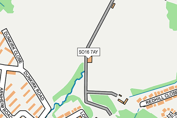
SO16 7AY is located in the Bassett electoral ward, within the unitary authority of Southampton and the English Parliamentary constituency of Romsey and Southampton North. The Sub Integrated Care Board (ICB) Location is NHS Hampshire and Isle of Wight ICB - D9Y0V and the police force is Hampshire. This postcode has been in use since December 1994.


GetTheData
Source: OS OpenMap – Local (Ordnance Survey)
Source: OS VectorMap District (Ordnance Survey)
Licence: Open Government Licence (requires attribution)
| Easting | 440845 |
| Northing | 115581 |
| Latitude | 50.938225 |
| Longitude | -1.420060 |
GetTheData
Source: Open Postcode Geo
Licence: Open Government Licence
| Country | England |
| Postcode District | SO16 |
| ➜ SO16 open data dashboard ➜ See where SO16 is on a map ➜ Where is Southampton? | |
GetTheData
Source: Land Registry Price Paid Data
Licence: Open Government Licence
Elevation or altitude of SO16 7AY as distance above sea level:
| Metres | Feet | |
|---|---|---|
| Elevation | 30m | 98ft |
Elevation is measured from the approximate centre of the postcode, to the nearest point on an OS contour line from OS Terrain 50, which has contour spacing of ten vertical metres.
➜ How high above sea level am I? Find the elevation of your current position using your device's GPS.
GetTheData
Source: Open Postcode Elevation
Licence: Open Government Licence
| Ward | Bassett |
| Constituency | Romsey And Southampton North |
GetTheData
Source: ONS Postcode Database
Licence: Open Government Licence
| January 2024 | Vehicle crime | On or near Parking Area | 164m |
| January 2024 | Violence and sexual offences | On or near Arnheim Road | 255m |
| January 2024 | Violence and sexual offences | On or near Dunkirk Road | 362m |
| ➜ Get more crime data in our Crime section | |||
GetTheData
Source: data.police.uk
Licence: Open Government Licence
| Dunkirk Road (Lordswood Road) | Upper Shirley | 278m |
| Dunkirk Road (Dale Valley Road) | Upper Shirley | 323m |
| Sports Centre (Hill Lane) | Upper Shirley | 325m |
| Dunkirk Road (Lordswood Road) | Upper Shirley | 330m |
| Sports Centre (Hill Lane) | Upper Shirley | 367m |
| St Denys Station | 2.9km |
| Swaythling Station | 3.1km |
| Millbrook (Hants) Station | 3.1km |
GetTheData
Source: NaPTAN
Licence: Open Government Licence
GetTheData
Source: ONS Postcode Database
Licence: Open Government Licence


➜ Get more ratings from the Food Standards Agency
GetTheData
Source: Food Standards Agency
Licence: FSA terms & conditions
| Last Collection | |||
|---|---|---|---|
| Location | Mon-Fri | Sat | Distance |
| Upper Hill Lane | 16:00 | 12:00 | 225m |
| Bassett Post Office | 17:15 | 12:00 | 424m |
| Redhill | 16:00 | 12:30 | 453m |
GetTheData
Source: Dracos
Licence: Creative Commons Attribution-ShareAlike
| Facility | Distance |
|---|---|
| Outdoor Sports Centre Thornhill Road, Southampton Athletics, Grass Pitches, Artificial Grass Pitch, Outdoor Tennis Courts, Cycling | 212m |
| Alpine Snowsports Centre Southampton Thornhill Road, Southampton Ski Slopes | 539m |
| Red Lodge Community Pool Vermont Close, Southampton Swimming Pool | 674m |
GetTheData
Source: Active Places
Licence: Open Government Licence
| School | Phase of Education | Distance |
|---|---|---|
| Hollybrook Infant School Hollybrook Infant School, Seagarth Close, Southampton, SO16 6RN | Primary | 329m |
| Hollybrook Junior School Hollybrook Junior School, Seagarth Lane, Hollybrook School, Southampton, SO16 6RL | Primary | 391m |
| Rosewood Free School Aldermoor Road, Southampton, SO16 5NA | Not applicable | 694m |
GetTheData
Source: Edubase
Licence: Open Government Licence
The below table lists the International Territorial Level (ITL) codes (formerly Nomenclature of Territorial Units for Statistics (NUTS) codes) and Local Administrative Units (LAU) codes for SO16 7AY:
| ITL 1 Code | Name |
|---|---|
| TLJ | South East (England) |
| ITL 2 Code | Name |
| TLJ3 | Hampshire and Isle of Wight |
| ITL 3 Code | Name |
| TLJ32 | Southampton |
| LAU 1 Code | Name |
| E06000045 | Southampton |
GetTheData
Source: ONS Postcode Directory
Licence: Open Government Licence
The below table lists the Census Output Area (OA), Lower Layer Super Output Area (LSOA), and Middle Layer Super Output Area (MSOA) for SO16 7AY:
| Code | Name | |
|---|---|---|
| OA | E00086613 | |
| LSOA | E01017151 | Southampton 006C |
| MSOA | E02003554 | Southampton 006 |
GetTheData
Source: ONS Postcode Directory
Licence: Open Government Licence
| SO16 6RY | Lordswood Gardens | 67m |
| SO16 6SB | Lordswood Close | 132m |
| SO16 7AX | Highclere Road | 157m |
| SO16 6SA | Lordswood Road | 191m |
| SO15 7TY | Hill Lane | 195m |
| SO16 7AW | Highclere Road | 195m |
| SO16 6SD | Lordswood Road | 202m |
| SO16 6LW | Arnheim Road | 226m |
| SO16 7AT | Thornhill Road | 231m |
| SO16 7BT | Redhill Close | 242m |
GetTheData
Source: Open Postcode Geo; Land Registry Price Paid Data
Licence: Open Government Licence