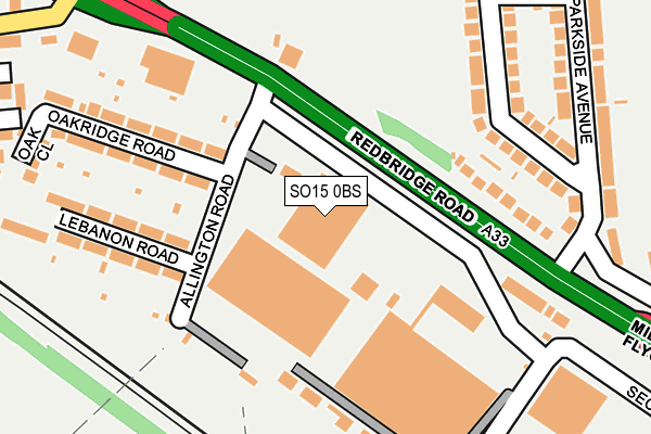
SO15 0BS is located in the Redbridge electoral ward, within the unitary authority of Southampton and the English Parliamentary constituency of Southampton, Test. The Sub Integrated Care Board (ICB) Location is NHS Hampshire and Isle of Wight ICB - D9Y0V and the police force is Hampshire. This postcode has been in use since June 2001.


GetTheData
Source: OS OpenMap – Local (Ordnance Survey)
Source: OS VectorMap District (Ordnance Survey)
Licence: Open Government Licence (requires attribution)
| Easting | 437756 |
| Northing | 113480 |
| Latitude | 50.919543 |
| Longitude | -1.464238 |
GetTheData
Source: Open Postcode Geo
Licence: Open Government Licence
| Country | England |
| Postcode District | SO15 |
| ➜ SO15 open data dashboard ➜ See where SO15 is on a map ➜ Where is Southampton? | |
GetTheData
Source: Land Registry Price Paid Data
Licence: Open Government Licence
Elevation or altitude of SO15 0BS as distance above sea level:
| Metres | Feet | |
|---|---|---|
| Elevation | 10m | 33ft |
Elevation is measured from the approximate centre of the postcode, to the nearest point on an OS contour line from OS Terrain 50, which has contour spacing of ten vertical metres.
➜ How high above sea level am I? Find the elevation of your current position using your device's GPS.
GetTheData
Source: Open Postcode Elevation
Licence: Open Government Licence
| Ward | Redbridge |
| Constituency | Southampton, Test |
GetTheData
Source: ONS Postcode Database
Licence: Open Government Licence
| January 2024 | Violence and sexual offences | On or near Parking Area | 476m |
| January 2024 | Drugs | On or near Parking Area | 476m |
| December 2023 | Violence and sexual offences | On or near Oakridge Road | 186m |
| ➜ Get more crime data in our Crime section | |||
GetTheData
Source: data.police.uk
Licence: Open Government Licence
| Parkside Avenue (Redbridge Road) | Redbridge | 139m |
| Parkside Avenue (Redbridge Road) | Redbridge | 159m |
| Redbridge School (A33 Redbridge Road) | Redbridge | 204m |
| Redbridge Roundabout (Redbridge Causeway) | Redbridge | 400m |
| Millbrook Roundabout (A33) | Millbrook | 429m |
| Redbridge (Hants) Station | 0.4km |
| Totton Station | 1.3km |
| Millbrook (Hants) Station | 2.3km |
GetTheData
Source: NaPTAN
Licence: Open Government Licence
GetTheData
Source: ONS Postcode Database
Licence: Open Government Licence


➜ Get more ratings from the Food Standards Agency
GetTheData
Source: Food Standards Agency
Licence: FSA terms & conditions
| Last Collection | |||
|---|---|---|---|
| Location | Mon-Fri | Sat | Distance |
| Redbridge Road | 17:15 | 12:00 | 130m |
| Brookwood Road | 16:00 | 12:30 | 240m |
| Millbrook Roundabout | 18:30 | 12:00 | 498m |
GetTheData
Source: Dracos
Licence: Creative Commons Attribution-ShareAlike
| Facility | Distance |
|---|---|
| Green Park Kendal Avenue, Southampton Grass Pitches | 401m |
| Redbridge Community School Cuckmere Lane, Southampton Sports Hall, Health and Fitness Gym, Artificial Grass Pitch, Grass Pitches, Studio | 406m |
| Redbridge Primary School Studland Road, Southampton Grass Pitches, Sports Hall | 576m |
GetTheData
Source: Active Places
Licence: Open Government Licence
| School | Phase of Education | Distance |
|---|---|---|
| Redbridge Community School Cuckmere Lane, Southampton, SO16 9RJ | Secondary | 378m |
| Redbridge Primary School Studland Road, Millbrook, Southampton, SO16 9BB | Primary | 614m |
| Mason Moor Primary School Helvellyn Road, Millbrook, Southampton, SO16 4AS | Primary | 848m |
GetTheData
Source: Edubase
Licence: Open Government Licence
The below table lists the International Territorial Level (ITL) codes (formerly Nomenclature of Territorial Units for Statistics (NUTS) codes) and Local Administrative Units (LAU) codes for SO15 0BS:
| ITL 1 Code | Name |
|---|---|
| TLJ | South East (England) |
| ITL 2 Code | Name |
| TLJ3 | Hampshire and Isle of Wight |
| ITL 3 Code | Name |
| TLJ32 | Southampton |
| LAU 1 Code | Name |
| E06000045 | Southampton |
GetTheData
Source: ONS Postcode Directory
Licence: Open Government Licence
The below table lists the Census Output Area (OA), Lower Layer Super Output Area (LSOA), and Middle Layer Super Output Area (MSOA) for SO15 0BS:
| Code | Name | |
|---|---|---|
| OA | E00087093 | |
| LSOA | E01017239 | Southampton 012C |
| MSOA | E02003560 | Southampton 012 |
GetTheData
Source: ONS Postcode Directory
Licence: Open Government Licence
| SO15 0LU | Redbridge Road | 142m |
| SO15 0LX | Oakridge Road | 176m |
| SO15 0LY | Oakridge Road | 184m |
| SO16 9AH | Brookwood Road | 188m |
| SO15 0NB | Lebanon Road | 190m |
| SO15 0NA | Lebanon Road | 194m |
| SO16 9AJ | Brookwood Road | 209m |
| SO15 0LT | Redbridge Road | 214m |
| SO15 0ND | Redbridge Road | 224m |
| SO16 9AF | Parkside Avenue | 248m |
GetTheData
Source: Open Postcode Geo; Land Registry Price Paid Data
Licence: Open Government Licence