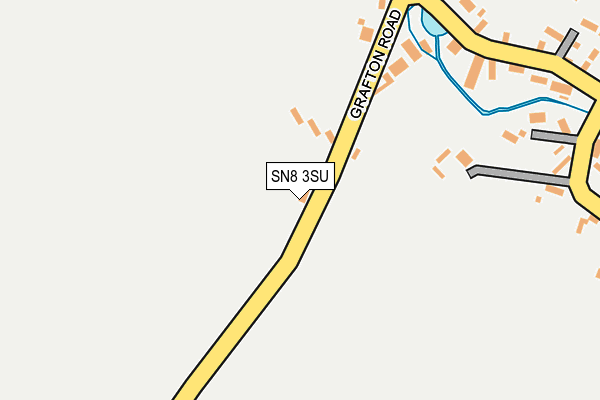
SN8 3SU is located in the Pewsey Vale East electoral ward, within the unitary authority of Wiltshire and the English Parliamentary constituency of Devizes. The Sub Integrated Care Board (ICB) Location is NHS Bath and North East Somerset, Swindon and Wiltshire ICB - 92 and the police force is Wiltshire. This postcode has been in use since January 1980.


GetTheData
Source: OS OpenMap – Local (Ordnance Survey)
Source: OS VectorMap District (Ordnance Survey)
Licence: Open Government Licence (requires attribution)
| Easting | 426547 |
| Northing | 161392 |
| Latitude | 51.350988 |
| Longitude | -1.620176 |
GetTheData
Source: Open Postcode Geo
Licence: Open Government Licence
| Country | England |
| Postcode District | SN8 |
| ➜ SN8 open data dashboard ➜ See where SN8 is on a map ➜ Where is Wilton? | |
GetTheData
Source: Land Registry Price Paid Data
Licence: Open Government Licence
Elevation or altitude of SN8 3SU as distance above sea level:
| Metres | Feet | |
|---|---|---|
| Elevation | 140m | 459ft |
Elevation is measured from the approximate centre of the postcode, to the nearest point on an OS contour line from OS Terrain 50, which has contour spacing of ten vertical metres.
➜ How high above sea level am I? Find the elevation of your current position using your device's GPS.
GetTheData
Source: Open Postcode Elevation
Licence: Open Government Licence
| Ward | Pewsey Vale East |
| Constituency | Devizes |
GetTheData
Source: ONS Postcode Database
Licence: Open Government Licence
| March 2021 | Anti-social behaviour | On or near Grafton Road | 147m |
| ➜ Get more crime data in our Crime section | |||
GetTheData
Source: data.police.uk
Licence: Open Government Licence
| Swan Inn (Grafton Road) | Wilton | 278m |
| Swan Inn (Grafton Road) | Wilton | 301m |
| Lynden Close (Wilton Road) | East Grafton | 764m |
| Lynden Close (Wilton Road) | East Grafton | 765m |
| Millstones (Wilton Road) | East Grafton | 900m |
| Bedwyn Station | 3.5km |
GetTheData
Source: NaPTAN
Licence: Open Government Licence
| Percentage of properties with Next Generation Access | 100.0% |
| Percentage of properties with Superfast Broadband | 100.0% |
| Percentage of properties with Ultrafast Broadband | 0.0% |
| Percentage of properties with Full Fibre Broadband | 0.0% |
Superfast Broadband is between 30Mbps and 300Mbps
Ultrafast Broadband is > 300Mbps
| Percentage of properties unable to receive 2Mbps | 0.0% |
| Percentage of properties unable to receive 5Mbps | 0.0% |
| Percentage of properties unable to receive 10Mbps | 0.0% |
| Percentage of properties unable to receive 30Mbps | 0.0% |
GetTheData
Source: Ofcom
Licence: Ofcom Terms of Use (requires attribution)
GetTheData
Source: ONS Postcode Database
Licence: Open Government Licence


➜ Get more ratings from the Food Standards Agency
GetTheData
Source: Food Standards Agency
Licence: FSA terms & conditions
| Last Collection | |||
|---|---|---|---|
| Location | Mon-Fri | Sat | Distance |
| Crofton | 16:00 | 08:30 | 1,273m |
| Marten | 16:15 | 09:00 | 2,250m |
| Savernake Forest Hotel | 16:00 | 08:00 | 2,349m |
GetTheData
Source: Dracos
Licence: Creative Commons Attribution-ShareAlike
| Facility | Distance |
|---|---|
| Burbage & Easton Royal Sports Club Eastsands, Burbage, Marlborough Grass Pitches, Outdoor Tennis Courts | 2.9km |
| Barn Meadow Eastcourt Road, Burbage Grass Pitches | 3.2km |
| Burbage Primary School Blackmans Lane, Burbage, Marlborough Grass Pitches | 3.4km |
GetTheData
Source: Active Places
Licence: Open Government Licence
| School | Phase of Education | Distance |
|---|---|---|
| Burbage Primary School Blackmans Lane, Off Ailesbury Way, Burbage, Marlborough, SN8 3TP | Primary | 3.4km |
| St Katharine's CofE Primary School Savernake Forest, Marlborough, SN8 3BG | Primary | 3.9km |
| Great Bedwyn Church of England School Farm Lane, Great Bedwyn, Marlborough, SN8 3TR | Primary | 4km |
GetTheData
Source: Edubase
Licence: Open Government Licence
The below table lists the International Territorial Level (ITL) codes (formerly Nomenclature of Territorial Units for Statistics (NUTS) codes) and Local Administrative Units (LAU) codes for SN8 3SU:
| ITL 1 Code | Name |
|---|---|
| TLK | South West (England) |
| ITL 2 Code | Name |
| TLK1 | Gloucestershire, Wiltshire and Bath/Bristol area |
| ITL 3 Code | Name |
| TLK15 | Wiltshire |
| LAU 1 Code | Name |
| E06000054 | Wiltshire |
GetTheData
Source: ONS Postcode Directory
Licence: Open Government Licence
The below table lists the Census Output Area (OA), Lower Layer Super Output Area (LSOA), and Middle Layer Super Output Area (MSOA) for SN8 3SU:
| Code | Name | |
|---|---|---|
| OA | E00162396 | |
| LSOA | E01031843 | Wiltshire 029A |
| MSOA | E02006640 | Wiltshire 029 |
GetTheData
Source: ONS Postcode Directory
Licence: Open Government Licence
| SN8 3ST | Upper Brooklands | 76m |
| SN8 3SS | 228m | |
| SN8 3SR | Hollow Lane | 329m |
| SN8 3SP | 445m | |
| SN8 3DL | Severalls | 774m |
| SN8 3US | Lynden Close | 831m |
| SN8 3DG | Hungerford Road | 886m |
| SN8 3DH | 918m | |
| SN8 3DN | 950m | |
| SN8 3DF | 974m |
GetTheData
Source: Open Postcode Geo; Land Registry Price Paid Data
Licence: Open Government Licence