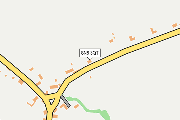
SN8 3QT lies on Old Rectory Cottages in Ham, Marlborough. SN8 3QT is located in the Pewsey Vale East electoral ward, within the unitary authority of Wiltshire and the English Parliamentary constituency of Devizes. The Sub Integrated Care Board (ICB) Location is NHS Bath and North East Somerset, Swindon and Wiltshire ICB - 92 and the police force is Wiltshire. This postcode has been in use since January 1980.


GetTheData
Source: OS OpenMap – Local (Ordnance Survey)
Source: OS VectorMap District (Ordnance Survey)
Licence: Open Government Licence (requires attribution)
| Easting | 433233 |
| Northing | 163221 |
| Latitude | 51.367083 |
| Longitude | -1.523999 |
GetTheData
Source: Open Postcode Geo
Licence: Open Government Licence
| Street | Old Rectory Cottages |
| Locality | Ham |
| Town/City | Marlborough |
| Country | England |
| Postcode District | SN8 |
| ➜ SN8 open data dashboard ➜ See where SN8 is on a map ➜ Where is Ham? | |
GetTheData
Source: Land Registry Price Paid Data
Licence: Open Government Licence
Elevation or altitude of SN8 3QT as distance above sea level:
| Metres | Feet | |
|---|---|---|
| Elevation | 150m | 492ft |
Elevation is measured from the approximate centre of the postcode, to the nearest point on an OS contour line from OS Terrain 50, which has contour spacing of ten vertical metres.
➜ How high above sea level am I? Find the elevation of your current position using your device's GPS.
GetTheData
Source: Open Postcode Elevation
Licence: Open Government Licence
| Ward | Pewsey Vale East |
| Constituency | Devizes |
GetTheData
Source: ONS Postcode Database
Licence: Open Government Licence
| January 2022 | Other theft | On or near Church Road | 327m |
| January 2022 | Possession of weapons | On or near Church Road | 327m |
| November 2021 | Vehicle crime | On or near Church Road | 327m |
| ➜ Get more crime data in our Crime section | |||
GetTheData
Source: data.police.uk
Licence: Open Government Licence
| Crown & Anchor (Main Street) | Ham | 220m |
| Crown & Anchor (Main Street) | Ham | 233m |
| Spray Farm (Spray Road) | Ham | 1,041m |
| Spray Farm (Spray Road) | Ham | 1,087m |
GetTheData
Source: NaPTAN
Licence: Open Government Licence
| Percentage of properties with Next Generation Access | 100.0% |
| Percentage of properties with Superfast Broadband | 100.0% |
| Percentage of properties with Ultrafast Broadband | 0.0% |
| Percentage of properties with Full Fibre Broadband | 0.0% |
Superfast Broadband is between 30Mbps and 300Mbps
Ultrafast Broadband is > 300Mbps
| Percentage of properties unable to receive 2Mbps | 0.0% |
| Percentage of properties unable to receive 5Mbps | 0.0% |
| Percentage of properties unable to receive 10Mbps | 0.0% |
| Percentage of properties unable to receive 30Mbps | 0.0% |
GetTheData
Source: Ofcom
Licence: Ofcom Terms of Use (requires attribution)
GetTheData
Source: ONS Postcode Database
Licence: Open Government Licence

➜ Get more ratings from the Food Standards Agency
GetTheData
Source: Food Standards Agency
Licence: FSA terms & conditions
| Last Collection | |||
|---|---|---|---|
| Location | Mon-Fri | Sat | Distance |
| Ham Spray | 16:00 | 10:00 | 1,031m |
| Rolfes Farm | 16:45 | 07:30 | 3,883m |
| Post Office Road | 16:00 | 08:00 | 4,157m |
GetTheData
Source: Dracos
Licence: Creative Commons Attribution-ShareAlike
| Facility | Distance |
|---|---|
| Shalbourne Recreation Ground Rivar Road, Shalbourne Grass Pitches, Outdoor Tennis Courts | 1.6km |
| Shalbourne C Of E Primary School Kingston Road, Shalbourne, Marlborough Grass Pitches | 1.8km |
| Inkpen Memorial Playing Fields Post Office Road, Inkpen, Hungerford Grass Pitches, Outdoor Tennis Courts | 4.1km |
GetTheData
Source: Active Places
Licence: Open Government Licence
| School | Phase of Education | Distance |
|---|---|---|
| Shalbourne CofE Primary School Shalbourne, Kingston Road, Shalbourne , Marlborough, SN8 3QH | Primary | 1.7km |
| Inkpen Primary School Weavers Lane, Inkpen, Hungerford, RG17 9QE | Primary | 3.9km |
| John O'Gaunt School Priory Road, Hungerford, RG17 0AN | Secondary | 4.3km |
GetTheData
Source: Edubase
Licence: Open Government Licence
The below table lists the International Territorial Level (ITL) codes (formerly Nomenclature of Territorial Units for Statistics (NUTS) codes) and Local Administrative Units (LAU) codes for SN8 3QT:
| ITL 1 Code | Name |
|---|---|
| TLK | South West (England) |
| ITL 2 Code | Name |
| TLK1 | Gloucestershire, Wiltshire and Bath/Bristol area |
| ITL 3 Code | Name |
| TLK15 | Wiltshire |
| LAU 1 Code | Name |
| E06000054 | Wiltshire |
GetTheData
Source: ONS Postcode Directory
Licence: Open Government Licence
The below table lists the Census Output Area (OA), Lower Layer Super Output Area (LSOA), and Middle Layer Super Output Area (MSOA) for SN8 3QT:
| Code | Name | |
|---|---|---|
| OA | E00162591 | |
| LSOA | E01031877 | Wiltshire 029D |
| MSOA | E02006640 | Wiltshire 029 |
GetTheData
Source: ONS Postcode Directory
Licence: Open Government Licence
| SN8 3QR | 75m | |
| SN8 3RF | Manor Cottages | 284m |
| SN8 3QU | Severalls | 358m |
| SN8 3RB | 365m | |
| SN8 3QX | Acorn Cottages | 540m |
| SN8 3QP | Ham Road | 557m |
| RG17 0RW | Cutting Hill | 721m |
| SN8 3QY | 885m | |
| SN8 3QW | Kew Gardens | 1109m |
| RG17 0RN | Cutting Hill | 1124m |
GetTheData
Source: Open Postcode Geo; Land Registry Price Paid Data
Licence: Open Government Licence