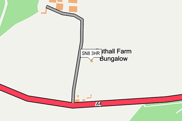
SN8 3HR is located in the Pewsey Vale East electoral ward, within the unitary authority of Wiltshire and the English Parliamentary constituency of Devizes. The Sub Integrated Care Board (ICB) Location is NHS Bath and North East Somerset, Swindon and Wiltshire ICB - 92 and the police force is Wiltshire. This postcode has been in use since January 1980.


GetTheData
Source: OS OpenMap – Local (Ordnance Survey)
Source: OS VectorMap District (Ordnance Survey)
Licence: Open Government Licence (requires attribution)
| Easting | 424050 |
| Northing | 167879 |
| Latitude | 51.409429 |
| Longitude | -1.655605 |
GetTheData
Source: Open Postcode Geo
Licence: Open Government Licence
| Country | England |
| Postcode District | SN8 |
| ➜ SN8 open data dashboard ➜ See where SN8 is on a map | |
GetTheData
Source: Land Registry Price Paid Data
Licence: Open Government Licence
Elevation or altitude of SN8 3HR as distance above sea level:
| Metres | Feet | |
|---|---|---|
| Elevation | 140m | 459ft |
Elevation is measured from the approximate centre of the postcode, to the nearest point on an OS contour line from OS Terrain 50, which has contour spacing of ten vertical metres.
➜ How high above sea level am I? Find the elevation of your current position using your device's GPS.
GetTheData
Source: Open Postcode Elevation
Licence: Open Government Licence
| Ward | Pewsey Vale East |
| Constituency | Devizes |
GetTheData
Source: ONS Postcode Database
Licence: Open Government Licence
| Bedwyn Station | 5.2km |
GetTheData
Source: NaPTAN
Licence: Open Government Licence
| Percentage of properties with Next Generation Access | 100.0% |
| Percentage of properties with Superfast Broadband | 0.0% |
| Percentage of properties with Ultrafast Broadband | 0.0% |
| Percentage of properties with Full Fibre Broadband | 0.0% |
Superfast Broadband is between 30Mbps and 300Mbps
Ultrafast Broadband is > 300Mbps
| Percentage of properties unable to receive 2Mbps | 0.0% |
| Percentage of properties unable to receive 5Mbps | 100.0% |
| Percentage of properties unable to receive 10Mbps | 100.0% |
| Percentage of properties unable to receive 30Mbps | 100.0% |
GetTheData
Source: Ofcom
Licence: Ofcom Terms of Use (requires attribution)
GetTheData
Source: ONS Postcode Database
Licence: Open Government Licence
| Last Collection | |||
|---|---|---|---|
| Location | Mon-Fri | Sat | Distance |
| Forest Hill | 17:15 | 07:00 | 3,317m |
| Cadley | 17:15 | 07:00 | 3,489m |
| Barnfield | 17:30 | 12:00 | 4,031m |
GetTheData
Source: Dracos
Licence: Creative Commons Attribution-ShareAlike
| Facility | Distance |
|---|---|
| Minal Cricket Club And Sports Field Werg, Werg, Mildenhall Grass Pitches | 3.3km |
| Marlborough Cricket Club Forest Hill, Marlborough Grass Pitches | 3.7km |
| Elcot Lane Playing Field Elcot Lane, Marlborough Grass Pitches | 4.5km |
GetTheData
Source: Active Places
Licence: Open Government Licence
| School | Phase of Education | Distance |
|---|---|---|
| St Katharine's CofE Primary School Savernake Forest, Marlborough, SN8 3BG | Primary | 3km |
| Great Bedwyn Church of England School Farm Lane, Great Bedwyn, Marlborough, SN8 3TR | Primary | 5km |
| Ramsbury Primary School Back Lane, Ramsbury, Marlborough, SN8 2QH | Primary | 5.2km |
GetTheData
Source: Edubase
Licence: Open Government Licence
The below table lists the International Territorial Level (ITL) codes (formerly Nomenclature of Territorial Units for Statistics (NUTS) codes) and Local Administrative Units (LAU) codes for SN8 3HR:
| ITL 1 Code | Name |
|---|---|
| TLK | South West (England) |
| ITL 2 Code | Name |
| TLK1 | Gloucestershire, Wiltshire and Bath/Bristol area |
| ITL 3 Code | Name |
| TLK15 | Wiltshire |
| LAU 1 Code | Name |
| E06000054 | Wiltshire |
GetTheData
Source: ONS Postcode Directory
Licence: Open Government Licence
The below table lists the Census Output Area (OA), Lower Layer Super Output Area (LSOA), and Middle Layer Super Output Area (MSOA) for SN8 3HR:
| Code | Name | |
|---|---|---|
| OA | E00162402 | |
| LSOA | E01031843 | Wiltshire 029A |
| MSOA | E02006640 | Wiltshire 029 |
GetTheData
Source: ONS Postcode Directory
Licence: Open Government Licence
| SN8 3HP | 1322m | |
| SN8 2EU | 1964m | |
| SN8 3LH | 2074m | |
| SN8 2EY | Stone Lane | 2121m |
| SN8 2EX | 2267m | |
| SN8 2EZ | Kennet Rise | 2303m |
| SN8 2NG | 2309m | |
| SN8 2HA | 2325m | |
| SN8 3HY | Horsehall Hill | 2362m |
| SN8 3HT | 2526m |
GetTheData
Source: Open Postcode Geo; Land Registry Price Paid Data
Licence: Open Government Licence