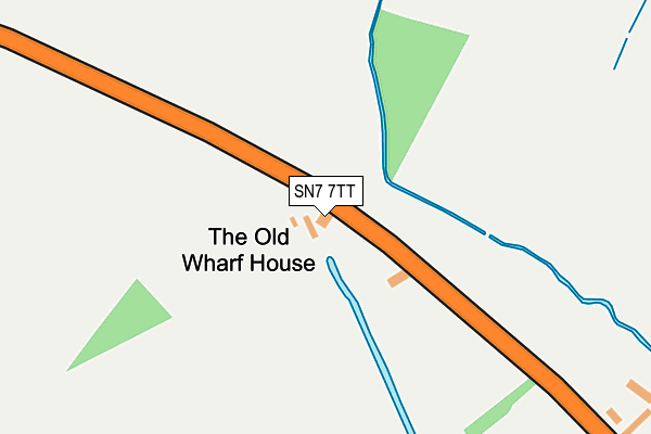
SN7 7TT is located in the Watchfield & Shrivenham electoral ward, within the local authority district of Vale of White Horse and the English Parliamentary constituency of Wantage. The Sub Integrated Care Board (ICB) Location is NHS Bath and North East Somerset, Swindon and Wiltshire ICB - 92 and the police force is Thames Valley. This postcode has been in use since January 1980.


GetTheData
Source: OS OpenMap – Local (Ordnance Survey)
Source: OS VectorMap District (Ordnance Survey)
Licence: Open Government Licence (requires attribution)
| Easting | 426657 |
| Northing | 190540 |
| Latitude | 51.613063 |
| Longitude | -1.616417 |
GetTheData
Source: Open Postcode Geo
Licence: Open Government Licence
| Country | England |
| Postcode District | SN7 |
| ➜ SN7 open data dashboard ➜ See where SN7 is on a map | |
GetTheData
Source: Land Registry Price Paid Data
Licence: Open Government Licence
Elevation or altitude of SN7 7TT as distance above sea level:
| Metres | Feet | |
|---|---|---|
| Elevation | 90m | 295ft |
Elevation is measured from the approximate centre of the postcode, to the nearest point on an OS contour line from OS Terrain 50, which has contour spacing of ten vertical metres.
➜ How high above sea level am I? Find the elevation of your current position using your device's GPS.
GetTheData
Source: Open Postcode Elevation
Licence: Open Government Licence
| Ward | Watchfield & Shrivenham |
| Constituency | Wantage |
GetTheData
Source: ONS Postcode Database
Licence: Open Government Licence
| Green (Kings Lane) | Longcot | 738m |
| Hughes Crescent (Kings Lane) | Longcot | 746m |
| Green (Kings Lane) | Longcot | 748m |
| Hughes Crescent (Kings Lane) | Longcot | 751m |
| Military College (Faringdon Road) | Watchfield | 1,390m |
GetTheData
Source: NaPTAN
Licence: Open Government Licence
GetTheData
Source: ONS Postcode Database
Licence: Open Government Licence


➜ Get more ratings from the Food Standards Agency
GetTheData
Source: Food Standards Agency
Licence: FSA terms & conditions
| Last Collection | |||
|---|---|---|---|
| Location | Mon-Fri | Sat | Distance |
| Fernham | 16:45 | 07:00 | 2,947m |
| Shrivenham Post Office | 18:30 | 12:30 | 3,101m |
| Little Coxwell | 17:00 | 07:15 | 3,238m |
GetTheData
Source: Dracos
Licence: Creative Commons Attribution-ShareAlike
| Facility | Distance |
|---|---|
| Longcot And Fernham Church Of England Primary School The Green, Longcot, Faringdon Grass Pitches, Outdoor Tennis Courts | 696m |
| The Defence Academy (Shrivenham Station) Faringdon Road, Shrivenham, Swindon Sports Hall, Swimming Pool, Health and Fitness Gym, Golf, Squash Courts, Outdoor Tennis Courts, Artificial Grass Pitch, Grass Pitches | 1.7km |
| Watchfield Primary School North Street, Watchfield, Swindon Grass Pitches | 2km |
GetTheData
Source: Active Places
Licence: Open Government Licence
| School | Phase of Education | Distance |
|---|---|---|
| Longcot and Fernham Church of England Primary School Kings Lane, Longcot, Faringdon, SN7 7SY | Primary | 696m |
| Watchfield Primary School North Street, Watchfield, SN6 8SD | Primary | 2km |
| Shrivenham Church of England School High Street, Shrivenham, Swindon, SN6 8AA | Primary | 3.2km |
GetTheData
Source: Edubase
Licence: Open Government Licence
The below table lists the International Territorial Level (ITL) codes (formerly Nomenclature of Territorial Units for Statistics (NUTS) codes) and Local Administrative Units (LAU) codes for SN7 7TT:
| ITL 1 Code | Name |
|---|---|
| TLJ | South East (England) |
| ITL 2 Code | Name |
| TLJ1 | Berkshire, Buckinghamshire and Oxfordshire |
| ITL 3 Code | Name |
| TLJ14 | Oxfordshire CC |
| LAU 1 Code | Name |
| E07000180 | Vale of White Horse |
GetTheData
Source: ONS Postcode Directory
Licence: Open Government Licence
The below table lists the Census Output Area (OA), Lower Layer Super Output Area (LSOA), and Middle Layer Super Output Area (MSOA) for SN7 7TT:
| Code | Name | |
|---|---|---|
| OA | E00146410 | |
| LSOA | E01028747 | Vale of White Horse 016C |
| MSOA | E02006886 | Vale of White Horse 016 |
GetTheData
Source: ONS Postcode Directory
Licence: Open Government Licence
| SN7 7TR | Majors Road | 86m |
| SN7 7TP | Longcot Road | 398m |
| SN7 7TW | Shrivenham Road | 412m |
| SN7 7TL | Shrivenham Road | 669m |
| SN7 7TA | Church View | 696m |
| SN7 7TN | Church Close | 700m |
| SN7 7SZ | Church View Cottages | 732m |
| SN7 7SS | Kings Lane | 741m |
| SN7 7SY | The Green | 756m |
| SN7 7TB | Radnor Court | 773m |
GetTheData
Source: Open Postcode Geo; Land Registry Price Paid Data
Licence: Open Government Licence