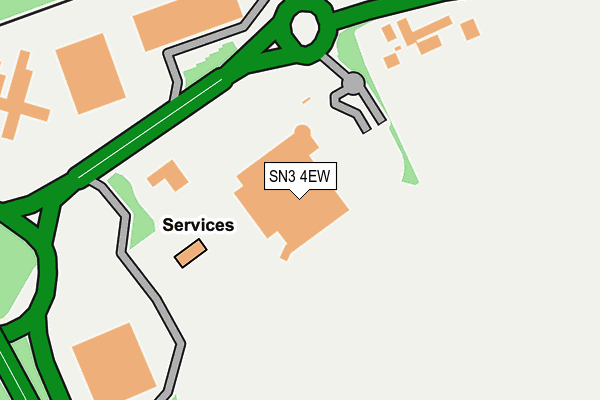
SN3 4EW is located in the St Margaret and South Marston electoral ward, within the unitary authority of Swindon and the English Parliamentary constituency of North Swindon. The Sub Integrated Care Board (ICB) Location is NHS Bath and North East Somerset, Swindon and Wiltshire ICB - 92 and the police force is Wiltshire. This postcode has been in use since March 1988.


GetTheData
Source: OS OpenMap – Local (Ordnance Survey)
Source: OS VectorMap District (Ordnance Survey)
Licence: Open Government Licence (requires attribution)
| Easting | 418916 |
| Northing | 186482 |
| Latitude | 51.576888 |
| Longitude | -1.728428 |
GetTheData
Source: Open Postcode Geo
Licence: Open Government Licence
| Country | England |
| Postcode District | SN3 |
| ➜ SN3 open data dashboard ➜ See where SN3 is on a map ➜ Where is Stratton St Margaret? | |
GetTheData
Source: Land Registry Price Paid Data
Licence: Open Government Licence
Elevation or altitude of SN3 4EW as distance above sea level:
| Metres | Feet | |
|---|---|---|
| Elevation | 100m | 328ft |
Elevation is measured from the approximate centre of the postcode, to the nearest point on an OS contour line from OS Terrain 50, which has contour spacing of ten vertical metres.
➜ How high above sea level am I? Find the elevation of your current position using your device's GPS.
GetTheData
Source: Open Postcode Elevation
Licence: Open Government Licence
| Ward | St Margaret And South Marston |
| Constituency | North Swindon |
GetTheData
Source: ONS Postcode Database
Licence: Open Government Licence
| Sainsburys (A420) | Stratton Park | 127m |
| Sainsburys (A420) | Stratton Park | 172m |
| White Hart (Oxford Road) | Stratton Park | 561m |
| Corinium Way (Sywell Road) | Coleview | 726m |
| Corinium Way (Sywell Road) | Coleview | 746m |
| Swindon Station | 4.2km |
GetTheData
Source: NaPTAN
Licence: Open Government Licence
GetTheData
Source: ONS Postcode Database
Licence: Open Government Licence


➜ Get more ratings from the Food Standards Agency
GetTheData
Source: Food Standards Agency
Licence: FSA terms & conditions
| Last Collection | |||
|---|---|---|---|
| Location | Mon-Fri | Sat | Distance |
| Sywell Road | 17:30 | 12:00 | 745m |
| Whilestone Way | 17:30 | 12:00 | 804m |
| Swanbrook | 17:45 | 12:00 | 918m |
GetTheData
Source: Dracos
Licence: Creative Commons Attribution-ShareAlike
| Facility | Distance |
|---|---|
| Colebrook Junior School Towcester Road, Swindon Grass Pitches | 980m |
| St Josephs Catholic Comprehensive School (Closed) Nythe Road, Swindon Sports Hall, Grass Pitches | 1.2km |
| Grange Leisure Centre Grange Drive, Swindon Sports Hall, Health and Fitness Gym, Squash Courts, Artificial Grass Pitch | 1.3km |
GetTheData
Source: Active Places
Licence: Open Government Licence
| School | Phase of Education | Distance |
|---|---|---|
| Colebrook Junior School Towcester Road, Stratton St Margaret, Swindon, SN3 4AS | Primary | 1.1km |
| Colebrook Infant Academy Towcester Road, Coleview, Swindon, SN3 4AS | Primary | 1.1km |
| Covingham Park Primary School The Harriers, Covingham Park, Swindon, SN3 5BD | Primary | 1.3km |
GetTheData
Source: Edubase
Licence: Open Government Licence
The below table lists the International Territorial Level (ITL) codes (formerly Nomenclature of Territorial Units for Statistics (NUTS) codes) and Local Administrative Units (LAU) codes for SN3 4EW:
| ITL 1 Code | Name |
|---|---|
| TLK | South West (England) |
| ITL 2 Code | Name |
| TLK1 | Gloucestershire, Wiltshire and Bath/Bristol area |
| ITL 3 Code | Name |
| TLK14 | Swindon |
| LAU 1 Code | Name |
| E06000030 | Swindon |
GetTheData
Source: ONS Postcode Directory
Licence: Open Government Licence
The below table lists the Census Output Area (OA), Lower Layer Super Output Area (LSOA), and Middle Layer Super Output Area (MSOA) for SN3 4EW:
| Code | Name | |
|---|---|---|
| OA | E00078254 | |
| LSOA | E01015473 | Swindon 008A |
| MSOA | E02003219 | Swindon 008 |
GetTheData
Source: ONS Postcode Directory
Licence: Open Government Licence
| SN3 4GA | Reed Court | 484m |
| SN3 4HG | Wanborough Road | 518m |
| SN3 4RS | Shrivenham Road | 541m |
| SN3 4BS | Trajan Road | 554m |
| SN3 4HQ | Wanborough Road | 561m |
| SN3 4RU | Shrivenham Road | 563m |
| SN3 4AB | Capitol Close | 566m |
| SN3 4AD | Constantine Close | 615m |
| SN3 4HU | Cullerne Road | 627m |
| SN3 4AE | Verulam Close | 634m |
GetTheData
Source: Open Postcode Geo; Land Registry Price Paid Data
Licence: Open Government Licence