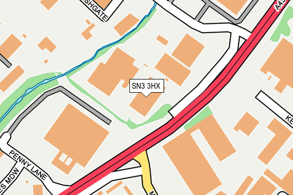
SN3 3HX is located in the St Margaret and South Marston electoral ward, within the unitary authority of Swindon and the English Parliamentary constituency of North Swindon. The Sub Integrated Care Board (ICB) Location is NHS Bath and North East Somerset, Swindon and Wiltshire ICB - 92 and the police force is Wiltshire. This postcode has been in use since January 1980.


GetTheData
Source: OS OpenMap – Local (Ordnance Survey)
Source: OS VectorMap District (Ordnance Survey)
Licence: Open Government Licence (requires attribution)
| Easting | 416950 |
| Northing | 185460 |
| Latitude | 51.567762 |
| Longitude | -1.756847 |
GetTheData
Source: Open Postcode Geo
Licence: Open Government Licence
| Country | England |
| Postcode District | SN3 |
| ➜ SN3 open data dashboard ➜ See where SN3 is on a map ➜ Where is Stratton St Margaret? | |
GetTheData
Source: Land Registry Price Paid Data
Licence: Open Government Licence
Elevation or altitude of SN3 3HX as distance above sea level:
| Metres | Feet | |
|---|---|---|
| Elevation | 100m | 328ft |
Elevation is measured from the approximate centre of the postcode, to the nearest point on an OS contour line from OS Terrain 50, which has contour spacing of ten vertical metres.
➜ How high above sea level am I? Find the elevation of your current position using your device's GPS.
GetTheData
Source: Open Postcode Elevation
Licence: Open Government Licence
| Ward | St Margaret And South Marston |
| Constituency | North Swindon |
GetTheData
Source: ONS Postcode Database
Licence: Open Government Licence
| January 2024 | Anti-social behaviour | On or near Parking Area | 373m |
| January 2024 | Violence and sexual offences | On or near Parking Area | 373m |
| January 2024 | Violence and sexual offences | On or near Parking Area | 373m |
| ➜ Get more crime data in our Crime section | |||
GetTheData
Source: data.police.uk
Licence: Open Government Licence
| Drakes Park (Drakes Way) | Walcot East | 66m |
| Drakes Park (Drakes Way) | Walcot East | 147m |
| Marlowe Avenue Shops (Marlowe Avenue) | Walcot East | 259m |
| Maitland Road (Frobisher Drive) | Walcot East | 301m |
| Marlowe Avenue Shops (Marlowe Avenue) | Walcot East | 319m |
| Swindon Station | 2km |
GetTheData
Source: NaPTAN
Licence: Open Government Licence
GetTheData
Source: ONS Postcode Database
Licence: Open Government Licence


➜ Get more ratings from the Food Standards Agency
GetTheData
Source: Food Standards Agency
Licence: FSA terms & conditions
| Last Collection | |||
|---|---|---|---|
| Location | Mon-Fri | Sat | Distance |
| Maitland Road | 17:45 | 12:15 | 287m |
| Stratton Road | 17:45 | 12:30 | 455m |
| Norfolk Close | 17:45 | 12:00 | 512m |
GetTheData
Source: Dracos
Licence: Creative Commons Attribution-ShareAlike
| Facility | Distance |
|---|---|
| The Gym Group (Swindon) Greenbridge Retail Park, Garrard Way, Swindon Health and Fitness Gym | 423m |
| Nuffield Health (Swindon) Greenbridge Retail Park, Garrard Way, Swindon Swimming Pool, Health and Fitness Gym, Studio | 471m |
| Youth First Centre For Health Marlowe Avenue, Swindon Sports Hall | 476m |
GetTheData
Source: Active Places
Licence: Open Government Licence
| School | Phase of Education | Distance |
|---|---|---|
| Horizons College Bincknoll Lane, Unit 5, Interface Business Park, Royal Wootton Bassett, SN4 8QQ | Not applicable | 477m |
| Mountford Manor Primary School Bothwell Road, Walcot, Swindon, SN3 3EZ | Primary | 533m |
| St Joseph's Catholic College Ocotal Way, Swindon, SN3 3LR | Secondary | 577m |
GetTheData
Source: Edubase
Licence: Open Government Licence
The below table lists the International Territorial Level (ITL) codes (formerly Nomenclature of Territorial Units for Statistics (NUTS) codes) and Local Administrative Units (LAU) codes for SN3 3HX:
| ITL 1 Code | Name |
|---|---|
| TLK | South West (England) |
| ITL 2 Code | Name |
| TLK1 | Gloucestershire, Wiltshire and Bath/Bristol area |
| ITL 3 Code | Name |
| TLK14 | Swindon |
| LAU 1 Code | Name |
| E06000030 | Swindon |
GetTheData
Source: ONS Postcode Directory
Licence: Open Government Licence
The below table lists the Census Output Area (OA), Lower Layer Super Output Area (LSOA), and Middle Layer Super Output Area (MSOA) for SN3 3HX:
| Code | Name | |
|---|---|---|
| OA | E00078653 | |
| LSOA | E01015549 | Swindon 009A |
| MSOA | E02003220 | Swindon 009 |
GetTheData
Source: ONS Postcode Directory
Licence: Open Government Licence
| SN3 3JF | 165m | |
| SN3 3EL | Marlowe Avenue | 218m |
| SN3 3EP | Markham Close | 237m |
| SN3 3EW | Frobisher Drive | 282m |
| SN3 3SQ | Greenbridge Retail Park | 288m |
| SN3 3ER | Hamilton Close | 302m |
| SN3 3HQ | Marlowe Avenue | 315m |
| SN3 3HB | Frobisher Drive | 322m |
| SN3 3JJ | Crampton Road | 338m |
| SN3 3HG | Maitland Road | 349m |
GetTheData
Source: Open Postcode Geo; Land Registry Price Paid Data
Licence: Open Government Licence