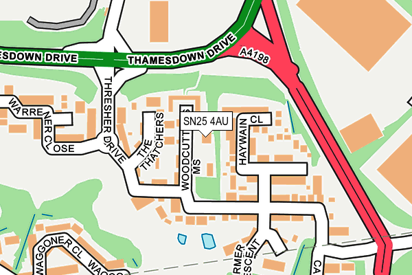
SN25 4AU is located in the St Andrews electoral ward, within the unitary authority of Swindon and the English Parliamentary constituency of North Swindon. The Sub Integrated Care Board (ICB) Location is NHS Bath and North East Somerset, Swindon and Wiltshire ICB - 92 and the police force is Wiltshire. This postcode has been in use since June 2000.


GetTheData
Source: OS OpenMap – Local (Ordnance Survey)
Source: OS VectorMap District (Ordnance Survey)
Licence: Open Government Licence (requires attribution)
| Easting | 415175 |
| Northing | 189033 |
| Latitude | 51.599938 |
| Longitude | -1.782303 |
GetTheData
Source: Open Postcode Geo
Licence: Open Government Licence
| Country | England |
| Postcode District | SN25 |
| ➜ SN25 open data dashboard ➜ See where SN25 is on a map ➜ Where is Swindon? | |
GetTheData
Source: Land Registry Price Paid Data
Licence: Open Government Licence
Elevation or altitude of SN25 4AU as distance above sea level:
| Metres | Feet | |
|---|---|---|
| Elevation | 130m | 427ft |
Elevation is measured from the approximate centre of the postcode, to the nearest point on an OS contour line from OS Terrain 50, which has contour spacing of ten vertical metres.
➜ How high above sea level am I? Find the elevation of your current position using your device's GPS.
GetTheData
Source: Open Postcode Elevation
Licence: Open Government Licence
| Ward | St Andrews |
| Constituency | North Swindon |
GetTheData
Source: ONS Postcode Database
Licence: Open Government Licence
| January 2024 | Violence and sexual offences | On or near Warrener Close | 281m |
| November 2023 | Vehicle crime | On or near Warrener Close | 281m |
| October 2023 | Vehicle crime | On or near Warrener Close | 281m |
| ➜ Get more crime data in our Crime section | |||
GetTheData
Source: data.police.uk
Licence: Open Government Licence
| Warrener Close | Groundwell | 155m |
| Groundwell West (Cricklade Road) | Groundwell | 190m |
| Groundwell West (Cricklade Road) | Groundwell | 259m |
| Arkwright Road | Groundwell | 347m |
| Arkwright Road | Groundwell | 359m |
| Swindon Station | 3.8km |
GetTheData
Source: NaPTAN
Licence: Open Government Licence
GetTheData
Source: ONS Postcode Database
Licence: Open Government Licence


➜ Get more ratings from the Food Standards Agency
GetTheData
Source: Food Standards Agency
Licence: FSA terms & conditions
| Last Collection | |||
|---|---|---|---|
| Location | Mon-Fri | Sat | Distance |
| Groundwell Industrial Estate | 18:45 | 11:30 | 104m |
| Hilmarton Avenue | 17:30 | 11:45 | 535m |
| Turnpike | 16:15 | 09:00 | 589m |
GetTheData
Source: Dracos
Licence: Creative Commons Attribution-ShareAlike
| Facility | Distance |
|---|---|
| David Lloyd (Swindon) Latham Road, Swindon Swimming Pool, Health and Fitness Gym, Sports Hall, Indoor Tennis Centre, Studio, Outdoor Tennis Courts | 440m |
| Abbey Meads Community Primary School Hugo Drive, Swindon Artificial Grass Pitch, Grass Pitches | 719m |
| Nalgo Sports And Leisure Club Cricklade Road, Swindon Grass Pitches, Outdoor Tennis Courts | 773m |
GetTheData
Source: Active Places
Licence: Open Government Licence
| School | Phase of Education | Distance |
|---|---|---|
| Abbey Meads Community Primary School Hugo Drive, Abbey Meads, Swindon, SN25 4GY | Primary | 693m |
| Seven Fields Primary School Leigh Road, Penhill, Swindon, SN2 5DE | Primary | 1.1km |
| St Luke's Academy Cricklade Road, Swindon, SN2 7AS | Not applicable | 1.2km |
GetTheData
Source: Edubase
Licence: Open Government Licence
The below table lists the International Territorial Level (ITL) codes (formerly Nomenclature of Territorial Units for Statistics (NUTS) codes) and Local Administrative Units (LAU) codes for SN25 4AU:
| ITL 1 Code | Name |
|---|---|
| TLK | South West (England) |
| ITL 2 Code | Name |
| TLK1 | Gloucestershire, Wiltshire and Bath/Bristol area |
| ITL 3 Code | Name |
| TLK14 | Swindon |
| LAU 1 Code | Name |
| E06000030 | Swindon |
GetTheData
Source: ONS Postcode Directory
Licence: Open Government Licence
The below table lists the Census Output Area (OA), Lower Layer Super Output Area (LSOA), and Middle Layer Super Output Area (MSOA) for SN25 4AU:
| Code | Name | |
|---|---|---|
| OA | E00166476 | |
| LSOA | E01015472 | Swindon 028B |
| MSOA | E02006849 | Swindon 028 |
GetTheData
Source: ONS Postcode Directory
Licence: Open Government Licence
| SN25 4DR | Woodcutters Mews | 24m |
| SN25 4DP | Woodcutters Mews | 33m |
| SN25 4AS | Woodcutters Mews | 40m |
| SN25 4AB | Haywain Close | 90m |
| SN25 4AT | The Thatchers | 93m |
| SN25 4AE | Thresher Drive | 98m |
| SN25 4AF | Thresher Drive | 121m |
| SN25 4AG | Thresher Drive | 167m |
| SN25 4WU | Waggoner Close | 258m |
| SN2 5NB | Shrewton Walk | 300m |
GetTheData
Source: Open Postcode Geo; Land Registry Price Paid Data
Licence: Open Government Licence