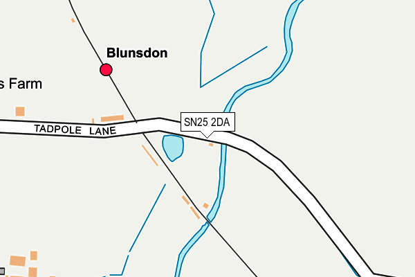
SN25 2DA is located in the Purton electoral ward, within the unitary authority of Wiltshire and the English Parliamentary constituency of North Wiltshire. The Sub Integrated Care Board (ICB) Location is NHS Bath and North East Somerset, Swindon and Wiltshire ICB - 92 and the police force is Wiltshire. This postcode has been in use since June 2000.


GetTheData
Source: OS OpenMap – Local (Ordnance Survey)
Source: OS VectorMap District (Ordnance Survey)
Licence: Open Government Licence (requires attribution)
| Easting | 411078 |
| Northing | 189717 |
| Latitude | 51.606182 |
| Longitude | -1.841432 |
GetTheData
Source: Open Postcode Geo
Licence: Open Government Licence
| Country | England |
| Postcode District | SN25 |
➜ See where SN25 is on a map | |
GetTheData
Source: Land Registry Price Paid Data
Licence: Open Government Licence
Elevation or altitude of SN25 2DA as distance above sea level:
| Metres | Feet | |
|---|---|---|
| Elevation | 90m | 295ft |
Elevation is measured from the approximate centre of the postcode, to the nearest point on an OS contour line from OS Terrain 50, which has contour spacing of ten vertical metres.
➜ How high above sea level am I? Find the elevation of your current position using your device's GPS.
GetTheData
Source: Open Postcode Elevation
Licence: Open Government Licence
| Ward | Purton |
| Constituency | North Wiltshire |
GetTheData
Source: ONS Postcode Database
Licence: Open Government Licence
| Railway Station (Unnamed Access Road) | Hayes Knoll | 16m |
| Tortworth Road (Redhouse Way) | Redhouse | 1,143m |
| Tortworth Road (Redhouse Way) | Redhouse | 1,205m |
| Hartington Road (Oakhurst Way) | Oakhurst | 1,210m |
| Hartington Road (Oakhurst Way) | Oakhurst | 1,243m |
| Swindon Station | 6km |
GetTheData
Source: NaPTAN
Licence: Open Government Licence
GetTheData
Source: ONS Postcode Database
Licence: Open Government Licence


➜ Get more ratings from the Food Standards Agency
GetTheData
Source: Food Standards Agency
Licence: FSA terms & conditions
| Last Collection | |||
|---|---|---|---|
| Location | Mon-Fri | Sat | Distance |
| Oakhurst Way | 17:30 | 12:15 | 1,227m |
| Queen Elizabeth Drive | 17:25 | 12:00 | 1,787m |
| Taw Hill | 17:30 | 12:00 | 2,190m |
GetTheData
Source: Dracos
Licence: Creative Commons Attribution-ShareAlike
| Risk of SN25 2DA flooding from rivers and sea | Medium |
| ➜ SN25 2DA flood map | |
GetTheData
Source: Open Flood Risk by Postcode
Licence: Open Government Licence
The below table lists the International Territorial Level (ITL) codes (formerly Nomenclature of Territorial Units for Statistics (NUTS) codes) and Local Administrative Units (LAU) codes for SN25 2DA:
| ITL 1 Code | Name |
|---|---|
| TLK | South West (England) |
| ITL 2 Code | Name |
| TLK1 | Gloucestershire, Wiltshire and Bath/Bristol area |
| ITL 3 Code | Name |
| TLK15 | Wiltshire |
| LAU 1 Code | Name |
| E06000054 | Wiltshire |
GetTheData
Source: ONS Postcode Directory
Licence: Open Government Licence
The below table lists the Census Output Area (OA), Lower Layer Super Output Area (LSOA), and Middle Layer Super Output Area (MSOA) for SN25 2DA:
| Code | Name | |
|---|---|---|
| OA | E00162969 | |
| LSOA | E01031954 | Wiltshire 003A |
| MSOA | E02006646 | Wiltshire 003 |
GetTheData
Source: ONS Postcode Directory
Licence: Open Government Licence
| SN5 4JN | Crosslanes | 321m |
| SN25 2HL | Boatman Close | 404m |
| SN25 2HW | Minnow Close | 405m |
| SN25 2HN | Mayfly Road | 461m |
| SN25 2JN | Ulysses Road | 520m |
| SN25 2JJ | Ariadne Road | 530m |
| SN25 2NE | Jason Close | 533m |
| SN25 2JL | Clementine Road | 565m |
| SN25 2JR | Ulysses Road | 574m |
| SN25 2JH | Ariadne Road | 576m |
GetTheData
Source: Open Postcode Geo; Land Registry Price Paid Data
Licence: Open Government Licence