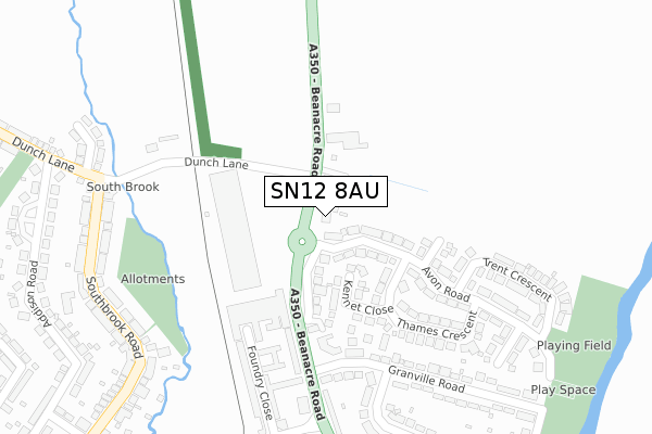
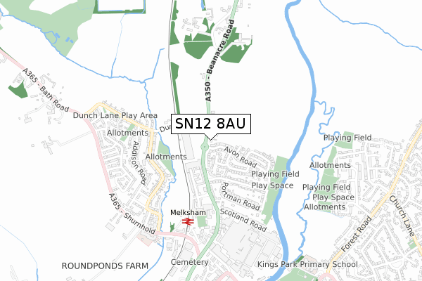
SN12 8AU lies on Beanacre Road in Melksham. SN12 8AU is located in the Melksham Without North & Shurnhold electoral ward, within the unitary authority of Wiltshire and the English Parliamentary constituency of Chippenham. The Sub Integrated Care Board (ICB) Location is NHS Bath and North East Somerset, Swindon and Wiltshire ICB - 92 and the police force is Wiltshire. This postcode has been in use since January 1980.


GetTheData
Source: OS Open Zoomstack (Ordnance Survey)
Licence: Open Government Licence (requires attribution)
Attribution: Contains OS data © Crown copyright and database right 2024
Source: Open Postcode Geo
Licence: Open Government Licence (requires attribution)
Attribution: Contains OS data © Crown copyright and database right 2024; Contains Royal Mail data © Royal Mail copyright and database right 2024; Source: Office for National Statistics licensed under the Open Government Licence v.3.0
| Easting | 390167 |
| Northing | 165060 |
| Latitude | 51.384499 |
| Longitude | -2.142687 |
GetTheData
Source: Open Postcode Geo
Licence: Open Government Licence
| Street | Beanacre Road |
| Town/City | Melksham |
| Country | England |
| Postcode District | SN12 |
| ➜ SN12 open data dashboard ➜ See where SN12 is on a map ➜ Where is Melksham? | |
GetTheData
Source: Land Registry Price Paid Data
Licence: Open Government Licence
Elevation or altitude of SN12 8AU as distance above sea level:
| Metres | Feet | |
|---|---|---|
| Elevation | 40m | 131ft |
Elevation is measured from the approximate centre of the postcode, to the nearest point on an OS contour line from OS Terrain 50, which has contour spacing of ten vertical metres.
➜ How high above sea level am I? Find the elevation of your current position using your device's GPS.
GetTheData
Source: Open Postcode Elevation
Licence: Open Government Licence
| Ward | Melksham Without North & Shurnhold |
| Constituency | Chippenham |
GetTheData
Source: ONS Postcode Database
Licence: Open Government Licence
| December 2023 | Violence and sexual offences | On or near Avon Road | 209m |
| November 2022 | Anti-social behaviour | On or near Avon Road | 209m |
| June 2022 | Vehicle crime | On or near Parking Area | 214m |
| ➜ Beanacre Road crime map and outcomes | |||
GetTheData
Source: data.police.uk
Licence: Open Government Licence
| Nortree Motors (Beanacre Road) | Beanacre | 61m |
| Nortree Motors (Beanacre Road) | Beanacre | 62m |
| Leekes Superstore (Beanacre Road) | Melksham | 84m |
| Leekes (Beanacre Road) | Melksham | 84m |
| Thames Crescent (Avon Road) | Melksham | 120m |
| Melksham Station | 0.5km |
GetTheData
Source: NaPTAN
Licence: Open Government Licence
| Percentage of properties with Next Generation Access | 100.0% |
| Percentage of properties with Superfast Broadband | 100.0% |
| Percentage of properties with Ultrafast Broadband | 100.0% |
| Percentage of properties with Full Fibre Broadband | 0.0% |
Superfast Broadband is between 30Mbps and 300Mbps
Ultrafast Broadband is > 300Mbps
| Percentage of properties unable to receive 2Mbps | 0.0% |
| Percentage of properties unable to receive 5Mbps | 0.0% |
| Percentage of properties unable to receive 10Mbps | 0.0% |
| Percentage of properties unable to receive 30Mbps | 0.0% |
GetTheData
Source: Ofcom
Licence: Ofcom Terms of Use (requires attribution)
GetTheData
Source: ONS Postcode Database
Licence: Open Government Licence


➜ Get more ratings from the Food Standards Agency
GetTheData
Source: Food Standards Agency
Licence: FSA terms & conditions
| Last Collection | |||
|---|---|---|---|
| Location | Mon-Fri | Sat | Distance |
| Beanacre Road | 17:30 | 11:00 | 231m |
| Bath Road Post Office | 18:00 | 11:15 | 787m |
| Beanacre | 17:30 | 07:00 | 1,018m |
GetTheData
Source: Dracos
Licence: Creative Commons Attribution-ShareAlike
| Facility | Distance |
|---|---|
| The George Ward School (Closed) Shurnhold, Melksham Grass Pitches, Sports Hall | 576m |
| City Fitness Roundpond, Melksham Health and Fitness Gym, Studio | 599m |
| Forest Community Centre Loxley Close, Melksham Grass Pitches | 748m |
GetTheData
Source: Active Places
Licence: Open Government Licence
| School | Phase of Education | Distance |
|---|---|---|
| River Mead School Lowbourne, Melksham, SN12 7ED | Primary | 937m |
| The Manor CofE VC Primary School Ruskin Avenue, Melksham, SN12 7NG | Primary | 1.3km |
| Shaw CE Primary School Corsham Road, Shaw, Melksham, SN12 8EQ | Primary | 1.5km |
GetTheData
Source: Edubase
Licence: Open Government Licence
The below table lists the International Territorial Level (ITL) codes (formerly Nomenclature of Territorial Units for Statistics (NUTS) codes) and Local Administrative Units (LAU) codes for SN12 8AU:
| ITL 1 Code | Name |
|---|---|
| TLK | South West (England) |
| ITL 2 Code | Name |
| TLK1 | Gloucestershire, Wiltshire and Bath/Bristol area |
| ITL 3 Code | Name |
| TLK15 | Wiltshire |
| LAU 1 Code | Name |
| E06000054 | Wiltshire |
GetTheData
Source: ONS Postcode Directory
Licence: Open Government Licence
The below table lists the Census Output Area (OA), Lower Layer Super Output Area (LSOA), and Middle Layer Super Output Area (MSOA) for SN12 8AU:
| Code | Name | |
|---|---|---|
| OA | E00163536 | |
| LSOA | E01032063 | Wiltshire 020A |
| MSOA | E02006678 | Wiltshire 020 |
GetTheData
Source: ONS Postcode Directory
Licence: Open Government Licence
| SN12 8AY | Avon Road | 79m |
| SN12 8BL | Beanacre Road | 92m |
| SN12 8AT | Beanacre Road | 117m |
| SN12 8BJ | Kennet Close | 132m |
| SN12 8AP | Elliott Place | 170m |
| SN12 8AZ | Tamar Road | 190m |
| SN12 8AE | Spencer Close | 201m |
| SN12 8BA | Avon Road | 202m |
| SN12 8FB | Beanacre Road | 213m |
| SN12 8BH | Thames Crescent | 219m |
GetTheData
Source: Open Postcode Geo; Land Registry Price Paid Data
Licence: Open Government Licence