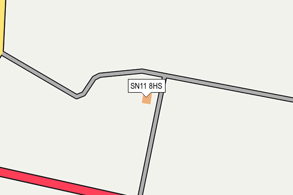
SN11 8HS is located in the Calne Rural electoral ward, within the unitary authority of Wiltshire and the English Parliamentary constituency of North Wiltshire. The Sub Integrated Care Board (ICB) Location is NHS Bath and North East Somerset, Swindon and Wiltshire ICB - 92 and the police force is Wiltshire. This postcode has been in use since September 2004.


GetTheData
Source: OS OpenMap – Local (Ordnance Survey)
Source: OS VectorMap District (Ordnance Survey)
Licence: Open Government Licence (requires attribution)
| Easting | 406088 |
| Northing | 170325 |
| Latitude | 51.431893 |
| Longitude | -1.913807 |
GetTheData
Source: Open Postcode Geo
Licence: Open Government Licence
| Country | England |
| Postcode District | SN11 |
| ➜ SN11 open data dashboard ➜ See where SN11 is on a map | |
GetTheData
Source: Land Registry Price Paid Data
Licence: Open Government Licence
Elevation or altitude of SN11 8HS as distance above sea level:
| Metres | Feet | |
|---|---|---|
| Elevation | 170m | 558ft |
Elevation is measured from the approximate centre of the postcode, to the nearest point on an OS contour line from OS Terrain 50, which has contour spacing of ten vertical metres.
➜ How high above sea level am I? Find the elevation of your current position using your device's GPS.
GetTheData
Source: Open Postcode Elevation
Licence: Open Government Licence
| Ward | Calne Rural |
| Constituency | North Wiltshire |
GetTheData
Source: ONS Postcode Database
Licence: Open Government Licence
| All Saints Church (The Avenue) | Yatesbury | 1,109m |
| All Saints Church (The Avenue) | Yatesbury | 1,119m |
| Little London (The Avenue) | Yatesbury | 1,283m |
| Poachers Croft (A4 Calne Road) | Cherhill | 1,474m |
| Poachers Croft (A4 Calne Road) | Cherhill | 1,486m |
GetTheData
Source: NaPTAN
Licence: Open Government Licence
GetTheData
Source: ONS Postcode Database
Licence: Open Government Licence
| Last Collection | |||
|---|---|---|---|
| Location | Mon-Fri | Sat | Distance |
| Nolands | 16:00 | 10:00 | 1,197m |
| Yatesbury | 16:00 | 10:15 | 1,448m |
| Cherhill Old Post Office | 16:00 | 09:30 | 2,047m |
GetTheData
Source: Dracos
Licence: Creative Commons Attribution-ShareAlike
| Facility | Distance |
|---|---|
| Cherhill C Of E Primary School Middle Lane, Cherhill, Calne Grass Pitches | 2.8km |
| Compton Bassett Cricket Ground Quemerford Gate, Calne Grass Pitches | 3.5km |
| Avebury Sports Field Avebury, Marlborough Grass Pitches | 4.2km |
GetTheData
Source: Active Places
Licence: Open Government Licence
| School | Phase of Education | Distance |
|---|---|---|
| Cherhill CofE School Middle Lane, Cherhill, Calne, SN11 8XX | Primary | 2.7km |
| Hilmarton Primary School Compton Road, Hilmarton, Calne, SN11 8SG | Primary | 6.4km |
GetTheData
Source: Edubase
Licence: Open Government Licence
The below table lists the International Territorial Level (ITL) codes (formerly Nomenclature of Territorial Units for Statistics (NUTS) codes) and Local Administrative Units (LAU) codes for SN11 8HS:
| ITL 1 Code | Name |
|---|---|
| TLK | South West (England) |
| ITL 2 Code | Name |
| TLK1 | Gloucestershire, Wiltshire and Bath/Bristol area |
| ITL 3 Code | Name |
| TLK15 | Wiltshire |
| LAU 1 Code | Name |
| E06000054 | Wiltshire |
GetTheData
Source: ONS Postcode Directory
Licence: Open Government Licence
The below table lists the Census Output Area (OA), Lower Layer Super Output Area (LSOA), and Middle Layer Super Output Area (MSOA) for SN11 8HS:
| Code | Name | |
|---|---|---|
| OA | E00162886 | |
| LSOA | E01031938 | Wiltshire 013D |
| MSOA | E02006655 | Wiltshire 013 |
GetTheData
Source: ONS Postcode Directory
Licence: Open Government Licence
| SN11 8YE | 1123m | |
| SN11 8YA | Jugglers Lane | 1344m |
| SN11 8YG | 1481m | |
| SN11 8YQ | The Lymers | 1535m |
| SN11 8YB | Nolands Road | 1653m |
| SN11 8YD | Nolands Road | 1765m |
| SN11 8XW | Park Lane | 2069m |
| SN11 8XN | Park Lane | 2096m |
| SN11 8UY | Main Road | 2097m |
| SN11 8HP | Oldbury Fields | 2129m |
GetTheData
Source: Open Postcode Geo; Land Registry Price Paid Data
Licence: Open Government Licence