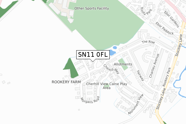
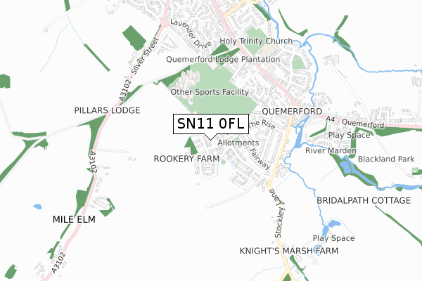
SN11 0FL is located in the Calne South electoral ward, within the unitary authority of Wiltshire and the English Parliamentary constituency of North Wiltshire. The Sub Integrated Care Board (ICB) Location is NHS Bath and North East Somerset, Swindon and Wiltshire ICB - 92 and the police force is Wiltshire. This postcode has been in use since December 2016.


GetTheData
Source: OS Open Zoomstack (Ordnance Survey)
Licence: Open Government Licence (requires attribution)
Attribution: Contains OS data © Crown copyright and database right 2024
Source: Open Postcode Geo
Licence: Open Government Licence (requires attribution)
Attribution: Contains OS data © Crown copyright and database right 2024; Contains Royal Mail data © Royal Mail copyright and database right 2024; Source: Office for National Statistics licensed under the Open Government Licence v.3.0
| Easting | 400044 |
| Northing | 169612 |
| Latitude | 51.425514 |
| Longitude | -2.000749 |
GetTheData
Source: Open Postcode Geo
Licence: Open Government Licence
| Country | England |
| Postcode District | SN11 |
| ➜ SN11 open data dashboard ➜ See where SN11 is on a map ➜ Where is Calne? | |
GetTheData
Source: Land Registry Price Paid Data
Licence: Open Government Licence
Elevation or altitude of SN11 0FL as distance above sea level:
| Metres | Feet | |
|---|---|---|
| Elevation | 90m | 295ft |
Elevation is measured from the approximate centre of the postcode, to the nearest point on an OS contour line from OS Terrain 50, which has contour spacing of ten vertical metres.
➜ How high above sea level am I? Find the elevation of your current position using your device's GPS.
GetTheData
Source: Open Postcode Elevation
Licence: Open Government Licence
| Ward | Calne South |
| Constituency | North Wiltshire |
GetTheData
Source: ONS Postcode Database
Licence: Open Government Licence
2023 30 JUN £490,000 |
5, OLIVERS COURT, CALNE, SN11 0FL 2017 7 APR £373,995 |
2, OLIVERS COURT, CALNE, SN11 0FL 2017 31 MAR £347,995 |
1, OLIVERS COURT, CALNE, SN11 0FL 2017 31 MAR £373,995 |
6, OLIVERS COURT, CALNE, SN11 0FL 2017 31 MAR £331,995 |
7, OLIVERS COURT, CALNE, SN11 0FL 2017 21 FEB £358,995 |
9, OLIVERS COURT, CALNE, SN11 0FL 2016 16 DEC £360,995 |
2016 16 DEC £340,995 |
10, OLIVERS COURT, CALNE, SN11 0FL 2016 16 DEC £356,995 |
GetTheData
Source: HM Land Registry Price Paid Data
Licence: Contains HM Land Registry data © Crown copyright and database right 2024. This data is licensed under the Open Government Licence v3.0.
| June 2022 | Violence and sexual offences | On or near Fairway | 260m |
| June 2022 | Vehicle crime | On or near Fairway | 260m |
| June 2022 | Anti-social behaviour | On or near Sports/Recreation Area | 395m |
| ➜ Get more crime data in our Crime section | |||
GetTheData
Source: data.police.uk
Licence: Open Government Licence
| Elm Close (The Rise) | Calne | 319m |
| Fairway | Calne | 370m |
| Rookery Park | Calne | 457m |
| John Bently School (Grounds) | Calne | 475m |
| Ebor Paddock (Stockley Lane) | Calne | 486m |
GetTheData
Source: NaPTAN
Licence: Open Government Licence
| Percentage of properties with Next Generation Access | 100.0% |
| Percentage of properties with Superfast Broadband | 100.0% |
| Percentage of properties with Ultrafast Broadband | 100.0% |
| Percentage of properties with Full Fibre Broadband | 100.0% |
Superfast Broadband is between 30Mbps and 300Mbps
Ultrafast Broadband is > 300Mbps
| Percentage of properties unable to receive 2Mbps | 0.0% |
| Percentage of properties unable to receive 5Mbps | 0.0% |
| Percentage of properties unable to receive 10Mbps | 0.0% |
| Percentage of properties unable to receive 30Mbps | 0.0% |
GetTheData
Source: Ofcom
Licence: Ofcom Terms of Use (requires attribution)
GetTheData
Source: ONS Postcode Database
Licence: Open Government Licence


➜ Get more ratings from the Food Standards Agency
GetTheData
Source: Food Standards Agency
Licence: FSA terms & conditions
| Last Collection | |||
|---|---|---|---|
| Location | Mon-Fri | Sat | Distance |
| Rookery Park | 17:30 | 12:00 | 369m |
| Wessington | 17:30 | 12:00 | 508m |
| Wessington Park | 17:30 | 12:00 | 653m |
GetTheData
Source: Dracos
Licence: Creative Commons Attribution-ShareAlike
| Facility | Distance |
|---|---|
| Kingsbury Green Academy Calne Grass Pitches, Sports Hall | 390m |
| Calne Community Campus White Horse Way, Calne Sports Hall, Swimming Pool, Health and Fitness Gym, Studio, Squash Courts | 453m |
| Holy Trinity Church Of England Academy Quemerford, Calne Grass Pitches | 576m |
GetTheData
Source: Active Places
Licence: Open Government Licence
| School | Phase of Education | Distance |
|---|---|---|
| Holy Trinity Church of England Academy Quemerford, Calne, SN11 0AR | Primary | 584m |
| Kingsbury Green Academy White Horse Way, Calne, SN11 8YH | Secondary | 972m |
| Priestley Primary School Prince Charles Drive, Calne, SN11 8TG | Primary | 1.4km |
GetTheData
Source: Edubase
Licence: Open Government Licence
The below table lists the International Territorial Level (ITL) codes (formerly Nomenclature of Territorial Units for Statistics (NUTS) codes) and Local Administrative Units (LAU) codes for SN11 0FL:
| ITL 1 Code | Name |
|---|---|
| TLK | South West (England) |
| ITL 2 Code | Name |
| TLK1 | Gloucestershire, Wiltshire and Bath/Bristol area |
| ITL 3 Code | Name |
| TLK15 | Wiltshire |
| LAU 1 Code | Name |
| E06000054 | Wiltshire |
GetTheData
Source: ONS Postcode Directory
Licence: Open Government Licence
The below table lists the Census Output Area (OA), Lower Layer Super Output Area (LSOA), and Middle Layer Super Output Area (MSOA) for SN11 0FL:
| Code | Name | |
|---|---|---|
| OA | E00162733 | |
| LSOA | E01031904 | Wiltshire 013B |
| MSOA | E02006655 | Wiltshire 013 |
GetTheData
Source: ONS Postcode Directory
Licence: Open Government Licence
| SN11 0FG | Cherhill Way | 124m |
| SN11 0LH | Rookery Park | 180m |
| SN11 0LE | Fairway | 220m |
| SN11 0LG | The Rise | 244m |
| SN11 0LL | Bay Close | 277m |
| SN11 0LN | Elm Close | 322m |
| SN11 0LB | Fairway | 346m |
| SN11 0LD | Charlieu Avenue | 348m |
| SN11 0LQ | The Rise | 384m |
| SN11 0LJ | Stockley Lane | 386m |
GetTheData
Source: Open Postcode Geo; Land Registry Price Paid Data
Licence: Open Government Licence