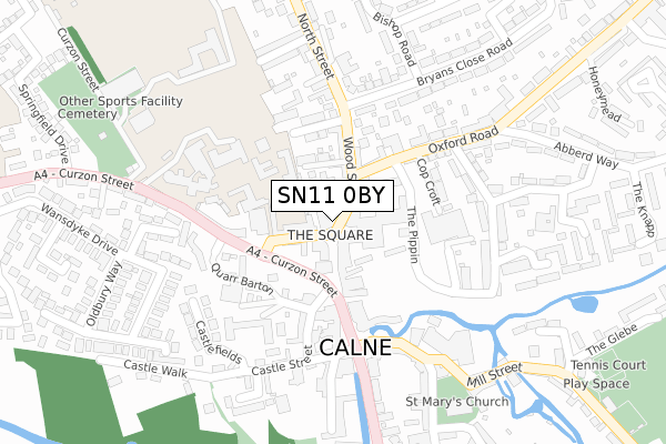
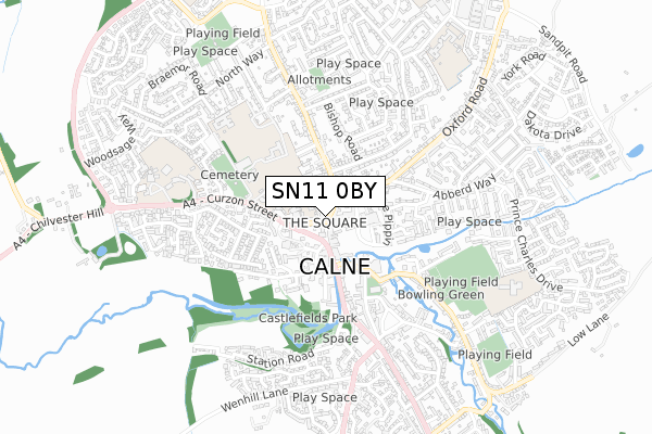
SN11 0BY is located in the Calne Chilvester & Abberd electoral ward, within the unitary authority of Wiltshire and the English Parliamentary constituency of North Wiltshire. The Sub Integrated Care Board (ICB) Location is NHS Bath and North East Somerset, Swindon and Wiltshire ICB - 92 and the police force is Wiltshire. This postcode has been in use since January 1980.


GetTheData
Source: OS Open Zoomstack (Ordnance Survey)
Licence: Open Government Licence (requires attribution)
Attribution: Contains OS data © Crown copyright and database right 2024
Source: Open Postcode Geo
Licence: Open Government Licence (requires attribution)
Attribution: Contains OS data © Crown copyright and database right 2024; Contains Royal Mail data © Royal Mail copyright and database right 2024; Source: Office for National Statistics licensed under the Open Government Licence v.3.0
| Easting | 399709 |
| Northing | 171182 |
| Latitude | 51.439633 |
| Longitude | -2.005576 |
GetTheData
Source: Open Postcode Geo
Licence: Open Government Licence
| Country | England |
| Postcode District | SN11 |
| ➜ SN11 open data dashboard ➜ See where SN11 is on a map ➜ Where is The Square? | |
GetTheData
Source: Land Registry Price Paid Data
Licence: Open Government Licence
Elevation or altitude of SN11 0BY as distance above sea level:
| Metres | Feet | |
|---|---|---|
| Elevation | 70m | 230ft |
Elevation is measured from the approximate centre of the postcode, to the nearest point on an OS contour line from OS Terrain 50, which has contour spacing of ten vertical metres.
➜ How high above sea level am I? Find the elevation of your current position using your device's GPS.
GetTheData
Source: Open Postcode Elevation
Licence: Open Government Licence
| Ward | Calne Chilvester & Abberd |
| Constituency | North Wiltshire |
GetTheData
Source: ONS Postcode Database
Licence: Open Government Licence
| January 2024 | Anti-social behaviour | On or near The Knapp | 465m |
| December 2023 | Other theft | On or near The Knapp | 465m |
| November 2023 | Violence and sexual offences | On or near The Knapp | 465m |
| ➜ Get more crime data in our Crime section | |||
GetTheData
Source: data.police.uk
Licence: Open Government Licence
| Post Office (The Square) | Calne | 30m |
| Sainsburys (The Pippin) | Calne | 135m |
| Coopers Cars (Curzon Street) | Calne | 158m |
| The Pippin (Oxford Road) | Calne | 168m |
| The Pippin (Oxford Road) | Calne | 180m |
GetTheData
Source: NaPTAN
Licence: Open Government Licence
GetTheData
Source: ONS Postcode Database
Licence: Open Government Licence


➜ Get more ratings from the Food Standards Agency
GetTheData
Source: Food Standards Agency
Licence: FSA terms & conditions
| Last Collection | |||
|---|---|---|---|
| Location | Mon-Fri | Sat | Distance |
| Calne Delivery Office | 18:30 | 12:30 | 43m |
| Castle Street | 17:45 | 12:15 | 259m |
| Church Street | 17:30 | 12:00 | 267m |
GetTheData
Source: Dracos
Licence: Creative Commons Attribution-ShareAlike
| Facility | Distance |
|---|---|
| St Marys Calne Sports Centre Curzon Street, Calne Swimming Pool, Health and Fitness Gym, Artificial Grass Pitch, Studio, Sports Hall | 372m |
| Calne Recreation Club Anchor Road, Calne Grass Pitches, Outdoor Tennis Courts | 499m |
| Springfields Academy Curzon Street, Calne Grass Pitches, Sports Hall, Studio, Artificial Grass Pitch, Health and Fitness Gym | 591m |
GetTheData
Source: Active Places
Licence: Open Government Licence
| School | Phase of Education | Distance |
|---|---|---|
| St Mary's School (Snr) and St Margaret's School (Prep) 63 Curzon Street, Calne, SN11 0DF | Not applicable | 228m |
| The Springfields Academy Curzon Street, Calne, SN11 0DS | Not applicable | 591m |
| Kingsbury Green Academy White Horse Way, Calne, SN11 8YH | Secondary | 658m |
GetTheData
Source: Edubase
Licence: Open Government Licence
The below table lists the International Territorial Level (ITL) codes (formerly Nomenclature of Territorial Units for Statistics (NUTS) codes) and Local Administrative Units (LAU) codes for SN11 0BY:
| ITL 1 Code | Name |
|---|---|
| TLK | South West (England) |
| ITL 2 Code | Name |
| TLK1 | Gloucestershire, Wiltshire and Bath/Bristol area |
| ITL 3 Code | Name |
| TLK15 | Wiltshire |
| LAU 1 Code | Name |
| E06000054 | Wiltshire |
GetTheData
Source: ONS Postcode Directory
Licence: Open Government Licence
The below table lists the Census Output Area (OA), Lower Layer Super Output Area (LSOA), and Middle Layer Super Output Area (MSOA) for SN11 0BY:
| Code | Name | |
|---|---|---|
| OA | E00162699 | |
| LSOA | E01031898 | Wiltshire 015D |
| MSOA | E02006657 | Wiltshire 015 |
GetTheData
Source: ONS Postcode Directory
Licence: Open Government Licence
| SN11 0DA | Wood Street | 39m |
| SN11 0BZ | Wood Street | 47m |
| SN11 0HA | Phelps Parade | 63m |
| SN11 0DD | Curzon Street | 67m |
| SN11 0BS | High Street | 78m |
| SN11 8JQ | The Pippin | 95m |
| SN11 0HQ | North Street | 109m |
| SN11 8AA | Oxford Road | 126m |
| SN11 0BJ | High Street | 133m |
| SN11 0SD | Whitehall Gardens | 150m |
GetTheData
Source: Open Postcode Geo; Land Registry Price Paid Data
Licence: Open Government Licence