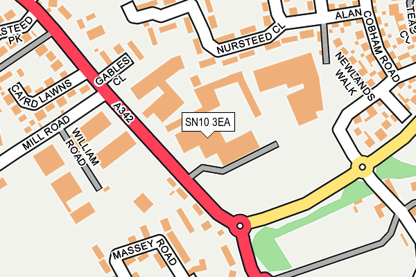
SN10 3EA is located in the Devizes East electoral ward, within the unitary authority of Wiltshire and the English Parliamentary constituency of Devizes. The Sub Integrated Care Board (ICB) Location is NHS Bath and North East Somerset, Swindon and Wiltshire ICB - 92 and the police force is Wiltshire. This postcode has been in use since June 1996.


GetTheData
Source: OS OpenMap – Local (Ordnance Survey)
Source: OS VectorMap District (Ordnance Survey)
Licence: Open Government Licence (requires attribution)
| Easting | 401731 |
| Northing | 160550 |
| Latitude | 51.344032 |
| Longitude | -1.976534 |
GetTheData
Source: Open Postcode Geo
Licence: Open Government Licence
| Country | England |
| Postcode District | SN10 |
| ➜ SN10 open data dashboard ➜ See where SN10 is on a map ➜ Where is Devizes? | |
GetTheData
Source: Land Registry Price Paid Data
Licence: Open Government Licence
Elevation or altitude of SN10 3EA as distance above sea level:
| Metres | Feet | |
|---|---|---|
| Elevation | 120m | 394ft |
Elevation is measured from the approximate centre of the postcode, to the nearest point on an OS contour line from OS Terrain 50, which has contour spacing of ten vertical metres.
➜ How high above sea level am I? Find the elevation of your current position using your device's GPS.
GetTheData
Source: Open Postcode Elevation
Licence: Open Government Licence
| Ward | Devizes East |
| Constituency | Devizes |
GetTheData
Source: ONS Postcode Database
Licence: Open Government Licence
| January 2024 | Criminal damage and arson | On or near Massey Road | 189m |
| December 2023 | Violence and sexual offences | On or near Massey Road | 189m |
| December 2023 | Burglary | On or near Massey Road | 189m |
| ➜ Get more crime data in our Crime section | |||
GetTheData
Source: data.police.uk
Licence: Open Government Licence
| Banda Industrial Estate (Nursteed Road) | Nursteed | 81m |
| Osmund Close (Brickley Lane) | Nursteed | 146m |
| Osmund Close (Brickley Lane) | Nursteed | 168m |
| Marshall Road Roundabout (Nursteed Road) | Nursteed | 205m |
| Alan Cobham Road (Brickley Lane) | Nursteed | 246m |
GetTheData
Source: NaPTAN
Licence: Open Government Licence
GetTheData
Source: ONS Postcode Database
Licence: Open Government Licence


➜ Get more ratings from the Food Standards Agency
GetTheData
Source: Food Standards Agency
Licence: FSA terms & conditions
| Last Collection | |||
|---|---|---|---|
| Location | Mon-Fri | Sat | Distance |
| Nursteed Village | 17:30 | 12:30 | 270m |
| Eastleigh Road | 17:30 | 12:15 | 333m |
| Eastleigh Road Post Office | 17:30 | 12:30 | 493m |
GetTheData
Source: Dracos
Licence: Creative Commons Attribution-ShareAlike
| Facility | Distance |
|---|---|
| Nursteed Road Nursteed Road, Devizes Grass Pitches, Sports Hall | 456m |
| Southbroom St James Academy Nursteed Road, Devizes Grass Pitches | 652m |
| Nursteed Community Primary School Brickley Lane, Brickley Lane, Devizes Grass Pitches | 765m |
GetTheData
Source: Active Places
Licence: Open Government Licence
| School | Phase of Education | Distance |
|---|---|---|
| Southbroom St James Academy Nursteed Road, Devizes, SN10 3AH | Primary | 497m |
| Nursteed Community Primary School Brickley Lane, Devizes, SN10 3BF | Primary | 765m |
| Wansdyke School Downlands Road, Devizes, SN10 5EF | Primary | 964m |
GetTheData
Source: Edubase
Licence: Open Government Licence
The below table lists the International Territorial Level (ITL) codes (formerly Nomenclature of Territorial Units for Statistics (NUTS) codes) and Local Administrative Units (LAU) codes for SN10 3EA:
| ITL 1 Code | Name |
|---|---|
| TLK | South West (England) |
| ITL 2 Code | Name |
| TLK1 | Gloucestershire, Wiltshire and Bath/Bristol area |
| ITL 3 Code | Name |
| TLK15 | Wiltshire |
| LAU 1 Code | Name |
| E06000054 | Wiltshire |
GetTheData
Source: ONS Postcode Directory
Licence: Open Government Licence
The below table lists the Census Output Area (OA), Lower Layer Super Output Area (LSOA), and Middle Layer Super Output Area (MSOA) for SN10 3EA:
| Code | Name | |
|---|---|---|
| OA | E00162442 | |
| LSOA | E01031852 | Wiltshire 025C |
| MSOA | E02006637 | Wiltshire 025 |
GetTheData
Source: ONS Postcode Directory
Licence: Open Government Licence
| SN10 3DZ | Nursteed Road | 88m |
| SN10 3EZ | Wayside Drive | 112m |
| SN10 3EU | Nursteed Close | 164m |
| SN10 3UE | Massey Road | 168m |
| SN10 3EY | Nursteed Close | 170m |
| SN10 3ED | Gables Close | 179m |
| SN10 3ET | Nursteed Close | 194m |
| SN10 3HQ | Ivy Cottages | 215m |
| SN10 3GF | Newlands Walk | 235m |
| SN10 3DU | Nursteed Road | 250m |
GetTheData
Source: Open Postcode Geo; Land Registry Price Paid Data
Licence: Open Government Licence