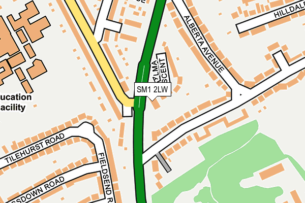
SM1 2LW lies on St Dunstans Hill in Cheam, Sutton. SM1 2LW is located in the Sutton West & East Cheam electoral ward, within the London borough of Sutton and the English Parliamentary constituency of Sutton and Cheam. The Sub Integrated Care Board (ICB) Location is NHS South West London ICB - 36L and the police force is Metropolitan Police. This postcode has been in use since November 2004.


GetTheData
Source: OS OpenMap – Local (Ordnance Survey)
Source: OS VectorMap District (Ordnance Survey)
Licence: Open Government Licence (requires attribution)
| Easting | 524425 |
| Northing | 164381 |
| Latitude | 51.364874 |
| Longitude | -0.214118 |
GetTheData
Source: Open Postcode Geo
Licence: Open Government Licence
| Street | St Dunstans Hill |
| Locality | Cheam |
| Town/City | Sutton |
| Country | England |
| Postcode District | SM1 |
| ➜ SM1 open data dashboard ➜ See where SM1 is on a map ➜ Where is London? | |
GetTheData
Source: Land Registry Price Paid Data
Licence: Open Government Licence
Elevation or altitude of SM1 2LW as distance above sea level:
| Metres | Feet | |
|---|---|---|
| Elevation | 40m | 131ft |
Elevation is measured from the approximate centre of the postcode, to the nearest point on an OS contour line from OS Terrain 50, which has contour spacing of ten vertical metres.
➜ How high above sea level am I? Find the elevation of your current position using your device's GPS.
GetTheData
Source: Open Postcode Elevation
Licence: Open Government Licence
| Ward | Sutton West & East Cheam |
| Constituency | Sutton And Cheam |
GetTheData
Source: ONS Postcode Database
Licence: Open Government Licence
| October 2023 | Vehicle crime | On or near Hilldale Road | 427m |
| September 2023 | Criminal damage and arson | On or near Tilehurst Road | 305m |
| August 2023 | Vehicle crime | On or near Hilldale Road | 427m |
| ➜ Get more crime data in our Crime section | |||
GetTheData
Source: data.police.uk
Licence: Open Government Licence
| Tilehurst Road Malden Road | West Sutton | 451m |
| Priory Road (Sm3) (Priory Road) | North Cheam | 455m |
| Tilehurst Road Malden Road | West Sutton | 461m |
| Lumley Road (Malden Road) | West Sutton | 478m |
| Priory Road (Sm3) (Church Hill Road) | North Cheam | 495m |
| West Sutton Station | 0.6km |
| Cheam Station | 1km |
| Sutton Common Station | 1.7km |
GetTheData
Source: NaPTAN
Licence: Open Government Licence
GetTheData
Source: ONS Postcode Database
Licence: Open Government Licence


➜ Get more ratings from the Food Standards Agency
GetTheData
Source: Food Standards Agency
Licence: FSA terms & conditions
| Last Collection | |||
|---|---|---|---|
| Location | Mon-Fri | Sat | Distance |
| St.dunstans Hill (61) | 17:00 | 12:00 | 345m |
| Churchill Road (100) | 18:45 | 12:00 | 413m |
| Malden Road (130) | 17:00 | 12:00 | 446m |
GetTheData
Source: Dracos
Licence: Creative Commons Attribution-ShareAlike
| Facility | Distance |
|---|---|
| Cheam High School Chatsworth Road, Cheam, Sutton Sports Hall, Artificial Grass Pitch, Grass Pitches, Studio, Health and Fitness Gym | 301m |
| Sutton Churches Tennis Club Gander Green Lane, Sutton Outdoor Tennis Courts | 481m |
| Cheam Recreation Ground Cheam Park Way, Cheam, Sutton Grass Pitches, Outdoor Tennis Courts | 662m |
GetTheData
Source: Active Places
Licence: Open Government Licence
| School | Phase of Education | Distance |
|---|---|---|
| Cheam High School Chatsworth Road, Cheam, Sutton, SM3 8PW | Secondary | 314m |
| Cheam Fields Primary Academy Stoughton Avenue, Cheam, Sutton, SM3 8PQ | Primary | 382m |
| Homefield Preparatory School Western Road, Sutton, Surrey, SM1 2TE | Not applicable | 816m |
GetTheData
Source: Edubase
Licence: Open Government Licence
The below table lists the International Territorial Level (ITL) codes (formerly Nomenclature of Territorial Units for Statistics (NUTS) codes) and Local Administrative Units (LAU) codes for SM1 2LW:
| ITL 1 Code | Name |
|---|---|
| TLI | London |
| ITL 2 Code | Name |
| TLI6 | Outer London - South |
| ITL 3 Code | Name |
| TLI63 | Merton, Kingston upon Thames and Sutton |
| LAU 1 Code | Name |
| E09000029 | Sutton |
GetTheData
Source: ONS Postcode Directory
Licence: Open Government Licence
The below table lists the Census Output Area (OA), Lower Layer Super Output Area (LSOA), and Middle Layer Super Output Area (MSOA) for SM1 2LW:
| Code | Name | |
|---|---|---|
| OA | E00020948 | |
| LSOA | E01004161 | Sutton 014E |
| MSOA | E02000853 | Sutton 014 |
GetTheData
Source: ONS Postcode Directory
Licence: Open Government Licence
| SM1 2LN | Alma Crescent | 73m |
| SM1 2LJ | Alberta Avenue | 74m |
| SM1 2TX | St Dunstans Hill | 89m |
| SM1 2LH | Alberta Avenue | 102m |
| SM3 8LF | Church Hill Road | 109m |
| SM1 2LL | Alberta Avenue | 127m |
| SM1 2LQ | The Maisonettes | 131m |
| SM1 2LP | St Dunstans Hill | 144m |
| SM3 8PA | Fieldsend Road | 154m |
| SM3 9SR | Matlock Gardens | 158m |
GetTheData
Source: Open Postcode Geo; Land Registry Price Paid Data
Licence: Open Government Licence