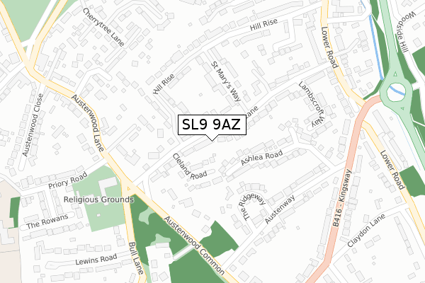
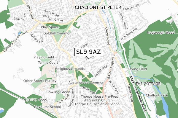
SL9 9AZ lies on School Lane in Chalfont St Peter, Gerrards Cross. SL9 9AZ is located in the Chalfont St Peter electoral ward, within the unitary authority of Buckinghamshire and the English Parliamentary constituency of Chesham and Amersham. The Sub Integrated Care Board (ICB) Location is NHS Buckinghamshire, Oxfordshire and Berkshire West ICB - 14Y and the police force is Thames Valley. This postcode has been in use since January 1980.


GetTheData
Source: OS Open Zoomstack (Ordnance Survey)
Licence: Open Government Licence (requires attribution)
Attribution: Contains OS data © Crown copyright and database right 2024
Source: Open Postcode Geo
Licence: Open Government Licence (requires attribution)
Attribution: Contains OS data © Crown copyright and database right 2024; Contains Royal Mail data © Royal Mail copyright and database right 2024; Source: Office for National Statistics licensed under the Open Government Licence v.3.0
| Easting | 499926 |
| Northing | 190081 |
| Latitude | 51.600716 |
| Longitude | -0.558630 |
GetTheData
Source: Open Postcode Geo
Licence: Open Government Licence
| Street | School Lane |
| Locality | Chalfont St Peter |
| Town/City | Gerrards Cross |
| Country | England |
| Postcode District | SL9 |
| ➜ SL9 open data dashboard ➜ See where SL9 is on a map ➜ Where is Chalfont St Peter? | |
GetTheData
Source: Land Registry Price Paid Data
Licence: Open Government Licence
Elevation or altitude of SL9 9AZ as distance above sea level:
| Metres | Feet | |
|---|---|---|
| Elevation | 80m | 262ft |
Elevation is measured from the approximate centre of the postcode, to the nearest point on an OS contour line from OS Terrain 50, which has contour spacing of ten vertical metres.
➜ How high above sea level am I? Find the elevation of your current position using your device's GPS.
GetTheData
Source: Open Postcode Elevation
Licence: Open Government Licence
| Ward | Chalfont St Peter |
| Constituency | Chesham And Amersham |
GetTheData
Source: ONS Postcode Database
Licence: Open Government Licence
| June 2022 | Other theft | On or near Penshurst Close | 335m |
| June 2022 | Other crime | On or near Kingsway | 345m |
| June 2022 | Anti-social behaviour | On or near Gold Hill East | 499m |
| ➜ School Lane crime map and outcomes | |||
GetTheData
Source: data.police.uk
Licence: Open Government Licence
| St Joseph's Church (Austenwood Lane) | Chalfont St Peter | 230m |
| St Joseph's Church (Austenwood Lane) | Chalfont St Peter | 243m |
| Austenwood Common (Austenwood Lane) | Chalfont St Peter | 384m |
| Austenwood Common (Austenwood Lane) | Chalfont St Peter | 422m |
| The Jolly Farmer (Gold Hill West) | Chalfont St Peter | 519m |
| Gerrards Cross Station | 1.3km |
| Seer Green Station | 3.6km |
| Denham Golf Club Station | 3.6km |
GetTheData
Source: NaPTAN
Licence: Open Government Licence
➜ Broadband speed and availability dashboard for SL9 9AZ
| Percentage of properties with Next Generation Access | 100.0% |
| Percentage of properties with Superfast Broadband | 92.3% |
| Percentage of properties with Ultrafast Broadband | 0.0% |
| Percentage of properties with Full Fibre Broadband | 0.0% |
Superfast Broadband is between 30Mbps and 300Mbps
Ultrafast Broadband is > 300Mbps
| Median download speed | 55.7Mbps |
| Average download speed | 52.3Mbps |
| Maximum download speed | 80.00Mbps |
| Median upload speed | 16.5Mbps |
| Average upload speed | 13.3Mbps |
| Maximum upload speed | 20.00Mbps |
| Percentage of properties unable to receive 2Mbps | 0.0% |
| Percentage of properties unable to receive 5Mbps | 0.0% |
| Percentage of properties unable to receive 10Mbps | 0.0% |
| Percentage of properties unable to receive 30Mbps | 7.7% |
➜ Broadband speed and availability dashboard for SL9 9AZ
GetTheData
Source: Ofcom
Licence: Ofcom Terms of Use (requires attribution)
Estimated total energy consumption in SL9 9AZ by fuel type, 2015.
| Consumption (kWh) | 294,960 |
|---|---|
| Meter count | 13 |
| Mean (kWh/meter) | 22,689 |
| Median (kWh/meter) | 23,781 |
| Consumption (kWh) | 66,109 |
|---|---|
| Meter count | 13 |
| Mean (kWh/meter) | 5,085 |
| Median (kWh/meter) | 5,480 |
GetTheData
Source: Postcode level gas estimates: 2015 (experimental)
Source: Postcode level electricity estimates: 2015 (experimental)
Licence: Open Government Licence
GetTheData
Source: ONS Postcode Database
Licence: Open Government Licence


➜ Get more ratings from the Food Standards Agency
GetTheData
Source: Food Standards Agency
Licence: FSA terms & conditions
| Last Collection | |||
|---|---|---|---|
| Location | Mon-Fri | Sat | Distance |
| Hill Rise | 17:30 | 12:00 | 424m |
| Kingsway | 17:30 | 12:00 | 443m |
| Gold Hill (East) | 17:45 | 12:00 | 478m |
GetTheData
Source: Dracos
Licence: Creative Commons Attribution-ShareAlike
| Facility | Distance |
|---|---|
| St Joseph's Catholic Primary School Priory Road, Chalfont St. Peter, Gerrards Cross Grass Pitches | 535m |
| Holy Cross Convent School (Closed) Gold Hill East, Chalfont St. Peter, Gerrards Cross Sports Hall, Swimming Pool, Grass Pitches | 537m |
| Thorpe House School (Priory Road Pitches) Priory Road, Chalfont St. Peter, Gerrards Cross Grass Pitches, Outdoor Tennis Courts | 542m |
GetTheData
Source: Active Places
Licence: Open Government Licence
| School | Phase of Education | Distance |
|---|---|---|
| St Joseph's Catholic Primary School Priory Road, Chalfont St Peter, Gerrards Cross, SL9 8SB | Primary | 535m |
| Thorpe House School Oval Way, Gerrards Cross, SL9 8QA | Not applicable | 649m |
| Maltman's Green School Maltmans Lane, Chalfont St Peter, Gerrards Cross, SL9 8RR | Not applicable | 696m |
GetTheData
Source: Edubase
Licence: Open Government Licence
The below table lists the International Territorial Level (ITL) codes (formerly Nomenclature of Territorial Units for Statistics (NUTS) codes) and Local Administrative Units (LAU) codes for SL9 9AZ:
| ITL 1 Code | Name |
|---|---|
| TLJ | South East (England) |
| ITL 2 Code | Name |
| TLJ1 | Berkshire, Buckinghamshire and Oxfordshire |
| ITL 3 Code | Name |
| TLJ13 | Buckinghamshire |
| LAU 1 Code | Name |
| E06000060 | Buckinghamshire |
GetTheData
Source: ONS Postcode Directory
Licence: Open Government Licence
The below table lists the Census Output Area (OA), Lower Layer Super Output Area (LSOA), and Middle Layer Super Output Area (MSOA) for SL9 9AZ:
| Code | Name | |
|---|---|---|
| OA | E00089568 | |
| LSOA | E01017751 | Chiltern 012A |
| MSOA | E02003687 | Chiltern 012 |
GetTheData
Source: ONS Postcode Directory
Licence: Open Government Licence
| SL9 9BE | Cleland Road | 52m |
| SL9 9BA | School Lane | 60m |
| SL9 9BG | Cleland Road | 106m |
| SL9 9BD | School Lane | 125m |
| SL9 8NY | Ashlea Road | 128m |
| SL9 8NP | The Ridgeway | 132m |
| SL9 9BL | St Marys Way | 136m |
| SL9 9BB | School Lane | 147m |
| SL9 9BJ | Hill Rise | 161m |
| SL9 8SF | Austenwood Lane | 175m |
GetTheData
Source: Open Postcode Geo; Land Registry Price Paid Data
Licence: Open Government Licence