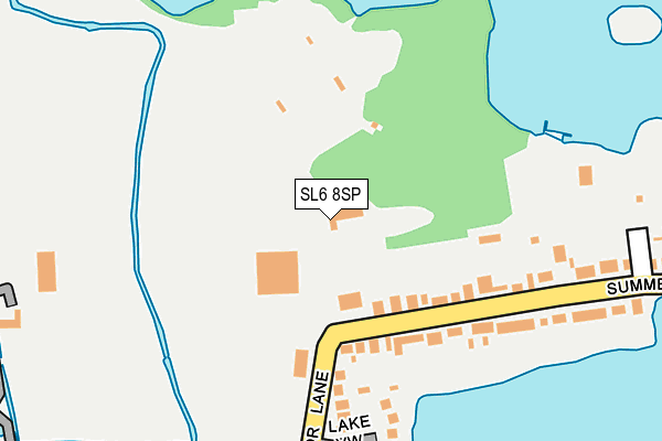
SL6 8SP is located in the Riverside electoral ward, within the unitary authority of Windsor and Maidenhead and the English Parliamentary constituency of Maidenhead. The Sub Integrated Care Board (ICB) Location is NHS Frimley ICB - D4U1Y and the police force is Thames Valley. This postcode has been in use since January 1980.


GetTheData
Source: OS OpenMap – Local (Ordnance Survey)
Source: OS VectorMap District (Ordnance Survey)
Licence: Open Government Licence (requires attribution)
| Easting | 489279 |
| Northing | 182526 |
| Latitude | 51.534590 |
| Longitude | -0.714227 |
GetTheData
Source: Open Postcode Geo
Licence: Open Government Licence
| Country | England |
| Postcode District | SL6 |
➜ See where SL6 is on a map ➜ Where is Maidenhead? | |
GetTheData
Source: Land Registry Price Paid Data
Licence: Open Government Licence
Elevation or altitude of SL6 8SP as distance above sea level:
| Metres | Feet | |
|---|---|---|
| Elevation | 30m | 98ft |
Elevation is measured from the approximate centre of the postcode, to the nearest point on an OS contour line from OS Terrain 50, which has contour spacing of ten vertical metres.
➜ How high above sea level am I? Find the elevation of your current position using your device's GPS.
GetTheData
Source: Open Postcode Elevation
Licence: Open Government Licence
| Ward | Riverside |
| Constituency | Maidenhead |
GetTheData
Source: ONS Postcode Database
Licence: Open Government Licence
| Veterinary Hospital (Summerleaze Road) | Maidenhead | 133m |
| Lonsdale Close (Blackamoor Lane) | Maidenhead | 222m |
| Lakeside (Summerleaze Road) | Maidenhead | 231m |
| Sheephouse Road (Summerleaze Road) | Maidenhead | 406m |
| Ray Mill Road East (Blackamoor Lane) | Maidenhead | 427m |
| Furze Platt Station | 1km |
| Maidenhead Station | 1.9km |
| Taplow Station | 2.6km |
GetTheData
Source: NaPTAN
Licence: Open Government Licence
GetTheData
Source: ONS Postcode Database
Licence: Open Government Licence


➜ Get more ratings from the Food Standards Agency
GetTheData
Source: Food Standards Agency
Licence: FSA terms & conditions
| Last Collection | |||
|---|---|---|---|
| Location | Mon-Fri | Sat | Distance |
| Woodstock Close | 16:30 | 11:45 | 451m |
| Raymill Road East | 17:30 | 11:45 | 476m |
| Raypark Avenue | 16:00 | 11:30 | 571m |
GetTheData
Source: Dracos
Licence: Creative Commons Attribution-ShareAlike
| Risk of SL6 8SP flooding from rivers and sea | Low |
| ➜ SL6 8SP flood map | |
GetTheData
Source: Open Flood Risk by Postcode
Licence: Open Government Licence
The below table lists the International Territorial Level (ITL) codes (formerly Nomenclature of Territorial Units for Statistics (NUTS) codes) and Local Administrative Units (LAU) codes for SL6 8SP:
| ITL 1 Code | Name |
|---|---|
| TLJ | South East (England) |
| ITL 2 Code | Name |
| TLJ1 | Berkshire, Buckinghamshire and Oxfordshire |
| ITL 3 Code | Name |
| TLJ11 | Berkshire |
| LAU 1 Code | Name |
| E06000040 | Windsor and Maidenhead |
GetTheData
Source: ONS Postcode Directory
Licence: Open Government Licence
The below table lists the Census Output Area (OA), Lower Layer Super Output Area (LSOA), and Middle Layer Super Output Area (MSOA) for SL6 8SP:
| Code | Name | |
|---|---|---|
| OA | E00083720 | |
| LSOA | E01016582 | Windsor and Maidenhead 001C |
| MSOA | E02003421 | Windsor and Maidenhead 001 |
GetTheData
Source: ONS Postcode Directory
Licence: Open Government Licence
| SL6 8EW | Summerleaze Road | 140m |
| SL6 8EN | Summerleaze Road | 146m |
| SL6 8TX | Lake View | 199m |
| SL6 8RX | Lonsdale Close | 236m |
| SL6 8RT | Blackamoor Lane | 262m |
| SL6 8HZ | Lakeside | 308m |
| SL6 8PU | Ray Meadow | 336m |
| SL6 8ER | Summerleaze Road | 357m |
| SL6 7JR | North Town Moor | 388m |
| SL6 8EP | Summerleaze Road | 402m |
GetTheData
Source: Open Postcode Geo; Land Registry Price Paid Data
Licence: Open Government Licence