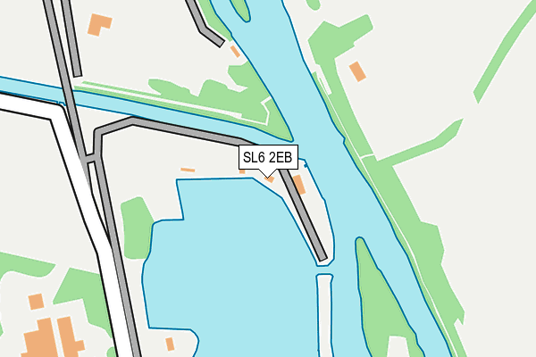
SL6 2EB is located in the Bray electoral ward, within the unitary authority of Windsor and Maidenhead and the English Parliamentary constituency of Maidenhead. The Sub Integrated Care Board (ICB) Location is NHS Frimley ICB - D4U1Y and the police force is Thames Valley. This postcode has been in use since January 1980.


GetTheData
Source: OS OpenMap – Local (Ordnance Survey)
Source: OS VectorMap District (Ordnance Survey)
Licence: Open Government Licence (requires attribution)
| Easting | 491588 |
| Northing | 178589 |
| Latitude | 51.498833 |
| Longitude | -0.681951 |
GetTheData
Source: Open Postcode Geo
Licence: Open Government Licence
| Country | England |
| Postcode District | SL6 |
➜ See where SL6 is on a map | |
GetTheData
Source: Land Registry Price Paid Data
Licence: Open Government Licence
Elevation or altitude of SL6 2EB as distance above sea level:
| Metres | Feet | |
|---|---|---|
| Elevation | 20m | 66ft |
Elevation is measured from the approximate centre of the postcode, to the nearest point on an OS contour line from OS Terrain 50, which has contour spacing of ten vertical metres.
➜ How high above sea level am I? Find the elevation of your current position using your device's GPS.
GetTheData
Source: Open Postcode Elevation
Licence: Open Government Licence
| Ward | Bray |
| Constituency | Maidenhead |
GetTheData
Source: ONS Postcode Database
Licence: Open Government Licence
| Westbrook (Windsor Road) | Bray Wick | 715m |
| Westbrook (Windsor Road) | Bray Wick | 752m |
| Braywick Post Office (Windsor Road) | Bray Wick | 848m |
| Elm View Farm (Court Lane) | Dorney | 864m |
| Braywick Post Office (Windsor Road) | Bray Wick | 869m |
| Taplow Station | 2.8km |
| Maidenhead Station | 3.6km |
| Burnham (Berks) Station | 3.7km |
GetTheData
Source: NaPTAN
Licence: Open Government Licence
GetTheData
Source: ONS Postcode Database
Licence: Open Government Licence


➜ Get more ratings from the Food Standards Agency
GetTheData
Source: Food Standards Agency
Licence: FSA terms & conditions
| Last Collection | |||
|---|---|---|---|
| Location | Mon-Fri | Sat | Distance |
| Bray Village Post Office | 17:30 | 11:30 | 1,606m |
| Lake End Road Dorney | 16:30 | 07:45 | 2,168m |
| Church Road | 16:45 | 11:30 | 2,238m |
GetTheData
Source: Dracos
Licence: Creative Commons Attribution-ShareAlike
| Risk of SL6 2EB flooding from rivers and sea | Medium |
| ➜ SL6 2EB flood map | |
GetTheData
Source: Open Flood Risk by Postcode
Licence: Open Government Licence
The below table lists the International Territorial Level (ITL) codes (formerly Nomenclature of Territorial Units for Statistics (NUTS) codes) and Local Administrative Units (LAU) codes for SL6 2EB:
| ITL 1 Code | Name |
|---|---|
| TLJ | South East (England) |
| ITL 2 Code | Name |
| TLJ1 | Berkshire, Buckinghamshire and Oxfordshire |
| ITL 3 Code | Name |
| TLJ11 | Berkshire |
| LAU 1 Code | Name |
| E06000040 | Windsor and Maidenhead |
GetTheData
Source: ONS Postcode Directory
Licence: Open Government Licence
The below table lists the Census Output Area (OA), Lower Layer Super Output Area (LSOA), and Middle Layer Super Output Area (MSOA) for SL6 2EB:
| Code | Name | |
|---|---|---|
| OA | E00083506 | |
| LSOA | E01016540 | Windsor and Maidenhead 009B |
| MSOA | E02003429 | Windsor and Maidenhead 009 |
GetTheData
Source: ONS Postcode Directory
Licence: Open Government Licence
| SL6 2ED | Monkey Island Lane | 535m |
| SL6 2UA | Broadwater Park | 538m |
| SL6 2EA | Monkey Island Lane | 541m |
| SL6 0DX | Dorney Reach Road | 577m |
| SL6 2DD | Tithe Barn Drive | 596m |
| SL6 2EF | Chestnut Park | 605m |
| SL6 2DE | Tithe Barn Drive | 627m |
| SL6 2DQ | Westbrook | 668m |
| SL6 2DP | Windsor Road | 680m |
| SL6 2LL | Monkey Island Court | 691m |
GetTheData
Source: Open Postcode Geo; Land Registry Price Paid Data
Licence: Open Government Licence