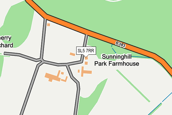
SL5 7RR is located in the Winkfield & Warfield East electoral ward, within the unitary authority of Bracknell Forest and the English Parliamentary constituency of Windsor. The Sub Integrated Care Board (ICB) Location is NHS Frimley ICB - D4U1Y and the police force is Thames Valley. This postcode has been in use since June 2004.


GetTheData
Source: OS OpenMap – Local (Ordnance Survey)
Source: OS VectorMap District (Ordnance Survey)
Licence: Open Government Licence (requires attribution)
| Easting | 494085 |
| Northing | 170606 |
| Latitude | 51.426662 |
| Longitude | -0.648129 |
GetTheData
Source: Open Postcode Geo
Licence: Open Government Licence
| Country | England |
| Postcode District | SL5 |
| ➜ SL5 open data dashboard ➜ See where SL5 is on a map | |
GetTheData
Source: Land Registry Price Paid Data
Licence: Open Government Licence
Elevation or altitude of SL5 7RR as distance above sea level:
| Metres | Feet | |
|---|---|---|
| Elevation | 70m | 230ft |
Elevation is measured from the approximate centre of the postcode, to the nearest point on an OS contour line from OS Terrain 50, which has contour spacing of ten vertical metres.
➜ How high above sea level am I? Find the elevation of your current position using your device's GPS.
GetTheData
Source: Open Postcode Elevation
Licence: Open Government Licence
| Ward | Winkfield & Warfield East |
| Constituency | Windsor |
GetTheData
Source: ONS Postcode Database
Licence: Open Government Licence
| Sunninghill Park (Sunninghill Road) | Woodend | 86m |
| Sunninghill Park (Sunninghill Road) | Woodend | 98m |
| Ascot Gate (Sunninghill Road) | Woodend | 765m |
| Ascot Gate (Sunninghill Road) | Woodend | 770m |
| Sunninghill Road | Woodend | 788m |
| Ascot Station | 3km |
| Sunningdale Station | 4km |
| Longcross Station | 5.9km |
GetTheData
Source: NaPTAN
Licence: Open Government Licence
GetTheData
Source: ONS Postcode Database
Licence: Open Government Licence


➜ Get more ratings from the Food Standards Agency
GetTheData
Source: Food Standards Agency
Licence: FSA terms & conditions
| Last Collection | |||
|---|---|---|---|
| Location | Mon-Fri | Sat | Distance |
| London Road Post Office | 17:15 | 11:45 | 1,254m |
| Cheapside Road | 18:00 | 11:30 | 1,454m |
| Cheapside Road | 18:00 | 11:45 | 1,858m |
GetTheData
Source: Dracos
Licence: Creative Commons Attribution-ShareAlike
| Facility | Distance |
|---|---|
| Ascot United Fc (The Racecourse Ground) Winkfield Road, Ascot Grass Pitches, Artificial Grass Pitch | 1.7km |
| Royal Ascot Golf Club Winkfield Road, Ascot Golf | 1.7km |
| Imperial College London Buckhurst Road, Ascot Health and Fitness Gym, Squash Courts | 2km |
GetTheData
Source: Active Places
Licence: Open Government Licence
| School | Phase of Education | Distance |
|---|---|---|
| Cheapside CofE Primary School Watersplash Lane, Cheapside, Ascot, SL5 7QJ | Primary | 955m |
| Papplewick School Windsor Road, Ascot, SL5 7LH | Not applicable | 2.2km |
| Cranbourne Primary School Lovel Road, Winkfield, Windsor, SL4 2EU | Primary | 2.3km |
GetTheData
Source: Edubase
Licence: Open Government Licence
The below table lists the International Territorial Level (ITL) codes (formerly Nomenclature of Territorial Units for Statistics (NUTS) codes) and Local Administrative Units (LAU) codes for SL5 7RR:
| ITL 1 Code | Name |
|---|---|
| TLJ | South East (England) |
| ITL 2 Code | Name |
| TLJ1 | Berkshire, Buckinghamshire and Oxfordshire |
| ITL 3 Code | Name |
| TLJ11 | Berkshire |
| LAU 1 Code | Name |
| E06000036 | Bracknell Forest |
GetTheData
Source: ONS Postcode Directory
Licence: Open Government Licence
The below table lists the Census Output Area (OA), Lower Layer Super Output Area (LSOA), and Middle Layer Super Output Area (MSOA) for SL5 7RR:
| Code | Name | |
|---|---|---|
| OA | E00082118 | |
| LSOA | E01016252 | Bracknell Forest 001C |
| MSOA | E02003352 | Bracknell Forest 001 |
GetTheData
Source: ONS Postcode Directory
Licence: Open Government Licence
| SL5 7RW | Pump Lane | 898m |
| SL5 7QP | Watersplash Lane | 954m |
| SL5 7RP | Sunninghill Road | 984m |
| SL5 7QJ | Green Lane | 985m |
| SL5 7QL | Dorian Drive | 1000m |
| SL4 2DE | Windsor Road | 1021m |
| SL5 7QS | Cheapside Road | 1030m |
| SL5 7QR | Cheapside Road | 1079m |
| SL4 2DG | Lovel Lane | 1107m |
| SL5 7QH | Cheapside Road | 1115m |
GetTheData
Source: Open Postcode Geo; Land Registry Price Paid Data
Licence: Open Government Licence