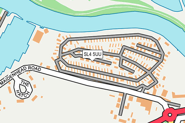
SL4 5UU is located in the Clewer & Dedworth West electoral ward, within the unitary authority of Windsor and Maidenhead and the English Parliamentary constituency of Windsor. The Sub Integrated Care Board (ICB) Location is NHS Frimley ICB - D4U1Y and the police force is Thames Valley. This postcode has been in use since December 1997.


GetTheData
Source: OS OpenMap – Local (Ordnance Survey)
Source: OS VectorMap District (Ordnance Survey)
Licence: Open Government Licence (requires attribution)
| Easting | 493309 |
| Northing | 177187 |
| Latitude | 51.485949 |
| Longitude | -0.657536 |
GetTheData
Source: Open Postcode Geo
Licence: Open Government Licence
| Country | England |
| Postcode District | SL4 |
➜ See where SL4 is on a map ➜ Where is Windsor? | |
GetTheData
Source: Land Registry Price Paid Data
Licence: Open Government Licence
Elevation or altitude of SL4 5UU as distance above sea level:
| Metres | Feet | |
|---|---|---|
| Elevation | 20m | 66ft |
Elevation is measured from the approximate centre of the postcode, to the nearest point on an OS contour line from OS Terrain 50, which has contour spacing of ten vertical metres.
➜ How high above sea level am I? Find the elevation of your current position using your device's GPS.
GetTheData
Source: Open Postcode Elevation
Licence: Open Government Licence
| Ward | Clewer & Dedworth West |
| Constituency | Windsor |
GetTheData
Source: ONS Postcode Database
Licence: Open Government Licence
| Ruddlesway Roundabout (Ruddlesway) | Dedworth | 343m |
| Ruddlesway Roundabout (Ruddleway) | Dedworth | 427m |
| Copper Beech Close (Testwood Road) | Dedworth | 522m |
| Copper Beech Close (Testwood Road) | Dedworth | 529m |
| Martin Close (Ruddlesway) | Dedworth | 590m |
| Windsor & Eton Central Station | 3.3km |
| Windsor & Eton Riverside Station | 3.5km |
| Burnham (Berks) Station | 4.2km |
GetTheData
Source: NaPTAN
Licence: Open Government Licence
| Percentage of properties with Next Generation Access | 100.0% |
| Percentage of properties with Superfast Broadband | 100.0% |
| Percentage of properties with Ultrafast Broadband | 0.0% |
| Percentage of properties with Full Fibre Broadband | 0.0% |
Superfast Broadband is between 30Mbps and 300Mbps
Ultrafast Broadband is > 300Mbps
| Percentage of properties unable to receive 2Mbps | 0.0% |
| Percentage of properties unable to receive 5Mbps | 0.0% |
| Percentage of properties unable to receive 10Mbps | 0.0% |
| Percentage of properties unable to receive 30Mbps | 0.0% |
GetTheData
Source: Ofcom
Licence: Ofcom Terms of Use (requires attribution)
GetTheData
Source: ONS Postcode Database
Licence: Open Government Licence


➜ Get more ratings from the Food Standards Agency
GetTheData
Source: Food Standards Agency
Licence: FSA terms & conditions
| Last Collection | |||
|---|---|---|---|
| Location | Mon-Fri | Sat | Distance |
| Hatch Lane | 17:30 | 11:45 | 2,096m |
| Clewer Hill Road | 17:30 | 11:45 | 2,553m |
| Lake End Road Dorney | 16:30 | 07:45 | 2,575m |
GetTheData
Source: Dracos
Licence: Creative Commons Attribution-ShareAlike
| Risk of SL4 5UU flooding from rivers and sea | Low |
| ➜ SL4 5UU flood map | |
GetTheData
Source: Open Flood Risk by Postcode
Licence: Open Government Licence
The below table lists the International Territorial Level (ITL) codes (formerly Nomenclature of Territorial Units for Statistics (NUTS) codes) and Local Administrative Units (LAU) codes for SL4 5UU:
| ITL 1 Code | Name |
|---|---|
| TLJ | South East (England) |
| ITL 2 Code | Name |
| TLJ1 | Berkshire, Buckinghamshire and Oxfordshire |
| ITL 3 Code | Name |
| TLJ11 | Berkshire |
| LAU 1 Code | Name |
| E06000040 | Windsor and Maidenhead |
GetTheData
Source: ONS Postcode Directory
Licence: Open Government Licence
The below table lists the Census Output Area (OA), Lower Layer Super Output Area (LSOA), and Middle Layer Super Output Area (MSOA) for SL4 5UU:
| Code | Name | |
|---|---|---|
| OA | E00083587 | |
| LSOA | E01016553 | Windsor and Maidenhead 013B |
| MSOA | E02003433 | Windsor and Maidenhead 013 |
GetTheData
Source: ONS Postcode Directory
Licence: Open Government Licence
| SL4 5UA | The Willows | 131m |
| SL4 5TY | Dairy Cottages | 163m |
| SL4 5UB | Maidenhead Road | 173m |
| SL4 5TH | River Road | 206m |
| SL4 5TR | Maidenhead Road | 211m |
| SL4 5TP | The Willows | 255m |
| SL4 5UD | The Hatch | 278m |
| SL4 5SF | Ruddlesway | 399m |
| SL4 5SG | Ruddlesway | 435m |
| SL4 5SQ | Ruddlesway | 442m |
GetTheData
Source: Open Postcode Geo; Land Registry Price Paid Data
Licence: Open Government Licence