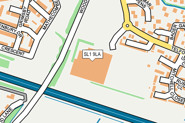
SL1 9LA is located in the Cippenham Manor electoral ward, within the unitary authority of Slough and the English Parliamentary constituency of Slough. The Sub Integrated Care Board (ICB) Location is NHS Frimley ICB - D4U1Y and the police force is Thames Valley. This postcode has been in use since February 1990.


GetTheData
Source: OS OpenMap – Local (Ordnance Survey)
Source: OS VectorMap District (Ordnance Survey)
Licence: Open Government Licence (requires attribution)
| Easting | 495169 |
| Northing | 179607 |
| Latitude | 51.507390 |
| Longitude | -0.630122 |
GetTheData
Source: Open Postcode Geo
Licence: Open Government Licence
| Country | England |
| Postcode District | SL1 |
➜ See where SL1 is on a map ➜ Where is Slough? | |
GetTheData
Source: Land Registry Price Paid Data
Licence: Open Government Licence
Elevation or altitude of SL1 9LA as distance above sea level:
| Metres | Feet | |
|---|---|---|
| Elevation | 20m | 66ft |
Elevation is measured from the approximate centre of the postcode, to the nearest point on an OS contour line from OS Terrain 50, which has contour spacing of ten vertical metres.
➜ How high above sea level am I? Find the elevation of your current position using your device's GPS.
GetTheData
Source: Open Postcode Elevation
Licence: Open Government Licence
| Ward | Cippenham Manor |
| Constituency | Slough |
GetTheData
Source: ONS Postcode Database
Licence: Open Government Licence
| Telford Drive Asda (Asda) | Cippenham | 71m |
| Braemar Gardens (Telford Drive) | Cippenham | 228m |
| Braemar Gardens (Telford Drive) | Cippenham | 251m |
| Grimsby Road (Eltham Avenue) | Cippenham | 327m |
| Grimsby Road (Eltham Avenue) | Cippenham | 343m |
| Burnham (Berks) Station | 2.1km |
| Slough Station | 2.7km |
| Windsor & Eton Riverside Station | 2.9km |
GetTheData
Source: NaPTAN
Licence: Open Government Licence
GetTheData
Source: ONS Postcode Database
Licence: Open Government Licence


➜ Get more ratings from the Food Standards Agency
GetTheData
Source: Food Standards Agency
Licence: FSA terms & conditions
| Last Collection | |||
|---|---|---|---|
| Location | Mon-Fri | Sat | Distance |
| Asda Superstore | 16:30 | 10:45 | 10m |
| Telford Drive | 16:30 | 10:30 | 510m |
| Richards Way | 18:15 | 10:45 | 519m |
GetTheData
Source: Dracos
Licence: Creative Commons Attribution-ShareAlike
| Risk of SL1 9LA flooding from rivers and sea | Very Low |
| ➜ SL1 9LA flood map | |
GetTheData
Source: Open Flood Risk by Postcode
Licence: Open Government Licence
The below table lists the International Territorial Level (ITL) codes (formerly Nomenclature of Territorial Units for Statistics (NUTS) codes) and Local Administrative Units (LAU) codes for SL1 9LA:
| ITL 1 Code | Name |
|---|---|
| TLJ | South East (England) |
| ITL 2 Code | Name |
| TLJ1 | Berkshire, Buckinghamshire and Oxfordshire |
| ITL 3 Code | Name |
| TLJ11 | Berkshire |
| LAU 1 Code | Name |
| E06000039 | Slough |
GetTheData
Source: ONS Postcode Directory
Licence: Open Government Licence
The below table lists the Census Output Area (OA), Lower Layer Super Output Area (LSOA), and Middle Layer Super Output Area (MSOA) for SL1 9LA:
| Code | Name | |
|---|---|---|
| OA | E00166714 | |
| LSOA | E01016477 | Slough 008E |
| MSOA | E02003414 | Slough 008 |
GetTheData
Source: ONS Postcode Directory
Licence: Open Government Licence
| SL1 9JB | Flamborough Spur | 152m |
| SL1 5FG | Mathecombe Road | 206m |
| SL1 9DD | Braemar Gardens | 207m |
| SL1 9DU | Garnet Close | 212m |
| SL1 9DT | Galahad Close | 231m |
| SL1 9DE | Braemar Gardens | 233m |
| SL1 5FF | St Margaret Way | 239m |
| SL1 9DJ | Bader Gardens | 246m |
| SL1 5FH | Dariel Close | 249m |
| SL1 5FE | Grimsby Road | 263m |
GetTheData
Source: Open Postcode Geo; Land Registry Price Paid Data
Licence: Open Government Licence