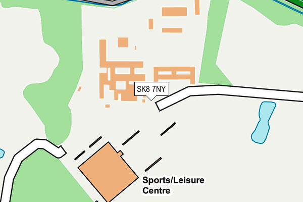
SK8 7NY is located in the Handforth electoral ward, within the unitary authority of Cheshire East and the English Parliamentary constituency of Tatton. The Sub Integrated Care Board (ICB) Location is NHS Cheshire and Merseyside ICB - 27D and the police force is Cheshire. This postcode has been in use since October 2004.


GetTheData
Source: OS OpenMap – Local (Ordnance Survey)
Source: OS VectorMap District (Ordnance Survey)
Licence: Open Government Licence (requires attribution)
| Easting | 387138 |
| Northing | 383881 |
| Latitude | 53.351673 |
| Longitude | -2.194685 |
GetTheData
Source: Open Postcode Geo
Licence: Open Government Licence
| Country | England |
| Postcode District | SK8 |
| ➜ SK8 open data dashboard ➜ See where SK8 is on a map ➜ Where is Handforth? | |
GetTheData
Source: Land Registry Price Paid Data
Licence: Open Government Licence
Elevation or altitude of SK8 7NY as distance above sea level:
| Metres | Feet | |
|---|---|---|
| Elevation | 80m | 262ft |
Elevation is measured from the approximate centre of the postcode, to the nearest point on an OS contour line from OS Terrain 50, which has contour spacing of ten vertical metres.
➜ How high above sea level am I? Find the elevation of your current position using your device's GPS.
GetTheData
Source: Open Postcode Elevation
Licence: Open Government Licence
| Ward | Handforth |
| Constituency | Tatton |
GetTheData
Source: ONS Postcode Database
Licence: Open Government Licence
| May 2021 | Public order | On or near Pedestrian Subway | 490m |
| ➜ Get more crime data in our Crime section | |||
GetTheData
Source: data.police.uk
Licence: Open Government Licence
| Shopping Centre (Grounds) | Handforth Dean | 657m |
| Grove Ln/Pointing Dog (Grove Ln) | Gillbent | 755m |
| Grove Ln/Rugby Club (Grove Ln) | Gillbent | 766m |
| Grove Ln/Rugby Club (Grove Ln) | Gillbent | 775m |
| Grove Ln/Pointing Dog (Grove Ln) | Gillbent | 780m |
| Handforth Station | 1.4km |
| Bramhall Station | 2.3km |
| Cheadle Hulme Station | 2.7km |
GetTheData
Source: NaPTAN
Licence: Open Government Licence
GetTheData
Source: ONS Postcode Database
Licence: Open Government Licence


➜ Get more ratings from the Food Standards Agency
GetTheData
Source: Food Standards Agency
Licence: FSA terms & conditions
| Last Collection | |||
|---|---|---|---|
| Location | Mon-Fri | Sat | Distance |
| Tesco Kiln Cross Lane | 17:00 | 12:00 | 761m |
| Grove Lane | 17:30 | 11:30 | 764m |
| Commercial Road | 17:15 | 11:30 | 795m |
GetTheData
Source: Dracos
Licence: Creative Commons Attribution-ShareAlike
| Facility | Distance |
|---|---|
| Total Fitness (Wilmslow) Wilmslow Way, Handforth, Wilmslow Swimming Pool, Health and Fitness Gym, Studio, Squash Courts, Outdoor Tennis Courts | 241m |
| Grove Park (Cheadle Hulme) Grove Lane, Cheadle Hulme, Cheadle Grass Pitches, Squash Courts | 584m |
| Pro Football Arena Earl Road, Cheadle Hulme, Cheadle Artificial Grass Pitch | 740m |
GetTheData
Source: Active Places
Licence: Open Government Licence
| School | Phase of Education | Distance |
|---|---|---|
| St James' Catholic High School St James' Way, Cheadle Hulme, Cheadle, SK8 6PZ | Secondary | 943m |
| St Benedict's Catholic Primary School Hall Road, Handforth, Wilmslow, SK9 3AE | Primary | 1km |
| Valley School Whitehaven Road, Bramhall, Stockport, SK7 1EN | Not applicable | 1.1km |
GetTheData
Source: Edubase
Licence: Open Government Licence
The below table lists the International Territorial Level (ITL) codes (formerly Nomenclature of Territorial Units for Statistics (NUTS) codes) and Local Administrative Units (LAU) codes for SK8 7NY:
| ITL 1 Code | Name |
|---|---|
| TLD | North West (England) |
| ITL 2 Code | Name |
| TLD6 | Cheshire |
| ITL 3 Code | Name |
| TLD62 | Cheshire East |
| LAU 1 Code | Name |
| E06000049 | Cheshire East |
GetTheData
Source: ONS Postcode Directory
Licence: Open Government Licence
The below table lists the Census Output Area (OA), Lower Layer Super Output Area (LSOA), and Middle Layer Super Output Area (MSOA) for SK8 7NY:
| Code | Name | |
|---|---|---|
| OA | E00093830 | |
| LSOA | E01018593 | Cheshire East 004C |
| MSOA | E02003856 | Cheshire East 004 |
GetTheData
Source: ONS Postcode Directory
Licence: Open Government Licence
| SK8 7NL | Spath Lane East | 656m |
| SK8 7NF | Ripley Avenue | 697m |
| SK8 6PW | Longsight Lane | 702m |
| SK8 7NJ | Spath Walk | 718m |
| SK8 7NH | Grove Lane | 722m |
| SK8 7ND | Grove Lane | 742m |
| SK8 7NB | Grove Lane | 774m |
| SK8 7NG | Grove Lane | 780m |
| SK8 7LZ | Grove Lane | 808m |
| SK8 7NE | Grove Lane | 809m |
GetTheData
Source: Open Postcode Geo; Land Registry Price Paid Data
Licence: Open Government Licence