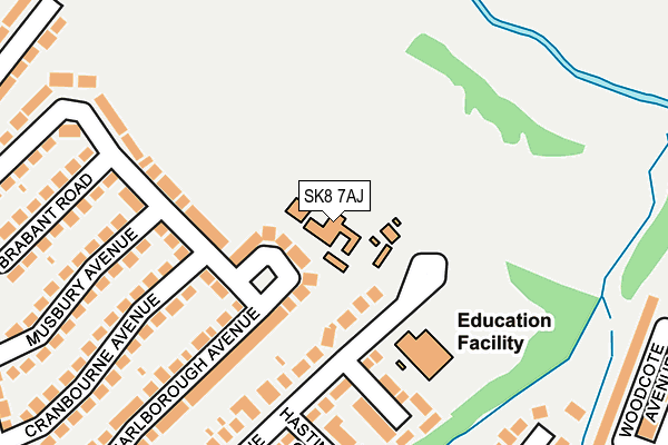
SK8 7AJ is located in the Cheadle Hulme South electoral ward, within the metropolitan district of Stockport and the English Parliamentary constituency of Cheadle. The Sub Integrated Care Board (ICB) Location is NHS Greater Manchester ICB - 01W and the police force is Greater Manchester. This postcode has been in use since January 1980.


GetTheData
Source: OS OpenMap – Local (Ordnance Survey)
Source: OS VectorMap District (Ordnance Survey)
Licence: Open Government Licence (requires attribution)
| Easting | 388108 |
| Northing | 386708 |
| Latitude | 53.377090 |
| Longitude | -2.180221 |
GetTheData
Source: Open Postcode Geo
Licence: Open Government Licence
| Country | England |
| Postcode District | SK8 |
| ➜ SK8 open data dashboard ➜ See where SK8 is on a map ➜ Where is Cheadle Hulme? | |
GetTheData
Source: Land Registry Price Paid Data
Licence: Open Government Licence
Elevation or altitude of SK8 7AJ as distance above sea level:
| Metres | Feet | |
|---|---|---|
| Elevation | 70m | 230ft |
Elevation is measured from the approximate centre of the postcode, to the nearest point on an OS contour line from OS Terrain 50, which has contour spacing of ten vertical metres.
➜ How high above sea level am I? Find the elevation of your current position using your device's GPS.
GetTheData
Source: Open Postcode Elevation
Licence: Open Government Licence
| Ward | Cheadle Hulme South |
| Constituency | Cheadle |
GetTheData
Source: ONS Postcode Database
Licence: Open Government Licence
| Station Rd/Monmouth Rd (Station Rd) | Cheadle Hulme | 506m |
| Station Rd/Lindsay Ave (Station Rd) | Cheadle Hulme | 522m |
| Station Rd/Monmouth Rd (Station Rd) | Cheadle Hulme | 528m |
| Station Rd/Platform 5 (Station Rd) | Cheadle Hulme | 532m |
| Station Rd/Beech Rd (Station Rd) | Cheadle Hulme | 540m |
| Cheadle Hulme Station | 0.6km |
| Bramhall Station | 2.1km |
| Davenport Station | 2.4km |
GetTheData
Source: NaPTAN
Licence: Open Government Licence
GetTheData
Source: ONS Postcode Database
Licence: Open Government Licence


➜ Get more ratings from the Food Standards Agency
GetTheData
Source: Food Standards Agency
Licence: FSA terms & conditions
| Last Collection | |||
|---|---|---|---|
| Location | Mon-Fri | Sat | Distance |
| Monmouth Road | 17:30 | 11:30 | 371m |
| Station Road | 17:30 | 11:30 | 539m |
| 11 Warren Road | 18:30 | 587m | |
GetTheData
Source: Dracos
Licence: Creative Commons Attribution-ShareAlike
| Facility | Distance |
|---|---|
| Lane End Primary School Ramillies Avenue, Cheadle Hulme, Cheadle Grass Pitches | 131m |
| Linney Road Linney Road, Bramhall, Stockport Grass Pitches | 449m |
| Bramhall Park Lawn Tennis Club Bramhall Park Road, Bramhall, Stockport Outdoor Tennis Courts | 667m |
GetTheData
Source: Active Places
Licence: Open Government Licence
| School | Phase of Education | Distance |
|---|---|---|
| Lane End Primary School Ramillies Avenue, Cheadle Hulme, Stockport, SK8 7AL | Primary | 132m |
| Nevill Road Infant School Nevill Road, Bramhall, Stockport, SK7 3ET | Primary | 993m |
| Nevill Road Junior School Nevill Road, Bramhall, Stockport, SK7 3ET | Primary | 1km |
GetTheData
Source: Edubase
Licence: Open Government Licence
The below table lists the International Territorial Level (ITL) codes (formerly Nomenclature of Territorial Units for Statistics (NUTS) codes) and Local Administrative Units (LAU) codes for SK8 7AJ:
| ITL 1 Code | Name |
|---|---|
| TLD | North West (England) |
| ITL 2 Code | Name |
| TLD3 | Greater Manchester |
| ITL 3 Code | Name |
| TLD35 | Greater Manchester South East |
| LAU 1 Code | Name |
| E08000007 | Stockport |
GetTheData
Source: ONS Postcode Directory
Licence: Open Government Licence
The below table lists the Census Output Area (OA), Lower Layer Super Output Area (LSOA), and Middle Layer Super Output Area (MSOA) for SK8 7AJ:
| Code | Name | |
|---|---|---|
| OA | E00029330 | |
| LSOA | E01005796 | Stockport 039E |
| MSOA | E02001225 | Stockport 039 |
GetTheData
Source: ONS Postcode Directory
Licence: Open Government Licence
| SK8 7GF | Newhaven Close | 168m |
| SK8 7AW | Marlborough Avenue | 181m |
| SK8 7AP | Marlborough Avenue | 207m |
| SK8 7AQ | Ramillies Avenue | 215m |
| SK8 7BE | Hastings Close | 227m |
| SK8 7AS | Cranbourne Avenue | 230m |
| SK8 7AT | Musbury Avenue | 232m |
| SK8 7AU | Brabant Road | 240m |
| SK8 7AR | Marlborough Avenue | 256m |
| SK8 7BY | Thornbury Close | 276m |
GetTheData
Source: Open Postcode Geo; Land Registry Price Paid Data
Licence: Open Government Licence