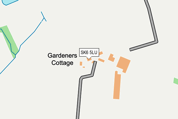
SK6 5LU is located in the Marple North electoral ward, within the metropolitan district of Stockport and the English Parliamentary constituency of Hazel Grove. The Sub Integrated Care Board (ICB) Location is NHS Greater Manchester ICB - 01W and the police force is Greater Manchester. This postcode has been in use since January 1980.


GetTheData
Source: OS OpenMap – Local (Ordnance Survey)
Source: OS VectorMap District (Ordnance Survey)
Licence: Open Government Licence (requires attribution)
| Easting | 398502 |
| Northing | 389286 |
| Latitude | 53.400397 |
| Longitude | -2.023995 |
GetTheData
Source: Open Postcode Geo
Licence: Open Government Licence
| Country | England |
| Postcode District | SK6 |
| ➜ SK6 open data dashboard ➜ See where SK6 is on a map | |
GetTheData
Source: Land Registry Price Paid Data
Licence: Open Government Licence
Elevation or altitude of SK6 5LU as distance above sea level:
| Metres | Feet | |
|---|---|---|
| Elevation | 220m | 722ft |
Elevation is measured from the approximate centre of the postcode, to the nearest point on an OS contour line from OS Terrain 50, which has contour spacing of ten vertical metres.
➜ How high above sea level am I? Find the elevation of your current position using your device's GPS.
GetTheData
Source: Open Postcode Elevation
Licence: Open Government Licence
| Ward | Marple North |
| Constituency | Hazel Grove |
GetTheData
Source: ONS Postcode Database
Licence: Open Government Licence
| Longhurst Ln/Devonshire Arms (Longhurst Ln) | Mellor | 807m |
| Longhurst Ln/Devonshire Arms (Longhurst Ln) | Mellor | 821m |
| Longhurst Ln/Mellor Terminus (Longhurst Ln) | Mellor | 843m |
| Moor End Ln/Oddfellows (Moor End Rd) | Mellor | 852m |
| Longhurst Ln/Turning Circle (Longhurst Ln) | Mellor | 856m |
| Marple Station | 2.2km |
| Strines Station | 2.9km |
| Rose Hill Marple Station | 3.5km |
GetTheData
Source: NaPTAN
Licence: Open Government Licence
| Percentage of properties with Next Generation Access | 100.0% |
| Percentage of properties with Superfast Broadband | 25.0% |
| Percentage of properties with Ultrafast Broadband | 0.0% |
| Percentage of properties with Full Fibre Broadband | 0.0% |
Superfast Broadband is between 30Mbps and 300Mbps
Ultrafast Broadband is > 300Mbps
| Percentage of properties unable to receive 2Mbps | 0.0% |
| Percentage of properties unable to receive 5Mbps | 0.0% |
| Percentage of properties unable to receive 10Mbps | 0.0% |
| Percentage of properties unable to receive 30Mbps | 75.0% |
GetTheData
Source: Ofcom
Licence: Ofcom Terms of Use (requires attribution)
GetTheData
Source: ONS Postcode Database
Licence: Open Government Licence


➜ Get more ratings from the Food Standards Agency
GetTheData
Source: Food Standards Agency
Licence: FSA terms & conditions
| Last Collection | |||
|---|---|---|---|
| Location | Mon-Fri | Sat | Distance |
| Mellor Church | 09:45 | 09:45 | 408m |
| Moorend Road | 17:30 | 11:00 | 859m |
| Devonshire | 17:30 | 11:30 | 939m |
GetTheData
Source: Dracos
Licence: Creative Commons Attribution-ShareAlike
| Facility | Distance |
|---|---|
| Mellor Sports Club Longhurst Lane, Mellor, Stockport Grass Pitches, Sports Hall, Outdoor Tennis Courts | 1.2km |
| Mellor Primary School Knowle Road, Mellor, Stockport Grass Pitches, Sports Hall | 1.3km |
| Mellor And Townscliffe Golf Club Gibb Lane, Mellor, Stockport Golf | 1.4km |
GetTheData
Source: Active Places
Licence: Open Government Licence
| School | Phase of Education | Distance |
|---|---|---|
| Mellor Primary School Knowle Road, Mellor, Stockport, SK6 5PL | Primary | 1.3km |
| St Mary's Catholic Voluntary Academy Lowry Drive, Marple Bridge, Stockport, SK6 5BR | Primary | 1.8km |
| Ludworth Primary School Ludworth Primary School, Lower Fold, Marple Bridge, Stockport, SK6 5DU | Primary | 2km |
GetTheData
Source: Edubase
Licence: Open Government Licence
The below table lists the International Territorial Level (ITL) codes (formerly Nomenclature of Territorial Units for Statistics (NUTS) codes) and Local Administrative Units (LAU) codes for SK6 5LU:
| ITL 1 Code | Name |
|---|---|
| TLD | North West (England) |
| ITL 2 Code | Name |
| TLD3 | Greater Manchester |
| ITL 3 Code | Name |
| TLD35 | Greater Manchester South East |
| LAU 1 Code | Name |
| E08000007 | Stockport |
GetTheData
Source: ONS Postcode Directory
Licence: Open Government Licence
The below table lists the Census Output Area (OA), Lower Layer Super Output Area (LSOA), and Middle Layer Super Output Area (MSOA) for SK6 5LU:
| Code | Name | |
|---|---|---|
| OA | E00029937 | |
| LSOA | E01005908 | Stockport 017D |
| MSOA | E02001203 | Stockport 017 |
GetTheData
Source: ONS Postcode Directory
Licence: Open Government Licence
| SK6 5LR | Hollywood Road | 373m |
| SK6 5LT | Chatterton Lane | 403m |
| SK6 5DQ | Holly Vale | 481m |
| SK6 5DH | 506m | |
| SK6 5LW | Mill Brow | 560m |
| SK6 5LY | Church Road | 573m |
| SK6 5PR | Church Road | 682m |
| SK6 5LL | Mill Brow | 734m |
| SK6 5LS | Chatterton Lane | 753m |
| SK6 5PS | Moor End Road | 760m |
GetTheData
Source: Open Postcode Geo; Land Registry Price Paid Data
Licence: Open Government Licence