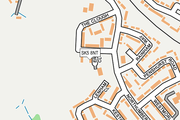
SK5 8NT is located in the Brinnington & Stockport Central electoral ward, within the metropolitan district of Stockport and the English Parliamentary constituency of Stockport. The Sub Integrated Care Board (ICB) Location is NHS Greater Manchester ICB - 01W and the police force is Greater Manchester. This postcode has been in use since January 1980.


GetTheData
Source: OS OpenMap – Local (Ordnance Survey)
Source: OS VectorMap District (Ordnance Survey)
Licence: Open Government Licence (requires attribution)
| Easting | 390757 |
| Northing | 392833 |
| Latitude | 53.432198 |
| Longitude | -2.140584 |
GetTheData
Source: Open Postcode Geo
Licence: Open Government Licence
| Country | England |
| Postcode District | SK5 |
| ➜ SK5 open data dashboard ➜ See where SK5 is on a map ➜ Where is Stockport? | |
GetTheData
Source: Land Registry Price Paid Data
Licence: Open Government Licence
Elevation or altitude of SK5 8NT as distance above sea level:
| Metres | Feet | |
|---|---|---|
| Elevation | 80m | 262ft |
Elevation is measured from the approximate centre of the postcode, to the nearest point on an OS contour line from OS Terrain 50, which has contour spacing of ten vertical metres.
➜ How high above sea level am I? Find the elevation of your current position using your device's GPS.
GetTheData
Source: Open Postcode Elevation
Licence: Open Government Licence
| Ward | Brinnington & Stockport Central |
| Constituency | Stockport |
GetTheData
Source: ONS Postcode Database
Licence: Open Government Licence
| Northumberland Rd (Northumberl'd R) | Brinnington | 85m |
| Northumberland Rd/Dunton Green (Northumberl'd R) | Brinnington | 89m |
| The Clough | Brinnington | 124m |
| Keston Crescent | Brinnington | 150m |
| Northumberland Rd/Hollow End (Northumberl'd R) | Brinnington | 188m |
| Brinnington Station | 0.4km |
| Reddish South Station | 1.3km |
| Reddish North Station | 2.2km |
GetTheData
Source: NaPTAN
Licence: Open Government Licence
| Percentage of properties with Next Generation Access | 100.0% |
| Percentage of properties with Superfast Broadband | 100.0% |
| Percentage of properties with Ultrafast Broadband | 100.0% |
| Percentage of properties with Full Fibre Broadband | 0.0% |
Superfast Broadband is between 30Mbps and 300Mbps
Ultrafast Broadband is > 300Mbps
| Percentage of properties unable to receive 2Mbps | 0.0% |
| Percentage of properties unable to receive 5Mbps | 0.0% |
| Percentage of properties unable to receive 10Mbps | 0.0% |
| Percentage of properties unable to receive 30Mbps | 0.0% |
GetTheData
Source: Ofcom
Licence: Ofcom Terms of Use (requires attribution)
GetTheData
Source: ONS Postcode Database
Licence: Open Government Licence


➜ Get more ratings from the Food Standards Agency
GetTheData
Source: Food Standards Agency
Licence: FSA terms & conditions
| Last Collection | |||
|---|---|---|---|
| Location | Mon-Fri | Sat | Distance |
| The Link | 17:15 | 12:15 | 292m |
| Brinnington Tso | 17:15 | 12:00 | 843m |
| Broomfield Tso | 17:30 | 12:15 | 989m |
GetTheData
Source: Dracos
Licence: Creative Commons Attribution-ShareAlike
| Facility | Distance |
|---|---|
| Westmorland Primary School Westmorland Drive, Stockport Grass Pitches, Artificial Grass Pitch | 380m |
| Tame Valley Primary School (Closed) Blackberry Lane, Brinnington, Stockport Grass Pitches | 495m |
| Life Leisure Brinnington Park Northumberland Road, Stockport Artificial Grass Pitch, Health and Fitness Gym, Studio, Sports Hall | 513m |
GetTheData
Source: Active Places
Licence: Open Government Licence
| School | Phase of Education | Distance |
|---|---|---|
| Westmorland Primary School Westmorland Drive, Brinnington, Stockport, SK5 8HH | Primary | 297m |
| St Mary's Church of England Primary School Broomfield Drive, South Reddish, Stockport, SK5 7DR | Primary | 862m |
| St Bernadette's Catholic Primary School Foliage Road, Brinnington, Stockport, SK5 8AR | Primary | 951m |
GetTheData
Source: Edubase
Licence: Open Government Licence
The below table lists the International Territorial Level (ITL) codes (formerly Nomenclature of Territorial Units for Statistics (NUTS) codes) and Local Administrative Units (LAU) codes for SK5 8NT:
| ITL 1 Code | Name |
|---|---|
| TLD | North West (England) |
| ITL 2 Code | Name |
| TLD3 | Greater Manchester |
| ITL 3 Code | Name |
| TLD35 | Greater Manchester South East |
| LAU 1 Code | Name |
| E08000007 | Stockport |
GetTheData
Source: ONS Postcode Directory
Licence: Open Government Licence
The below table lists the Census Output Area (OA), Lower Layer Super Output Area (LSOA), and Middle Layer Super Output Area (MSOA) for SK5 8NT:
| Code | Name | |
|---|---|---|
| OA | E00029164 | |
| LSOA | E01005754 | Stockport 004B |
| MSOA | E02001190 | Stockport 004 |
GetTheData
Source: ONS Postcode Directory
Licence: Open Government Licence
| SK5 8NS | The Clough | 49m |
| SK5 8NX | The Clough | 93m |
| SK5 8NW | Northumberland Road | 117m |
| SK5 8HW | Dunton Green | 142m |
| SK5 8NQ | Keston Crescent | 180m |
| SK5 8HN | Rainham Way | 181m |
| SK5 8NE | Romney Way | 183m |
| SK5 8HL | Penshurst Road | 215m |
| SK5 8PB | Northumberland Road | 221m |
| SK5 8NN | Northumberland Road | 245m |
GetTheData
Source: Open Postcode Geo; Land Registry Price Paid Data
Licence: Open Government Licence