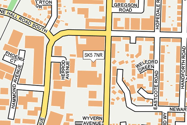
SK5 7NR is located in the Reddish South electoral ward, within the metropolitan district of Stockport and the English Parliamentary constituency of Denton and Reddish. The Sub Integrated Care Board (ICB) Location is NHS Greater Manchester ICB - 01W and the police force is Greater Manchester. This postcode has been in use since January 1993.


GetTheData
Source: OS OpenMap – Local (Ordnance Survey)
Source: OS VectorMap District (Ordnance Survey)
Licence: Open Government Licence (requires attribution)
| Easting | 389387 |
| Northing | 392477 |
| Latitude | 53.428989 |
| Longitude | -2.161190 |
GetTheData
Source: Open Postcode Geo
Licence: Open Government Licence
| Country | England |
| Postcode District | SK5 |
| ➜ SK5 open data dashboard ➜ See where SK5 is on a map ➜ Where is Reddish? | |
GetTheData
Source: Land Registry Price Paid Data
Licence: Open Government Licence
Elevation or altitude of SK5 7NR as distance above sea level:
| Metres | Feet | |
|---|---|---|
| Elevation | 70m | 230ft |
Elevation is measured from the approximate centre of the postcode, to the nearest point on an OS contour line from OS Terrain 50, which has contour spacing of ten vertical metres.
➜ How high above sea level am I? Find the elevation of your current position using your device's GPS.
GetTheData
Source: Open Postcode Elevation
Licence: Open Government Licence
| Ward | Reddish South |
| Constituency | Denton And Reddish |
GetTheData
Source: ONS Postcode Database
Licence: Open Government Licence
| Greg St/Broadstone Hall Rd South (Greg St) | South Reddish | 86m |
| Greg St/Broadstone Hall Rd South (Greg St) | South Reddish | 146m |
| Greg St/Wyvern Ave (Greg St) | South Reddish | 206m |
| Haigh Ave/Hammond Ave (Haig Ave) | South Reddish | 214m |
| Greg St/Wyvern Ave (Greg St) | South Reddish | 257m |
| Reddish South Station | 0.8km |
| Heaton Chapel Station | 1.2km |
| Brinnington Station | 1.8km |
GetTheData
Source: NaPTAN
Licence: Open Government Licence
GetTheData
Source: ONS Postcode Database
Licence: Open Government Licence


➜ Get more ratings from the Food Standards Agency
GetTheData
Source: Food Standards Agency
Licence: FSA terms & conditions
| Last Collection | |||
|---|---|---|---|
| Location | Mon-Fri | Sat | Distance |
| Melling Ave | 17:15 | 11:45 | 194m |
| Greg Street | 17:15 | 11:45 | 328m |
| Broomfield Tso | 17:30 | 12:15 | 429m |
GetTheData
Source: Dracos
Licence: Creative Commons Attribution-ShareAlike
| Facility | Distance |
|---|---|
| Life Leisure Houldsworth Village Broadstone Road, Stockport Health and Fitness Gym, Studio, Artificial Grass Pitch, Sports Hall | 555m |
| South Reddish Park Greg Street, Stockport Grass Pitches | 570m |
| Frederick Whittaker Scott Playing Fields Conway Street, Stockport Grass Pitches | 605m |
GetTheData
Source: Active Places
Licence: Open Government Licence
| School | Phase of Education | Distance |
|---|---|---|
| Broadstone Hall Primary School Broadstone Hall Road South, Heaton Chapel, Stockport, SK4 5JD | Primary | 533m |
| St Mary's Church of England Primary School Broomfield Drive, South Reddish, Stockport, SK5 7DR | Primary | 554m |
| Whitehill Primary School Whitehill Street West, Heaton Norris, Stockport, SK4 1PB | Primary | 665m |
GetTheData
Source: Edubase
Licence: Open Government Licence
The below table lists the International Territorial Level (ITL) codes (formerly Nomenclature of Territorial Units for Statistics (NUTS) codes) and Local Administrative Units (LAU) codes for SK5 7NR:
| ITL 1 Code | Name |
|---|---|
| TLD | North West (England) |
| ITL 2 Code | Name |
| TLD3 | Greater Manchester |
| ITL 3 Code | Name |
| TLD35 | Greater Manchester South East |
| LAU 1 Code | Name |
| E08000007 | Stockport |
GetTheData
Source: ONS Postcode Directory
Licence: Open Government Licence
The below table lists the Census Output Area (OA), Lower Layer Super Output Area (LSOA), and Middle Layer Super Output Area (MSOA) for SK5 7NR:
| Code | Name | |
|---|---|---|
| OA | E00029990 | |
| LSOA | E01005915 | Stockport 007B |
| MSOA | E02001193 | Stockport 007 |
GetTheData
Source: ONS Postcode Directory
Licence: Open Government Licence
| SK5 7NB | Greg Street | 73m |
| SK5 7BY | Broadstone Hall Road South | 112m |
| SK5 7NE | Three Acres Drive | 112m |
| SK5 7DF | Styal Avenue | 128m |
| SK5 7DE | Broadstone Hall Road South | 135m |
| SK5 7NT | Welford Green | 175m |
| SK5 7NU | Eastcote Road | 181m |
| SK5 7NS | Tanyard Green | 193m |
| SK5 7ND | Eastcote Road | 220m |
| SK4 5JE | Broadstone Hall Road South | 230m |
GetTheData
Source: Open Postcode Geo; Land Registry Price Paid Data
Licence: Open Government Licence