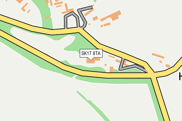
SK17 8TA is in Wormhill, Buxton. SK17 8TA is located in the Limestone Peak electoral ward, within the local authority district of High Peak and the English Parliamentary constituency of High Peak. The Sub Integrated Care Board (ICB) Location is NHS Derby and Derbyshire ICB - 15M and the police force is Derbyshire. This postcode has been in use since January 1980.


GetTheData
Source: OS OpenMap – Local (Ordnance Survey)
Source: OS VectorMap District (Ordnance Survey)
Licence: Open Government Licence (requires attribution)
| Easting | 411994 |
| Northing | 375073 |
| Latitude | 53.272526 |
| Longitude | -1.821609 |
GetTheData
Source: Open Postcode Geo
Licence: Open Government Licence
| Locality | Wormhill |
| Town/City | Buxton |
| Country | England |
| Postcode District | SK17 |
| ➜ SK17 open data dashboard ➜ See where SK17 is on a map ➜ Where is Hargatewall? | |
GetTheData
Source: Land Registry Price Paid Data
Licence: Open Government Licence
Elevation or altitude of SK17 8TA as distance above sea level:
| Metres | Feet | |
|---|---|---|
| Elevation | 360m | 1,181ft |
Elevation is measured from the approximate centre of the postcode, to the nearest point on an OS contour line from OS Terrain 50, which has contour spacing of ten vertical metres.
➜ How high above sea level am I? Find the elevation of your current position using your device's GPS.
GetTheData
Source: Open Postcode Elevation
Licence: Open Government Licence
| Ward | Limestone Peak |
| Constituency | High Peak |
GetTheData
Source: ONS Postcode Database
Licence: Open Government Licence
| Millers Dale Lane | Wormhill | 706m |
| Millers Dale Lane | Wormhill | 707m |
| Wheston Hall (Main Street) | Wheston | 1,842m |
| Dove Holes Station | 5.5km |
GetTheData
Source: NaPTAN
Licence: Open Government Licence
GetTheData
Source: ONS Postcode Database
Licence: Open Government Licence

➜ Get more ratings from the Food Standards Agency
GetTheData
Source: Food Standards Agency
Licence: FSA terms & conditions
| Last Collection | |||
|---|---|---|---|
| Location | Mon-Fri | Sat | Distance |
| Hargate | 17:00 | 08:30 | 155m |
| Wormhill | 17:00 | 08:30 | 914m |
| Tunstead | 09:00 | 08:00 | 1,088m |
GetTheData
Source: Dracos
Licence: Creative Commons Attribution-ShareAlike
| Facility | Distance |
|---|---|
| Tideswell Sports Complex St. Johns Road, Tideswell, Buxton Grass Pitches, Artificial Grass Pitch | 3.4km |
| Batham Gate Road Football Ground Batham Gate Road, Peak Dale, Buxton Grass Pitches | 3.8km |
| Peak Practice Golf (Closed) Fairfield, Buxton Golf | 4.8km |
GetTheData
Source: Active Places
Licence: Open Government Licence
| School | Phase of Education | Distance |
|---|---|---|
| Bishop Pursglove CofE (A) Primary School Tideswell, St. John's Road, Buxton, SK17 8NE | Primary | 3.4km |
| Peak Dale Primary School School Road, Peak Dale, Buxton, SK17 8AJ | Primary | 3.5km |
| Peak Forest Church of England Voluntary Controlled Primary School Hernstone Lane, Peak Forest, Buxton, SK17 8EJ | Primary | 4.2km |
GetTheData
Source: Edubase
Licence: Open Government Licence
The below table lists the International Territorial Level (ITL) codes (formerly Nomenclature of Territorial Units for Statistics (NUTS) codes) and Local Administrative Units (LAU) codes for SK17 8TA:
| ITL 1 Code | Name |
|---|---|
| TLF | East Midlands (England) |
| ITL 2 Code | Name |
| TLF1 | Derbyshire and Nottinghamshire |
| ITL 3 Code | Name |
| TLF13 | South and West Derbyshire |
| LAU 1 Code | Name |
| E07000037 | High Peak |
GetTheData
Source: ONS Postcode Directory
Licence: Open Government Licence
The below table lists the Census Output Area (OA), Lower Layer Super Output Area (LSOA), and Middle Layer Super Output Area (MSOA) for SK17 8TA:
| Code | Name | |
|---|---|---|
| OA | E00099888 | |
| LSOA | E01019742 | High Peak 013D |
| MSOA | E02006872 | High Peak 013 |
GetTheData
Source: ONS Postcode Directory
Licence: Open Government Licence
| SK17 8SJ | 175m | |
| SK17 8SL | 792m | |
| SK17 8TB | 1117m | |
| SK17 8JB | 1473m | |
| SK17 8HY | 1716m | |
| SK17 8JA | 1877m | |
| SK17 8HZ | 2357m | |
| SK17 9TF | Bakewell Road | 2438m |
| SK17 8SN | 2755m | |
| SK17 8BA | Springbank | 2963m |
GetTheData
Source: Open Postcode Geo; Land Registry Price Paid Data
Licence: Open Government Licence