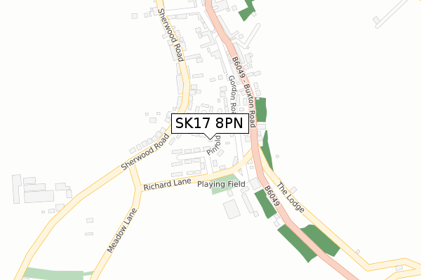
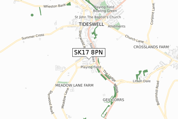
SK17 8PN lies on Pinfold Road in Tideswell, Buxton. SK17 8PN is located in the Tideswell electoral ward, within the local authority district of Derbyshire Dales and the English Parliamentary constituency of Derbyshire Dales. The Sub Integrated Care Board (ICB) Location is NHS Derby and Derbyshire ICB - 15M and the police force is Derbyshire. This postcode has been in use since January 1980.


GetTheData
Source: OS Open Zoomstack (Ordnance Survey)
Licence: Open Government Licence (requires attribution)
Attribution: Contains OS data © Crown copyright and database right 2024
Source: Open Postcode Geo
Licence: Open Government Licence (requires attribution)
Attribution: Contains OS data © Crown copyright and database right 2024; Contains Royal Mail data © Royal Mail copyright and database right 2024; Source: Office for National Statistics licensed under the Open Government Licence v.3.0
| Easting | 415141 |
| Northing | 375190 |
| Latitude | 53.273482 |
| Longitude | -1.774416 |
GetTheData
Source: Open Postcode Geo
Licence: Open Government Licence
| Street | Pinfold Road |
| Locality | Tideswell |
| Town/City | Buxton |
| Country | England |
| Postcode District | SK17 |
| ➜ SK17 open data dashboard ➜ See where SK17 is on a map ➜ Where is Tideswell? | |
GetTheData
Source: Land Registry Price Paid Data
Licence: Open Government Licence
Elevation or altitude of SK17 8PN as distance above sea level:
| Metres | Feet | |
|---|---|---|
| Elevation | 290m | 951ft |
Elevation is measured from the approximate centre of the postcode, to the nearest point on an OS contour line from OS Terrain 50, which has contour spacing of ten vertical metres.
➜ How high above sea level am I? Find the elevation of your current position using your device's GPS.
GetTheData
Source: Open Postcode Elevation
Licence: Open Government Licence
| Ward | Tideswell |
| Constituency | Derbyshire Dales |
GetTheData
Source: ONS Postcode Database
Licence: Open Government Licence
| January 2024 | Anti-social behaviour | On or near Pinfold Crescent | 56m |
| August 2023 | Anti-social behaviour | On or near Pinfold Road | 34m |
| July 2023 | Anti-social behaviour | On or near Pinfold Crescent | 56m |
| ➜ Pinfold Road crime map and outcomes | |||
GetTheData
Source: data.police.uk
Licence: Open Government Licence
| Buxton Road | Tideswell | 101m |
| Buxton Road | Tideswell | 110m |
| Fountain Square (Queen Street) | Tideswell | 377m |
| Fountain Square (Queen Street) | Tideswell | 378m |
| Whitecross Road | Tideswell | 829m |
GetTheData
Source: NaPTAN
Licence: Open Government Licence
➜ Broadband speed and availability dashboard for SK17 8PN
| Percentage of properties with Next Generation Access | 100.0% |
| Percentage of properties with Superfast Broadband | 100.0% |
| Percentage of properties with Ultrafast Broadband | 0.0% |
| Percentage of properties with Full Fibre Broadband | 0.0% |
Superfast Broadband is between 30Mbps and 300Mbps
Ultrafast Broadband is > 300Mbps
| Median download speed | 31.7Mbps |
| Average download speed | 29.2Mbps |
| Maximum download speed | 53.80Mbps |
| Median upload speed | 6.1Mbps |
| Average upload speed | 5.3Mbps |
| Maximum upload speed | 10.00Mbps |
| Percentage of properties unable to receive 2Mbps | 0.0% |
| Percentage of properties unable to receive 5Mbps | 0.0% |
| Percentage of properties unable to receive 10Mbps | 0.0% |
| Percentage of properties unable to receive 30Mbps | 0.0% |
➜ Broadband speed and availability dashboard for SK17 8PN
GetTheData
Source: Ofcom
Licence: Ofcom Terms of Use (requires attribution)
Estimated total energy consumption in SK17 8PN by fuel type, 2015.
| Consumption (kWh) | 222,167 |
|---|---|
| Meter count | 16 |
| Mean (kWh/meter) | 13,885 |
| Median (kWh/meter) | 14,074 |
| Consumption (kWh) | 27,864 |
|---|---|
| Meter count | 11 |
| Mean (kWh/meter) | 2,533 |
| Median (kWh/meter) | 2,290 |
GetTheData
Source: Postcode level gas estimates: 2015 (experimental)
Source: Postcode level electricity estimates: 2015 (experimental)
Licence: Open Government Licence
GetTheData
Source: ONS Postcode Database
Licence: Open Government Licence


➜ Get more ratings from the Food Standards Agency
GetTheData
Source: Food Standards Agency
Licence: FSA terms & conditions
| Last Collection | |||
|---|---|---|---|
| Location | Mon-Fri | Sat | Distance |
| Pinfold Road | 17:00 | 09:30 | 38m |
| Gordon Road | 17:00 | 09:45 | 182m |
| 1 Commercial Road | 17:30 | 12:00 | 538m |
GetTheData
Source: Dracos
Licence: Creative Commons Attribution-ShareAlike
| Facility | Distance |
|---|---|
| Tideswell Sports Complex St. Johns Road, Tideswell, Buxton Grass Pitches, Artificial Grass Pitch | 862m |
| Great Longstone Recreation Ground Main Street, Great Longstone Grass Pitches, Outdoor Tennis Courts | 6km |
| Great Longstone Thornbridge, Great Longstone, Bakewell Cycling | 6.2km |
GetTheData
Source: Active Places
Licence: Open Government Licence
| School | Phase of Education | Distance |
|---|---|---|
| Bishop Pursglove CofE (A) Primary School Tideswell, St. John's Road, Buxton, SK17 8NE | Primary | 781m |
| Litton CofE Primary School Litton, Buxton, SK17 8QU | Primary | 1.2km |
| Great Hucklow CE Primary School Lane, Great Hucklow, Buxton, SK17 8RG | Primary | 4km |
GetTheData
Source: Edubase
Licence: Open Government Licence
The below table lists the International Territorial Level (ITL) codes (formerly Nomenclature of Territorial Units for Statistics (NUTS) codes) and Local Administrative Units (LAU) codes for SK17 8PN:
| ITL 1 Code | Name |
|---|---|
| TLF | East Midlands (England) |
| ITL 2 Code | Name |
| TLF1 | Derbyshire and Nottinghamshire |
| ITL 3 Code | Name |
| TLF13 | South and West Derbyshire |
| LAU 1 Code | Name |
| E07000035 | Derbyshire Dales |
GetTheData
Source: ONS Postcode Directory
Licence: Open Government Licence
The below table lists the Census Output Area (OA), Lower Layer Super Output Area (LSOA), and Middle Layer Super Output Area (MSOA) for SK17 8PN:
| Code | Name | |
|---|---|---|
| OA | E00099325 | |
| LSOA | E01019631 | Derbyshire Dales 001D |
| MSOA | E02004068 | Derbyshire Dales 001 |
GetTheData
Source: ONS Postcode Directory
Licence: Open Government Licence
| SK17 8PR | Gordon Road | 53m |
| SK17 8PW | Pinfold Crescent | 63m |
| SK17 8PP | Tithe Barn Close | 74m |
| SK17 8HW | Sherwood Road | 80m |
| SK17 8PL | Richard Lane | 81m |
| SK17 8HR | Sherwood Road | 112m |
| SK17 8PS | Thorncliffe Terrace | 115m |
| SK17 8PQ | Buxton Road | 121m |
| SK17 8PU | Brockley Lane | 151m |
| SK17 8PT | Gordon Road | 171m |
GetTheData
Source: Open Postcode Geo; Land Registry Price Paid Data
Licence: Open Government Licence