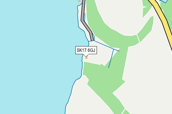
SK17 6GJ is located in the Burbage electoral ward, within the local authority district of High Peak and the English Parliamentary constituency of High Peak. The Sub Integrated Care Board (ICB) Location is NHS Derby and Derbyshire ICB - 15M and the police force is Derbyshire. This postcode has been in use since December 2012.


GetTheData
Source: OS OpenMap – Local (Ordnance Survey)
Source: OS VectorMap District (Ordnance Survey)
Licence: Open Government Licence (requires attribution)
| Easting | 401742 |
| Northing | 375555 |
| Latitude | 53.276990 |
| Longitude | -1.975335 |
GetTheData
Source: Open Postcode Geo
Licence: Open Government Licence
| Country | England |
| Postcode District | SK17 |
| ➜ SK17 open data dashboard ➜ See where SK17 is on a map | |
GetTheData
Source: Land Registry Price Paid Data
Licence: Open Government Licence
Elevation or altitude of SK17 6GJ as distance above sea level:
| Metres | Feet | |
|---|---|---|
| Elevation | 280m | 919ft |
Elevation is measured from the approximate centre of the postcode, to the nearest point on an OS contour line from OS Terrain 50, which has contour spacing of ten vertical metres.
➜ How high above sea level am I? Find the elevation of your current position using your device's GPS.
GetTheData
Source: Open Postcode Elevation
Licence: Open Government Licence
| Ward | Burbage |
| Constituency | High Peak |
GetTheData
Source: ONS Postcode Database
Licence: Open Government Licence
| September 2021 | Other theft | On or near Goyt'S Lane | 377m |
| ➜ Get more crime data in our Crime section | |||
GetTheData
Source: data.police.uk
Licence: Open Government Licence
| Buxton Station | 4.5km |
| Chapel-en-le-Frith Station | 5.4km |
GetTheData
Source: NaPTAN
Licence: Open Government Licence
GetTheData
Source: ONS Postcode Database
Licence: Open Government Licence

➜ Get more ratings from the Food Standards Agency
GetTheData
Source: Food Standards Agency
Licence: FSA terms & conditions
| Last Collection | |||
|---|---|---|---|
| Location | Mon-Fri | Sat | Distance |
| Fernilee | 16:30 | 11:15 | 3,423m |
| Nithen | 17:45 | 11:00 | 3,702m |
| Macclesfield Old Road | 17:45 | 11:45 | 3,736m |
GetTheData
Source: Dracos
Licence: Creative Commons Attribution-ShareAlike
| Facility | Distance |
|---|---|
| White Hall Outdoor Education Centre Manchester Road, Buxton Cycling | 1.7km |
| Cavendish Golf Club Watford Road, Buxton Golf | 3.6km |
| The Park (Buxton Cricket Tennis And Bowls Club) Park Road, Buxton Grass Pitches, Outdoor Tennis Courts | 4.1km |
GetTheData
Source: Active Places
Licence: Open Government Licence
| School | Phase of Education | Distance |
|---|---|---|
| Combs Infant School Lesser Lane, Chapel-en-le-Frith, Combs High Peak, SK23 9UZ | Primary | 3.7km |
| Burbage Primary School Cavendish Avenue, Burbage, Buxton, SK17 9AE | Primary | 3.9km |
| Buxton and Leek College Devonshire Road, Buxton, SK17 6RY | Not applicable | 4.3km |
GetTheData
Source: Edubase
Licence: Open Government Licence
The below table lists the International Territorial Level (ITL) codes (formerly Nomenclature of Territorial Units for Statistics (NUTS) codes) and Local Administrative Units (LAU) codes for SK17 6GJ:
| ITL 1 Code | Name |
|---|---|
| TLF | East Midlands (England) |
| ITL 2 Code | Name |
| TLF1 | Derbyshire and Nottinghamshire |
| ITL 3 Code | Name |
| TLF13 | South and West Derbyshire |
| LAU 1 Code | Name |
| E07000037 | High Peak |
GetTheData
Source: ONS Postcode Directory
Licence: Open Government Licence
The below table lists the Census Output Area (OA), Lower Layer Super Output Area (LSOA), and Middle Layer Super Output Area (MSOA) for SK17 6GJ:
| Code | Name | |
|---|---|---|
| OA | E00099749 | |
| LSOA | E01019714 | High Peak 012A |
| MSOA | E02004104 | High Peak 012 |
GetTheData
Source: ONS Postcode Directory
Licence: Open Government Licence
| SK17 6SU | Manchester Road | 2328m |
| SK17 6UP | Bishops Lane | 2716m |
| SK23 7HB | Fernilee | 2878m |
| SK17 6ST | Manchester Road | 2948m |
| SK17 6SS | Manchester Road | 3056m |
| SK23 7EA | Taxal | 3215m |
| SK10 5XL | Saltersford | 3426m |
| SK23 9UZ | Lesser Lane | 3477m |
| SK23 9UY | 3508m | |
| SK23 7HD | Fernilee | 3545m |
GetTheData
Source: Open Postcode Geo; Land Registry Price Paid Data
Licence: Open Government Licence