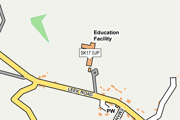
SK17 0JP is located in the Manifold electoral ward, within the local authority district of Staffordshire Moorlands and the English Parliamentary constituency of Staffordshire Moorlands. The Sub Integrated Care Board (ICB) Location is NHS Staffordshire and Stoke-on-Trent ICB - 05G and the police force is Staffordshire. This postcode has been in use since June 2016.


GetTheData
Source: OS OpenMap – Local (Ordnance Survey)
Source: OS VectorMap District (Ordnance Survey)
Licence: Open Government Licence (requires attribution)
| Easting | 408452 |
| Northing | 358934 |
| Latitude | 53.127525 |
| Longitude | -1.875140 |
GetTheData
Source: Open Postcode Geo
Licence: Open Government Licence
| Country | England |
| Postcode District | SK17 |
| ➜ SK17 open data dashboard ➜ See where SK17 is on a map ➜ Where is Warslow? | |
GetTheData
Source: Land Registry Price Paid Data
Licence: Open Government Licence
Elevation or altitude of SK17 0JP as distance above sea level:
| Metres | Feet | |
|---|---|---|
| Elevation | 310m | 1,017ft |
Elevation is measured from the approximate centre of the postcode, to the nearest point on an OS contour line from OS Terrain 50, which has contour spacing of ten vertical metres.
➜ How high above sea level am I? Find the elevation of your current position using your device's GPS.
GetTheData
Source: Open Postcode Elevation
Licence: Open Government Licence
| Ward | Manifold |
| Constituency | Staffordshire Moorlands |
GetTheData
Source: ONS Postcode Database
Licence: Open Government Licence
| June 2022 | Anti-social behaviour | On or near Stacey Close | 156m |
| May 2022 | Anti-social behaviour | On or near Stacey Close | 156m |
| April 2022 | Burglary | On or near Quarter Lane | 314m |
| ➜ Get more crime data in our Crime section | |||
GetTheData
Source: data.police.uk
Licence: Open Government Licence
| Post Office (Leek Rd) | Warslow | 286m |
| Post Office (Leek Rd) | Warslow | 289m |
| Village Hall (Cheadle Rd) | Warslow | 403m |
| Village Hall (Cheadle Rd) | Warslow | 410m |
GetTheData
Source: NaPTAN
Licence: Open Government Licence
GetTheData
Source: ONS Postcode Database
Licence: Open Government Licence


➜ Get more ratings from the Food Standards Agency
GetTheData
Source: Food Standards Agency
Licence: FSA terms & conditions
| Last Collection | |||
|---|---|---|---|
| Location | Mon-Fri | Sat | Distance |
| Holly Cottage | 11:00 | 10:00 | 208m |
| Warslow | 10:45 | 09:00 | 507m |
| Ape Tor | 16:30 | 10:30 | 1,649m |
GetTheData
Source: Dracos
Licence: Creative Commons Attribution-ShareAlike
| Facility | Distance |
|---|---|
| Wetton Village Playing Field Wetton, Ashbourne Grass Pitches | 4.6km |
| Alstonefield Cricket Club Alstonefield, Ashbourne Grass Pitches | 5.6km |
GetTheData
Source: Active Places
Licence: Open Government Licence
| School | Phase of Education | Distance |
|---|---|---|
| Manifold Church of England Primary School Off Leek Road, Warslow, Buxton, SK17 0JP | Primary | 13m |
| Hartington CofE Primary School The Dale, Hartington, Buxton, SK17 0AS | Primary | 4.8km |
GetTheData
Source: Edubase
Licence: Open Government Licence
The below table lists the International Territorial Level (ITL) codes (formerly Nomenclature of Territorial Units for Statistics (NUTS) codes) and Local Administrative Units (LAU) codes for SK17 0JP:
| ITL 1 Code | Name |
|---|---|
| TLG | West Midlands (England) |
| ITL 2 Code | Name |
| TLG2 | Shropshire and Staffordshire |
| ITL 3 Code | Name |
| TLG24 | Staffordshire CC |
| LAU 1 Code | Name |
| E07000198 | Staffordshire Moorlands |
GetTheData
Source: ONS Postcode Directory
Licence: Open Government Licence
The below table lists the Census Output Area (OA), Lower Layer Super Output Area (LSOA), and Middle Layer Super Output Area (MSOA) for SK17 0JP:
| Code | Name | |
|---|---|---|
| OA | E00151948 | |
| LSOA | E01029817 | Staffordshire Moorlands 007C |
| MSOA | E02006210 | Staffordshire Moorlands 007 |
GetTheData
Source: ONS Postcode Directory
Licence: Open Government Licence
| SK17 0JU | Stacey Close | 134m |
| SK17 0JY | Leek Road | 163m |
| SK17 0JN | 191m | |
| SK17 0JG | 250m | |
| SK17 0JR | 304m | |
| SK17 0JL | 312m | |
| SK17 0JQ | Church Terrace | 317m |
| SK17 0JH | 371m | |
| SK17 0JJ | 553m | |
| SK17 0LN | Reapsmoor | 1863m |
GetTheData
Source: Open Postcode Geo; Land Registry Price Paid Data
Licence: Open Government Licence