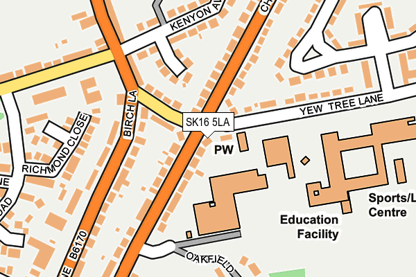
SK16 5LA is located in the Dukinfield Stalybridge electoral ward, within the metropolitan district of Tameside and the English Parliamentary constituency of Stalybridge and Hyde. The Sub Integrated Care Board (ICB) Location is NHS Greater Manchester ICB - 01Y and the police force is Greater Manchester. This postcode has been in use since January 1980.


GetTheData
Source: OS OpenMap – Local (Ordnance Survey)
Source: OS VectorMap District (Ordnance Survey)
Licence: Open Government Licence (requires attribution)
| Easting | 395128 |
| Northing | 396965 |
| Latitude | 53.469415 |
| Longitude | -2.074861 |
GetTheData
Source: Open Postcode Geo
Licence: Open Government Licence
| Country | England |
| Postcode District | SK16 |
| ➜ SK16 open data dashboard ➜ See where SK16 is on a map ➜ Where is Dukinfield? | |
GetTheData
Source: Land Registry Price Paid Data
Licence: Open Government Licence
Elevation or altitude of SK16 5LA as distance above sea level:
| Metres | Feet | |
|---|---|---|
| Elevation | 130m | 427ft |
Elevation is measured from the approximate centre of the postcode, to the nearest point on an OS contour line from OS Terrain 50, which has contour spacing of ten vertical metres.
➜ How high above sea level am I? Find the elevation of your current position using your device's GPS.
GetTheData
Source: Open Postcode Elevation
Licence: Open Government Licence
| Ward | Dukinfield Stalybridge |
| Constituency | Stalybridge And Hyde |
GetTheData
Source: ONS Postcode Database
Licence: Open Government Licence
| May 2021 | Criminal damage and arson | On or near Chester Avenue | 339m |
| February 2021 | Violence and sexual offences | On or near Silver Birch Mews | 446m |
| ➜ Get more crime data in our Crime section | |||
GetTheData
Source: data.police.uk
Licence: Open Government Licence
| Yew Tree Ln/Moravian Church (Yew Tree Ln) | Yew Tree | 41m |
| Cheetham Hill Rd/Yew Tree Ln (Cheetham Hill R) | Dukinfield | 45m |
| Yew Tree Ln/Moravian Church (Yew Tree Ln) | Yew Tree | 75m |
| Birch Ln/Yew Tree Ln (Birch Ln) | Dukinfield | 122m |
| Cheetham Hill Rd/Yew Tree Ln (Cheetham Hill R) | Dukinfield | 128m |
| Hyde North Station | 0.9km |
| Flowery Field Station | 0.9km |
| Newton for Hyde Station | 1.5km |
GetTheData
Source: NaPTAN
Licence: Open Government Licence
| Percentage of properties with Next Generation Access | 100.0% |
| Percentage of properties with Superfast Broadband | 100.0% |
| Percentage of properties with Ultrafast Broadband | 0.0% |
| Percentage of properties with Full Fibre Broadband | 0.0% |
Superfast Broadband is between 30Mbps and 300Mbps
Ultrafast Broadband is > 300Mbps
| Percentage of properties unable to receive 2Mbps | 0.0% |
| Percentage of properties unable to receive 5Mbps | 0.0% |
| Percentage of properties unable to receive 10Mbps | 0.0% |
| Percentage of properties unable to receive 30Mbps | 0.0% |
GetTheData
Source: Ofcom
Licence: Ofcom Terms of Use (requires attribution)
GetTheData
Source: ONS Postcode Database
Licence: Open Government Licence


➜ Get more ratings from the Food Standards Agency
GetTheData
Source: Food Standards Agency
Licence: FSA terms & conditions
| Last Collection | |||
|---|---|---|---|
| Location | Mon-Fri | Sat | Distance |
| Yew Tree Lane | 17:45 | 12:00 | 266m |
| Cheetham Hill | 17:30 | 11:50 | 590m |
| Acresfield Road | 17:30 | 11:45 | 621m |
GetTheData
Source: Dracos
Licence: Creative Commons Attribution-ShareAlike
| Facility | Distance |
|---|---|
| Astley Sports Village Yew Tree Lane, Dukinfield Health and Fitness Gym, Sports Hall, Artificial Grass Pitch, Studio | 189m |
| All Saints Catholic College Birch Lane, Dukinfield Grass Pitches, Sports Hall | 253m |
| Cromwell High School Coronation Avenue, Dukinfield Sports Hall | 326m |
GetTheData
Source: Active Places
Licence: Open Government Licence
| School | Phase of Education | Distance |
|---|---|---|
| Oakdale School Cheetham Hill Road, Dukinfield, SK16 5LD | Not applicable | 80m |
| Yew Tree Primary School Yew Tree Lane, Dukinfield, SK16 5BJ | Primary | 96m |
| St Mary's Catholic Primary School Cheetham Hill Road, Dukinfield, SK16 5LB | Primary | 172m |
GetTheData
Source: Edubase
Licence: Open Government Licence
The below table lists the International Territorial Level (ITL) codes (formerly Nomenclature of Territorial Units for Statistics (NUTS) codes) and Local Administrative Units (LAU) codes for SK16 5LA:
| ITL 1 Code | Name |
|---|---|
| TLD | North West (England) |
| ITL 2 Code | Name |
| TLD3 | Greater Manchester |
| ITL 3 Code | Name |
| TLD35 | Greater Manchester South East |
| LAU 1 Code | Name |
| E08000008 | Tameside |
GetTheData
Source: ONS Postcode Directory
Licence: Open Government Licence
The below table lists the Census Output Area (OA), Lower Layer Super Output Area (LSOA), and Middle Layer Super Output Area (MSOA) for SK16 5LA:
| Code | Name | |
|---|---|---|
| OA | E00030503 | |
| LSOA | E01006020 | Tameside 018E |
| MSOA | E02001246 | Tameside 018 |
GetTheData
Source: ONS Postcode Directory
Licence: Open Government Licence
| SK16 5AY | Yew Tree Lane | 86m |
| SK16 5AS | Brownville Grove | 112m |
| SK16 5JZ | Cheetham Hill Road | 139m |
| SK16 5AT | Birch Lane | 140m |
| SK16 5JX | Cheetham Hill Road | 158m |
| SK16 5LB | Cheetham Hill Road | 171m |
| SK16 5BJ | Yew Tree Lane | 184m |
| SK16 5AR | Kenyon Avenue | 194m |
| SK16 5AZ | Birch Lane | 197m |
| SK16 5GD | Oakfield | 202m |
GetTheData
Source: Open Postcode Geo; Land Registry Price Paid Data
Licence: Open Government Licence