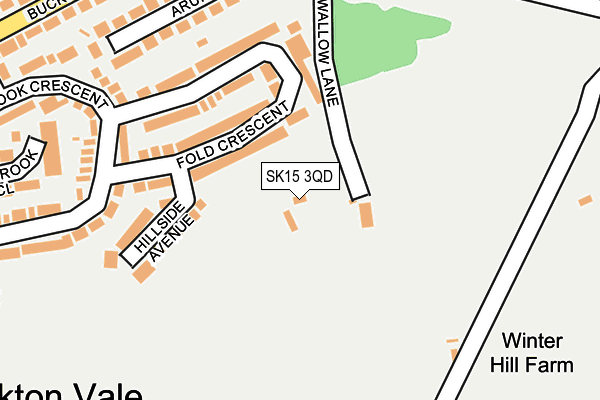
SK15 3QD is located in the Stalybridge North electoral ward, within the metropolitan district of Tameside and the English Parliamentary constituency of Stalybridge and Hyde. The Sub Integrated Care Board (ICB) Location is NHS Greater Manchester ICB - 01Y and the police force is Greater Manchester. This postcode has been in use since January 1980.


GetTheData
Source: OS OpenMap – Local (Ordnance Survey)
Source: OS VectorMap District (Ordnance Survey)
Licence: Open Government Licence (requires attribution)
| Easting | 398738 |
| Northing | 400661 |
| Latitude | 53.502658 |
| Longitude | -2.020493 |
GetTheData
Source: Open Postcode Geo
Licence: Open Government Licence
| Country | England |
| Postcode District | SK15 |
| ➜ SK15 open data dashboard ➜ See where SK15 is on a map | |
GetTheData
Source: Land Registry Price Paid Data
Licence: Open Government Licence
Elevation or altitude of SK15 3QD as distance above sea level:
| Metres | Feet | |
|---|---|---|
| Elevation | 220m | 722ft |
Elevation is measured from the approximate centre of the postcode, to the nearest point on an OS contour line from OS Terrain 50, which has contour spacing of ten vertical metres.
➜ How high above sea level am I? Find the elevation of your current position using your device's GPS.
GetTheData
Source: Open Postcode Elevation
Licence: Open Government Licence
| Ward | Stalybridge North |
| Constituency | Stalybridge And Hyde |
GetTheData
Source: ONS Postcode Database
Licence: Open Government Licence
| South View/Buckton Vale Rd (South View) | Carrbrook | 297m |
| Buckton Vale Rd/South View (Buckton Vale Rd) | Carrbrook | 304m |
| South View/Castle Ln (Castle Ln) | Carrbrook | 307m |
| Buckton Vale Rd/Moorgate Rd (Buckton Vale Rd) | Carrbrook | 310m |
| Buckton Vale Rd/Post Office (Buckton Vale Rd) | Buckton Vale | 479m |
| Mossley (Manchester) Station | 1.9km |
| Stalybridge Station | 3.4km |
| Greenfield Station | 4.1km |
GetTheData
Source: NaPTAN
Licence: Open Government Licence
GetTheData
Source: ONS Postcode Database
Licence: Open Government Licence


➜ Get more ratings from the Food Standards Agency
GetTheData
Source: Food Standards Agency
Licence: FSA terms & conditions
| Last Collection | |||
|---|---|---|---|
| Location | Mon-Fri | Sat | Distance |
| Buckton Drive | 17:00 | 11:30 | 651m |
| Heyhead | 16:30 | 11:30 | 920m |
| Brushes Road | 17:00 | 11:30 | 1,825m |
GetTheData
Source: Dracos
Licence: Creative Commons Attribution-ShareAlike
| Facility | Distance |
|---|---|
| Stamford Golf Club Huddersfield Road, Carrbrook, Stalybridge Golf | 735m |
| Micklehurst Cricket & Social Club Huddersfield Road, Mossley, Ashton-under-lyne Grass Pitches | 1.1km |
| King Georges Field (Mossley) Egmont Street, Mossley Grass Pitches | 1.5km |
GetTheData
Source: Active Places
Licence: Open Government Licence
| School | Phase of Education | Distance |
|---|---|---|
| Buckton Vale Primary School Swallow Lane, Carrbrook, Stalybridge, SK15 3NU | Primary | 462m |
| Millbrook Primary School Bank Road, Off Huddersfield Road, Stalybridge, SK15 3JX | Primary | 733m |
| St Raphael's Catholic Primary School Huddersfield Road, Millbrook, Stalybridge, SK15 3JL | Primary | 867m |
GetTheData
Source: Edubase
Licence: Open Government Licence
The below table lists the International Territorial Level (ITL) codes (formerly Nomenclature of Territorial Units for Statistics (NUTS) codes) and Local Administrative Units (LAU) codes for SK15 3QD:
| ITL 1 Code | Name |
|---|---|
| TLD | North West (England) |
| ITL 2 Code | Name |
| TLD3 | Greater Manchester |
| ITL 3 Code | Name |
| TLD35 | Greater Manchester South East |
| LAU 1 Code | Name |
| E08000008 | Tameside |
GetTheData
Source: ONS Postcode Directory
Licence: Open Government Licence
The below table lists the Census Output Area (OA), Lower Layer Super Output Area (LSOA), and Middle Layer Super Output Area (MSOA) for SK15 3QD:
| Code | Name | |
|---|---|---|
| OA | E00030704 | |
| LSOA | E01006061 | Tameside 003B |
| MSOA | E02001231 | Tameside 003 |
GetTheData
Source: ONS Postcode Directory
Licence: Open Government Licence
| SK15 3ND | Fold Crescent | 137m |
| SK15 3NE | Hillside Avenue | 150m |
| SK15 3NB | Fold Crescent | 162m |
| SK15 3LP | Carrbrook Crescent | 220m |
| SK15 3LS | Arundel Close | 241m |
| SK15 3LT | Carrbrook Close | 292m |
| SK15 3PJ | Buckton Vale Road | 307m |
| SK15 3PH | South View | 310m |
| SK15 3NG | Oakfield Avenue | 319m |
| SK15 3LR | Carrbrook Crescent | 321m |
GetTheData
Source: Open Postcode Geo; Land Registry Price Paid Data
Licence: Open Government Licence