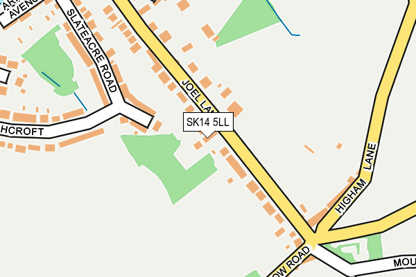
SK14 5LL is located in the Hyde Werneth electoral ward, within the metropolitan district of Tameside and the English Parliamentary constituency of Stalybridge and Hyde. The Sub Integrated Care Board (ICB) Location is NHS Greater Manchester ICB - 01Y and the police force is Greater Manchester. This postcode has been in use since January 1980.


GetTheData
Source: OS OpenMap – Local (Ordnance Survey)
Source: OS VectorMap District (Ordnance Survey)
Licence: Open Government Licence (requires attribution)
| Easting | 395819 |
| Northing | 392984 |
| Latitude | 53.433621 |
| Longitude | -2.064397 |
GetTheData
Source: Open Postcode Geo
Licence: Open Government Licence
| Country | England |
| Postcode District | SK14 |
| ➜ SK14 open data dashboard ➜ See where SK14 is on a map ➜ Where is Hyde? | |
GetTheData
Source: Land Registry Price Paid Data
Licence: Open Government Licence
Elevation or altitude of SK14 5LL as distance above sea level:
| Metres | Feet | |
|---|---|---|
| Elevation | 220m | 722ft |
Elevation is measured from the approximate centre of the postcode, to the nearest point on an OS contour line from OS Terrain 50, which has contour spacing of ten vertical metres.
➜ How high above sea level am I? Find the elevation of your current position using your device's GPS.
GetTheData
Source: Open Postcode Elevation
Licence: Open Government Licence
| Ward | Hyde Werneth |
| Constituency | Stalybridge And Hyde |
GetTheData
Source: ONS Postcode Database
Licence: Open Government Licence
| Joel Lane (Nw Bnd) (Joel Lane) | Gee Cross | 26m |
| Werneth Low Road (Sw Bnd) (Werneth Low Rd) | Gee Cross | 225m |
| Lord Derby Rd (Nth Bnd) (Lord Derby Road) | Gee Cross | 457m |
| Joel Lane (Se Bnd) (Joel Lane) | Gee Cross | 479m |
| Lord Derby Road (Se Bnd) (Lord Derby Rd) | Gee Cross | 571m |
| Woodley Station | 2km |
| Hattersley Station | 2.1km |
| Godley Station | 2.1km |
GetTheData
Source: NaPTAN
Licence: Open Government Licence
| Percentage of properties with Next Generation Access | 100.0% |
| Percentage of properties with Superfast Broadband | 100.0% |
| Percentage of properties with Ultrafast Broadband | 0.0% |
| Percentage of properties with Full Fibre Broadband | 0.0% |
Superfast Broadband is between 30Mbps and 300Mbps
Ultrafast Broadband is > 300Mbps
| Percentage of properties unable to receive 2Mbps | 0.0% |
| Percentage of properties unable to receive 5Mbps | 0.0% |
| Percentage of properties unable to receive 10Mbps | 0.0% |
| Percentage of properties unable to receive 30Mbps | 0.0% |
GetTheData
Source: Ofcom
Licence: Ofcom Terms of Use (requires attribution)
GetTheData
Source: ONS Postcode Database
Licence: Open Government Licence


➜ Get more ratings from the Food Standards Agency
GetTheData
Source: Food Standards Agency
Licence: FSA terms & conditions
| Last Collection | |||
|---|---|---|---|
| Location | Mon-Fri | Sat | Distance |
| Werneth Low | 17:45 | 11:45 | 199m |
| Slateacre Road | 17:45 | 11:45 | 320m |
| Lord Derby Brabyns Road | 17:45 | 11:45 | 446m |
GetTheData
Source: Dracos
Licence: Creative Commons Attribution-ShareAlike
| Facility | Distance |
|---|---|
| Hyde Cricket And Squash Club Werneth Low Road, Hyde Grass Pitches, Squash Courts, Sports Hall | 295m |
| Werneth Low Golf Club Werneth Low Road, Hyde Golf | 800m |
| Dowson Primary Academy Marlborough Road, Hyde Grass Pitches | 923m |
GetTheData
Source: Active Places
Licence: Open Government Licence
| School | Phase of Education | Distance |
|---|---|---|
| Gee Cross Holy Trinity CofE (VC) Primary School Higham Lane, Gee Cross, Hyde, SK14 5LX | Primary | 649m |
| Dowson Primary Academy Marlborough Road, Hyde, SK14 5HU | Primary | 923m |
| Alder Community High School Mottram Old Road, Gee Cross, Hyde, SK14 5NJ | Secondary | 929m |
GetTheData
Source: Edubase
Licence: Open Government Licence
The below table lists the International Territorial Level (ITL) codes (formerly Nomenclature of Territorial Units for Statistics (NUTS) codes) and Local Administrative Units (LAU) codes for SK14 5LL:
| ITL 1 Code | Name |
|---|---|
| TLD | North West (England) |
| ITL 2 Code | Name |
| TLD3 | Greater Manchester |
| ITL 3 Code | Name |
| TLD35 | Greater Manchester South East |
| LAU 1 Code | Name |
| E08000008 | Tameside |
GetTheData
Source: ONS Postcode Directory
Licence: Open Government Licence
The below table lists the Census Output Area (OA), Lower Layer Super Output Area (LSOA), and Middle Layer Super Output Area (MSOA) for SK14 5LL:
| Code | Name | |
|---|---|---|
| OA | E00030613 | |
| LSOA | E01006045 | Tameside 030D |
| MSOA | E02001258 | Tameside 030 |
GetTheData
Source: ONS Postcode Directory
Licence: Open Government Licence
| SK14 5LN | Joel Lane | 109m |
| SK14 5LF | Joel Lane | 160m |
| SK14 5LB | Slateacre Road | 173m |
| SK14 5LW | Higham Lane | 202m |
| SK14 5LJ | Hillcrest | 274m |
| SK14 5LE | Highcroft | 275m |
| SK14 5LD | Highcroft | 293m |
| SK14 3AA | Werneth Low Road | 295m |
| SK14 5LA | Arnold Avenue | 320m |
| SK14 5LH | Arnold Road | 336m |
GetTheData
Source: Open Postcode Geo; Land Registry Price Paid Data
Licence: Open Government Licence