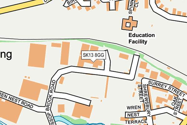
SK13 8GG is located in the Howard Town electoral ward, within the local authority district of High Peak and the English Parliamentary constituency of High Peak. The Sub Integrated Care Board (ICB) Location is NHS Derby and Derbyshire ICB - 15M and the police force is Derbyshire. This postcode has been in use since April 2006.


GetTheData
Source: OS OpenMap – Local (Ordnance Survey)
Source: OS VectorMap District (Ordnance Survey)
Licence: Open Government Licence (requires attribution)
| Easting | 403069 |
| Northing | 394377 |
| Latitude | 53.446168 |
| Longitude | -1.955257 |
GetTheData
Source: Open Postcode Geo
Licence: Open Government Licence
| Country | England |
| Postcode District | SK13 |
| ➜ SK13 open data dashboard ➜ See where SK13 is on a map ➜ Where is Glossop? | |
GetTheData
Source: Land Registry Price Paid Data
Licence: Open Government Licence
Elevation or altitude of SK13 8GG as distance above sea level:
| Metres | Feet | |
|---|---|---|
| Elevation | 150m | 492ft |
Elevation is measured from the approximate centre of the postcode, to the nearest point on an OS contour line from OS Terrain 50, which has contour spacing of ten vertical metres.
➜ How high above sea level am I? Find the elevation of your current position using your device's GPS.
GetTheData
Source: Open Postcode Elevation
Licence: Open Government Licence
| Ward | Howard Town |
| Constituency | High Peak |
GetTheData
Source: ONS Postcode Database
Licence: Open Government Licence
| January 2024 | Violence and sexual offences | On or near Sunlaws Court | 488m |
| January 2024 | Violence and sexual offences | On or near Sunlaws Court | 488m |
| December 2023 | Violence and sexual offences | On or near Sunlaws Court | 488m |
| ➜ Get more crime data in our Crime section | |||
GetTheData
Source: data.police.uk
Licence: Open Government Licence
| St Marys Road (High Street West) | Glossop | 294m |
| St Marys Road (High Street West) | Glossop | 301m |
| Arundel Street (High Street West) | Glossop | 320m |
| Library (Fauvel Road) | Glossop | 335m |
| Spire Hollin (Dinting Road) | Dinting | 350m |
| Glossop Station | 0.5km |
| Dinting Station | 1.1km |
| Hadfield Station | 1.8km |
GetTheData
Source: NaPTAN
Licence: Open Government Licence
GetTheData
Source: ONS Postcode Database
Licence: Open Government Licence


➜ Get more ratings from the Food Standards Agency
GetTheData
Source: Food Standards Agency
Licence: FSA terms & conditions
| Last Collection | |||
|---|---|---|---|
| Location | Mon-Fri | Sat | Distance |
| Howard Street | 18:00 | 11:45 | 240m |
| Station Norfolk Street | 18:00 | 11:45 | 465m |
| Talbot Road | 17:45 | 11:45 | 466m |
GetTheData
Source: Dracos
Licence: Creative Commons Attribution-ShareAlike
| Facility | Distance |
|---|---|
| Glossop North End Afc Surrey Street, Glossop Grass Pitches | 138m |
| St Lukes C Of E Primary School Spire Hollin, Glossop Grass Pitches | 139m |
| The Unit Fitness (Closed) Surrey Street, Glossop Health and Fitness Gym, Studio | 163m |
GetTheData
Source: Active Places
Licence: Open Government Licence
| School | Phase of Education | Distance |
|---|---|---|
| St Luke's CofE Primary School Spire Hollin, Glossop, SK13 7BS | Primary | 146m |
| St Philip Howard Catholic Voluntary Academy Sunlaws Street, Glossop, SK13 8DR | Secondary | 488m |
| Whitfield St James' CofE (VC) Primary School Chadwick Street, Glossop, SK13 8EF | Primary | 547m |
GetTheData
Source: Edubase
Licence: Open Government Licence
The below table lists the International Territorial Level (ITL) codes (formerly Nomenclature of Territorial Units for Statistics (NUTS) codes) and Local Administrative Units (LAU) codes for SK13 8GG:
| ITL 1 Code | Name |
|---|---|
| TLF | East Midlands (England) |
| ITL 2 Code | Name |
| TLF1 | Derbyshire and Nottinghamshire |
| ITL 3 Code | Name |
| TLF13 | South and West Derbyshire |
| LAU 1 Code | Name |
| E07000037 | High Peak |
GetTheData
Source: ONS Postcode Directory
Licence: Open Government Licence
The below table lists the Census Output Area (OA), Lower Layer Super Output Area (LSOA), and Middle Layer Super Output Area (MSOA) for SK13 8GG:
| Code | Name | |
|---|---|---|
| OA | E00099872 | |
| LSOA | E01019738 | High Peak 003A |
| MSOA | E02004095 | High Peak 003 |
GetTheData
Source: ONS Postcode Directory
Licence: Open Government Licence
| SK13 7AJ | Surrey Street | 69m |
| SK13 7AN | Shrewsbury Street | 135m |
| SK13 7AE | Edward Street | 163m |
| SK13 7AP | Oak Street | 166m |
| SK13 7BF | Shrewsbury Street | 175m |
| SK13 7BS | Spire Hollin | 186m |
| SK13 7BR | Spinney Close | 189m |
| SK13 7AQ | North Road | 189m |
| SK13 7BX | Shrewsbury Street | 193m |
| SK13 7BP | Cedar Close | 201m |
GetTheData
Source: Open Postcode Geo; Land Registry Price Paid Data
Licence: Open Government Licence