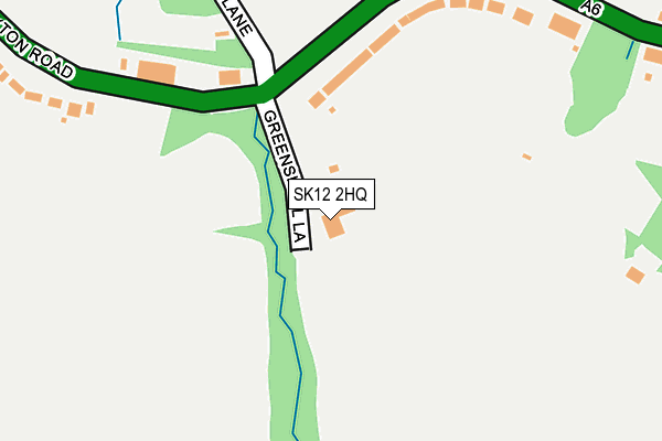
SK12 2HQ is located in the Disley electoral ward, within the unitary authority of Cheshire East and the English Parliamentary constituency of Macclesfield. The Sub Integrated Care Board (ICB) Location is NHS Cheshire and Merseyside ICB - 27D and the police force is Cheshire. This postcode has been in use since January 1980.


GetTheData
Source: OS OpenMap – Local (Ordnance Survey)
Source: OS VectorMap District (Ordnance Survey)
Licence: Open Government Licence (requires attribution)
| Easting | 398718 |
| Northing | 384442 |
| Latitude | 53.356857 |
| Longitude | -2.020725 |
GetTheData
Source: Open Postcode Geo
Licence: Open Government Licence
| Country | England |
| Postcode District | SK12 |
| ➜ SK12 open data dashboard ➜ See where SK12 is on a map ➜ Where is Disley? | |
GetTheData
Source: Land Registry Price Paid Data
Licence: Open Government Licence
Elevation or altitude of SK12 2HQ as distance above sea level:
| Metres | Feet | |
|---|---|---|
| Elevation | 190m | 623ft |
Elevation is measured from the approximate centre of the postcode, to the nearest point on an OS contour line from OS Terrain 50, which has contour spacing of ten vertical metres.
➜ How high above sea level am I? Find the elevation of your current position using your device's GPS.
GetTheData
Source: Open Postcode Elevation
Licence: Open Government Licence
| Ward | Disley |
| Constituency | Macclesfield |
GetTheData
Source: ONS Postcode Database
Licence: Open Government Licence
| June 2022 | Other theft | On or near Buxton Road | 318m |
| June 2022 | Other theft | On or near Buxton Road | 318m |
| June 2022 | Violence and sexual offences | On or near Buxton Road | 318m |
| ➜ Get more crime data in our Crime section | |||
GetTheData
Source: data.police.uk
Licence: Open Government Licence
| Greenshall Lane (Buxton Road) | Newtown | 142m |
| Lower Greenshall Lane (Buxton Road) | Newtown | 180m |
| Overdale Road (Buxton Road) | Newtown | 282m |
| Overdale Road (Buxton Road) | Newtown | 302m |
| Buxton Road | Danebank | 345m |
| New Mills Newtown Station | 0.9km |
| New Mills Central Station | 1.3km |
| Disley Station | 1.5km |
GetTheData
Source: NaPTAN
Licence: Open Government Licence
| Percentage of properties with Next Generation Access | 100.0% |
| Percentage of properties with Superfast Broadband | 0.0% |
| Percentage of properties with Ultrafast Broadband | 0.0% |
| Percentage of properties with Full Fibre Broadband | 0.0% |
Superfast Broadband is between 30Mbps and 300Mbps
Ultrafast Broadband is > 300Mbps
| Percentage of properties unable to receive 2Mbps | 0.0% |
| Percentage of properties unable to receive 5Mbps | 0.0% |
| Percentage of properties unable to receive 10Mbps | 0.0% |
| Percentage of properties unable to receive 30Mbps | 100.0% |
GetTheData
Source: Ofcom
Licence: Ofcom Terms of Use (requires attribution)
GetTheData
Source: ONS Postcode Database
Licence: Open Government Licence


➜ Get more ratings from the Food Standards Agency
GetTheData
Source: Food Standards Agency
Licence: FSA terms & conditions
| Last Collection | |||
|---|---|---|---|
| Location | Mon-Fri | Sat | Distance |
| 7 Springs Garage | 17:15 | 07:00 | 268m |
| Overdale Road | 17:15 | 08:30 | 296m |
| Corks Lane | 17:30 | 09:00 | 693m |
GetTheData
Source: Dracos
Licence: Creative Commons Attribution-ShareAlike
| Facility | Distance |
|---|---|
| Newtown Playing Field Buxton Road, Newtown, Disley, Stockport Grass Pitches | 410m |
| Arnold Rhodes Recreation Ground Buxton Road, Disley, Stockport Grass Pitches, Outdoor Tennis Courts, Health and Fitness Gym | 615m |
| New Bodies Gym (New Mills) Chapel Street, New Mills, High Peak Health and Fitness Gym, Studio | 937m |
GetTheData
Source: Active Places
Licence: Open Government Licence
| School | Phase of Education | Distance |
|---|---|---|
| Newtown Primary School (High Peak Federation) Buxton Road, New Mills, SK22 3JS | Primary | 866m |
| Disley Primary School Disley Primary School, Dane Bank Drive, Disley, Stockport, SK12 2BD | Primary | 1.1km |
| Hague Bar Primary School Lower Hague, New Mills, High Peak, SK22 3AP | Primary | 1.4km |
GetTheData
Source: Edubase
Licence: Open Government Licence
The below table lists the International Territorial Level (ITL) codes (formerly Nomenclature of Territorial Units for Statistics (NUTS) codes) and Local Administrative Units (LAU) codes for SK12 2HQ:
| ITL 1 Code | Name |
|---|---|
| TLD | North West (England) |
| ITL 2 Code | Name |
| TLD6 | Cheshire |
| ITL 3 Code | Name |
| TLD62 | Cheshire East |
| LAU 1 Code | Name |
| E06000049 | Cheshire East |
GetTheData
Source: ONS Postcode Directory
Licence: Open Government Licence
The below table lists the Census Output Area (OA), Lower Layer Super Output Area (LSOA), and Middle Layer Super Output Area (MSOA) for SK12 2HQ:
| Code | Name | |
|---|---|---|
| OA | E00093787 | |
| LSOA | E01018586 | Cheshire East 001B |
| MSOA | E02003853 | Cheshire East 001 |
GetTheData
Source: ONS Postcode Directory
Licence: Open Government Licence
| SK12 2RQ | Buxton Road | 176m |
| SK12 2RH | Buxton Road | 337m |
| SK12 2HG | Buxton Road | 342m |
| SK12 2RJ | Overdale Road | 386m |
| SK12 2AZ | Corks Lane | 422m |
| SK12 2RG | Peveril Gardens | 451m |
| SK12 2DW | Chantry Fold | 490m |
| SK12 2BZ | Ward Lane | 510m |
| SK12 2RN | Peveril Mews | 521m |
| SK12 2GB | Duddy Road | 529m |
GetTheData
Source: Open Postcode Geo; Land Registry Price Paid Data
Licence: Open Government Licence