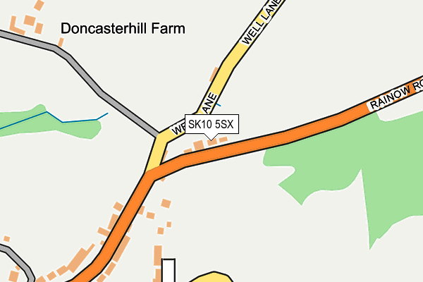
SK10 5SX lies on Rainow Road in Macclesfield. SK10 5SX is located in the Bollington electoral ward, within the unitary authority of Cheshire East and the English Parliamentary constituency of Macclesfield. The Sub Integrated Care Board (ICB) Location is NHS Cheshire and Merseyside ICB - 27D and the police force is Cheshire. This postcode has been in use since January 1980.


GetTheData
Source: OS OpenMap – Local (Ordnance Survey)
Source: OS VectorMap District (Ordnance Survey)
Licence: Open Government Licence (requires attribution)
| Easting | 393541 |
| Northing | 374881 |
| Latitude | 53.270877 |
| Longitude | -2.098308 |
GetTheData
Source: Open Postcode Geo
Licence: Open Government Licence
| Street | Rainow Road |
| Town/City | Macclesfield |
| Country | England |
| Postcode District | SK10 |
| ➜ SK10 open data dashboard ➜ See where SK10 is on a map ➜ Where is Higher Hurdsfield? | |
GetTheData
Source: Land Registry Price Paid Data
Licence: Open Government Licence
Elevation or altitude of SK10 5SX as distance above sea level:
| Metres | Feet | |
|---|---|---|
| Elevation | 190m | 623ft |
Elevation is measured from the approximate centre of the postcode, to the nearest point on an OS contour line from OS Terrain 50, which has contour spacing of ten vertical metres.
➜ How high above sea level am I? Find the elevation of your current position using your device's GPS.
GetTheData
Source: Open Postcode Elevation
Licence: Open Government Licence
| Ward | Bollington |
| Constituency | Macclesfield |
GetTheData
Source: ONS Postcode Database
Licence: Open Government Licence
| November 2022 | Violence and sexual offences | On or near Swanscoe Lane | 305m |
| June 2022 | Burglary | On or near Swanscoe Lane | 305m |
| June 2022 | Burglary | On or near Kerridge Road | 429m |
| ➜ Rainow Road crime map and outcomes | |||
GetTheData
Source: data.police.uk
Licence: Open Government Licence
| George & Dragon (Rainow Road) | Higher Hurdsfield | 186m |
| George & Dragon (Rainow Road) | Higher Hurdsfield | 191m |
| Kerridge Road (Rainow Road) | Higher Hurdsfield | 322m |
| Kerridge Road (Rainow Road) | Higher Hurdsfield | 322m |
| Three Crowns (Rainow Road) | Higher Hurdsfield | 576m |
| Macclesfield Station | 2km |
| Prestbury Station | 4km |
GetTheData
Source: NaPTAN
Licence: Open Government Licence
| Percentage of properties with Next Generation Access | 100.0% |
| Percentage of properties with Superfast Broadband | 100.0% |
| Percentage of properties with Ultrafast Broadband | 100.0% |
| Percentage of properties with Full Fibre Broadband | 0.0% |
Superfast Broadband is between 30Mbps and 300Mbps
Ultrafast Broadband is > 300Mbps
| Percentage of properties unable to receive 2Mbps | 0.0% |
| Percentage of properties unable to receive 5Mbps | 0.0% |
| Percentage of properties unable to receive 10Mbps | 0.0% |
| Percentage of properties unable to receive 30Mbps | 0.0% |
GetTheData
Source: Ofcom
Licence: Ofcom Terms of Use (requires attribution)
GetTheData
Source: ONS Postcode Database
Licence: Open Government Licence


➜ Get more ratings from the Food Standards Agency
GetTheData
Source: Food Standards Agency
Licence: FSA terms & conditions
| Last Collection | |||
|---|---|---|---|
| Location | Mon-Fri | Sat | Distance |
| Higher Hurdsfield | 17:45 | 12:00 | 264m |
| Hulley Road | 18:00 | 11:30 | 804m |
| Hurdsfield Road | 18:00 | 11:30 | 876m |
GetTheData
Source: Dracos
Licence: Creative Commons Attribution-ShareAlike
| Facility | Distance |
|---|---|
| Hurdsfield Primary School Hulley Road, Macclesfield Grass Pitches | 839m |
| Puregym (Macclesfield Silk Road) Hulley Road, Macclesfield Health and Fitness Gym | 1.4km |
| Tytherington Pitches Rugby Drive, Macclesfield Grass Pitches | 1.5km |
GetTheData
Source: Active Places
Licence: Open Government Licence
| School | Phase of Education | Distance |
|---|---|---|
| Hurdsfield Community Primary School Hulley Road, Macclesfield, SK10 2LW | Primary | 839m |
| Puss Bank School and Nursery Barracks Lane, Macclesfield, SK10 1QJ | Primary | 1.5km |
| Marlborough Primary School Tytherington Drive, Tytherington, Macclesfield, SK10 2HJ | Primary | 1.8km |
GetTheData
Source: Edubase
Licence: Open Government Licence
The below table lists the International Territorial Level (ITL) codes (formerly Nomenclature of Territorial Units for Statistics (NUTS) codes) and Local Administrative Units (LAU) codes for SK10 5SX:
| ITL 1 Code | Name |
|---|---|
| TLD | North West (England) |
| ITL 2 Code | Name |
| TLD6 | Cheshire |
| ITL 3 Code | Name |
| TLD62 | Cheshire East |
| LAU 1 Code | Name |
| E06000049 | Cheshire East |
GetTheData
Source: ONS Postcode Directory
Licence: Open Government Licence
The below table lists the Census Output Area (OA), Lower Layer Super Output Area (LSOA), and Middle Layer Super Output Area (MSOA) for SK10 5SX:
| Code | Name | |
|---|---|---|
| OA | E00094223 | |
| LSOA | E01018669 | Cheshire East 020C |
| MSOA | E02003872 | Cheshire East 020 |
GetTheData
Source: ONS Postcode Directory
Licence: Open Government Licence
| SK10 2PD | Rainow Road | 189m |
| SK10 2PE | Cliff Lane | 205m |
| SK10 5SZ | Swanscoe | 386m |
| SK10 5TD | Plungebrook | 465m |
| SK10 5TA | Kerridge Road | 475m |
| SK10 2PF | Rainow Road | 526m |
| SK10 2PG | Rainow Road | 585m |
| SK10 2PH | Springhill | 629m |
| SK10 2PJ | Bibbys Lane | 642m |
| SK10 2PU | Delamere Drive | 660m |
GetTheData
Source: Open Postcode Geo; Land Registry Price Paid Data
Licence: Open Government Licence